Mine La Motte, Missouri

Last updated

Mine La Motte, Missouri
MOMap-doton-Mine La Motte.png
Location in Missouri
Coordinates: 37°36′52″N90°17′40″W / 37.61444°N 90.29444°W / 37.61444; -90.29444
Country United States
State Missouri
County Madison
Area
[1]
  Total3.37 sq mi (8.73 km2)
  Land3.27 sq mi (8.47 km2)
  Water0.10 sq mi (0.25 km2)
Elevation
[2]
774 ft (236 m)
Population
 (2020) [3]
  Total364
  Density111.28/sq mi (42.97/km2)
ZIP code
63645 [4]
Area code 573
FIPS code 29-48602
GNIS feature ID2587090 [2]

Mine La Motte is an unincorporated community and census-designated place (CDP) in Madison County, Missouri, United States. [5] As of the 2020 census, the population was 364. [3]

Contents

History

Europeans discovered lead here and had also hoped to find silver. The French governor of Louisiana, Antoine de la Mothe Cadillac, failed to find silver, but succeeded in recruiting investors in the Company of the West, which was organized in 1717. [6] Mine La Motte was eventually settled by about 200 French settlers along with their slaves from Santo Domingo, under the leadership of Philip François Renault, to develop mines in 1717, making it one of the oldest settlements west of the Mississippi River. [7] The presence of lead, a critical ingredient for ammunition, attracted unusually early mining by French colonists in this otherwise remote interior region of the North American continent. That same lead, still used for ammunition nearly 150 years later at the time of the American Civil War, was also a factor in the Battle of Fredericktown, in which forces aligned with the Confederate States of America fought for control of the lead smelters in nearby Fredericktown with the Union forces, aligned with the United States of America.

Historical marker at the site of the first lead mine in Missouri Mine La Motte historical marker 1.jpg
Historical marker at the site of the first lead mine in Missouri

La Mothe named the mine after himself, and the town that grew up nearby was named after the mine. While dispatching workers and supervisors to the mines, La Mothe settled for a time in the Illinois Country east of the mid-Mississippi River, where the first French colonial villages were founded. In 1804 the village had a population of 150. [8] These settlers were mostly French Canadians who developed agriculture. Due to the rich soils, they were quickly able to produce grain surpluses that were critical to the survival of the lower Louisiana colony. The habitants shipped tons of grain to New Orleans and other points south on the Mississippi River. La Mothe later served as Governor-General of Louisiana. [9] [10]

Geography

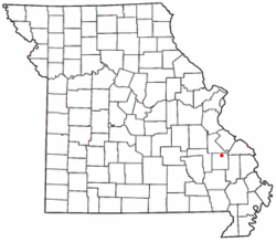
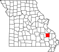
Mine La Motte is in northern Madison County, 4 miles (6 km) north of Frederickton, the county seat. According to the U.S. Census Bureau, the CDP has a total area of 3.37 square miles (8.73 km2), of which 0.10 square miles (0.26 km2), or 2.91%, are water. [1] Sweetwater Branch flows westward through the center of the community to the Little St. Francis River, which bends through the west side of the community on its way to join the St. Francis River.

Demographics

Historical population
CensusPop.Note
2010 348
2020 3644.6%
U.S. Decennial Census [11]

See also

Related Research Articles

<span class="mw-page-title-main">Ste. Genevieve County, Missouri</span> County in Missouri, United States

Sainte Genevieve County, often abbreviated Ste. Genevieve County, is a county located in the eastern portion of the U.S. state of Missouri. As of the 2020 census, the population was 18,479. The largest city and county seat is Ste. Genevieve. The county was officially organized on October 1, 1812, and is named after the Spanish district once located in the region, after Saint Genevieve, patroness of Paris, France.

<span class="mw-page-title-main">Madison County, Missouri</span> County in Missouri, United States

Madison County is a county located in the Lead Belt region of the U.S. state of Missouri. As of the 2020 census, the population was 12,626. Its county seat and largest city is Fredericktown. The county was officially organized on December 14, 1818, and was named after President James Madison.

<span class="mw-page-title-main">Harvey, Louisiana</span> Census-designated place in Louisiana, United States

Harvey is a census-designated place (CDP) in Jefferson Parish, Louisiana, United States. Harvey is on the south side of the Mississippi River, within the New Orleans–Metairie–Kenner metropolitan statistical area. The majority-minority population was 20,348 at the 2010 census, down from 22,226 at the 2000 census. The 2020 census determined 22,236 people lived in the CDP.

<span class="mw-page-title-main">Jefferson, Louisiana</span> Census-designated place in Louisiana, United States

Jefferson is a census-designated place (CDP) in Jefferson Parish, Louisiana, United States, on the north side of the Mississippi River. Jefferson is part of the New Orleans–Metairie–Kenner metropolitan statistical area. The population was 11,193 at the 2010 census, and 10,533 in 2020. It is often known by locals as "Old Jefferson", but should not be confused with Old Jefferson in East Baton Rouge Parish, Louisiana.

<span class="mw-page-title-main">Marrero, Louisiana</span> Census-designated place in Louisiana, United States

Marrero is a census-designated place (CDP) in Jefferson Parish, Louisiana, United States. Marrero is on the south side of the Mississippi River, within the New Orleans–Metairie–Kenner metropolitan statistical area. The population was 32,382 at the 2020 U.S. census.

<span class="mw-page-title-main">Fredericktown, Missouri</span> City in Missouri, United States

Fredericktown is a city in and the county seat of Madison County, Missouri, United States, in the northeastern foothills of the St. Francois Mountains. The population was 4,429 at the 2020 census, up from 3,985 in 2010. The city is surrounded on three sides by the easternmost parcel of the Mark Twain National Forest.

<span class="mw-page-title-main">Ste. Genevieve, Missouri</span> City in Missouri, United States

Ste. Genevieve is a city in Ste. Genevieve Township and is the county seat of Ste. Genevieve County, Missouri, United States. The population was 4,999 at the 2020 census. Founded in 1735 by French Canadian colonists and settlers from east of the river, it was the first organized European settlement west of the Mississippi River in present-day Missouri. Today, it is home to Ste. Genevieve National Historical Park, the 422nd unit of the National Park Service.

<span class="mw-page-title-main">St. Francois Mountains</span> Mountain range in Missouri, United States

The St. Francois Mountains in southeast Missouri are a mountain range of Precambrian igneous mountains rising over the Ozark Plateau. This range is one of the oldest exposures of igneous rock in North America. The name of the range is spelled out as Saint Francois Mountains in official GNIS sources, but it is sometimes misspelled in use as St. Francis Mountains to match the anglicized pronunciation of both the range and St. Francois County.

<span class="mw-page-title-main">Southeast Missouri Lead District</span> Lead mining area in Missouri, US

The Southeast Missouri Lead District, commonly called the Lead Belt, is a lead mining district in the southeastern part of Missouri. Counties in the Lead Belt include Saint Francois, Crawford, Dent, Iron, Madison, Reynolds, and Washington. This mining district is the most important and critical lead producer in the United States.

Excello is an unincorporated community and census-designated place (CDP) in southern Macon County, Missouri, United States. As of the 2020 United States census, it had a population of 61.

Fredericktown is a census-designated place located in East Bethlehem Township, Washington County in the state of Pennsylvania. The community was part of the Fredericktown-Millsboro CDP for the 2000 census, but was split into two separate CDPs for the 2010 census, the other community being Millsboro. Fredericktown is located in far southern Washington County, along Pennsylvania Route 88, which travels along the Monongahela River. As of the 2022 American Community Survey, the population was estimated to be 296.

Cherokee Pass is an unincorporated community and census-designated place in Madison County, Missouri, United States. As of the 2020 census, it had a population of 271, up from 235 in 2010.

<span class="mw-page-title-main">Kearney Park, Mississippi</span> Census-designated place in Mississippi, United States

Kearney Park is an unincorporated community and census-designated place (CDP) located on Livingston-Vernon Road in western Madison County, Mississippi, United States. As of the 2020 census, the population was 1,048. Kearney Park is part of the Jackson Metropolitan Statistical Area.

Holiday Shores is an unincorporated community and census-designated place (CDP) in Madison County, Illinois, United States. Its population was 2,840 as of the 2020 census.

La Saline is an abandoned village located in Beauvais Township in Sainte Genevieve County, Missouri, United States. La Saline is located approximately six miles south of Sainte Genevieve.

St. Michel is an abandoned village located in Madison County, Missouri, United States. St. Michel is now incorporated into Fredericktown.

Saint Michaels Township is a township in Madison County, Missouri, in the United States.

<span class="mw-page-title-main">Ste. Genevieve Township, Ste. Genevieve County, Missouri</span> Civil Township in Missouri, United States

Ste. Genevieve Township is a subdivision of Ste. Genevieve County, Missouri, in the United States of America, and is one of the five townships located in Ste. Genevieve County.

Village Creek is a stream in Madison County in the U.S. state of Missouri. It is a tributary of the Little Saint Francis River.

The Little St. Francis River is a stream in eastern St. Francois and northeastern Madison counties of southeastern Missouri. It is a tributary of the St. Francis River.

References

  1. 1 2 "2023 U.S. Gazetteer Files: Missouri". United States Census Bureau. Retrieved March 20, 2024.
  2. 1 2 U.S. Geological Survey Geographic Names Information System: Mine La Motte, Missouri
  3. 1 2 "P1. Race – Mine La Motte CDP, Missouri: 2020 DEC Redistricting Data (PL 94-171)". U.S. Census Bureau. Retrieved March 20, 2024.
  4. "Mine La Motte MO ZIP Code". zipdatamaps.com. 2024. Retrieved March 5, 2024.
  5. "Mine La Motte Census Designated Place". Geographic Names Information System . United States Geological Survey, United States Department of the Interior.
  6. Historic Resource Survey, City of Fredericktown Missouri http://www.dnr.mo.gov/shpo/survey/MOAS001-R.pdf
  7. McMillen, Margot Ford (1994). Paris, Tightwad and Peculiar: Missouri Place Names. Columbia, Missouri: University of Missouri Press. p. 20. ISBN   0-8262-0972-6.
  8. Walter A. Schroeder (2002). Opening the Ozarks: A Historical Geography of Missouri's Ste. Genevieve District, 1760-1830. University of Missouri Press. ISBN   9780826263063.
  9. A Directory of Towns, Villages, and Hamlets Past and Present of Madison County, Missouri http://thelibrary.org/lochist/moser/madisonpl.html
  10. State Historical Society of Missouri: Madison County http://shs.umsystem.edu/manuscripts/ramsay/ramsay_madison.html
  11. "Census of Population and Housing". Census.gov. Retrieved June 4, 2016.