References
- ↑ U.S. Geological Survey Geographic Names Information System: Cornwall, Missouri
- ↑ Higdon, MO, 7.5 Minute Topographic Quadrangle, USGS, 1959 (1990 rev.)
- ↑ "Madison County Place Names, 1928–1945". The State Historical Society of Missouri. Archived from the original on June 24, 2016. Retrieved October 31, 2016.
- ↑ "Post Offices". Jim Forte Postal History. Retrieved October 31, 2016.
Municipalities and communities of Madison County, Missouri, United States | ||
|---|---|---|
| Cities | 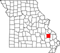 | |
| Villages | ||
| Townships | ||
| CDPs | ||
| Other communities | ||
| Abandoned villages | ||
37°30′44″N90°12′10″W / 37.51222°N 90.20278°W
| | This Madison County, Missouri state location article is a stub. You can help Wikipedia by expanding it. |