Knob Lick, Missouri | |
|---|---|
 View from Knob Lick Mountain | |
 Location of Knob Lick in Missouri | |
| Coordinates: 37°40′42″N90°22′04″W / 37.67833°N 90.36778°W | |
| Country | United States |
| State | Missouri |
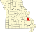
| County | Saint Francois |
| Area | |
• Total | 0.99 sq mi (2.57 km2) |
| • Land | 0.99 sq mi (2.57 km2) |
| • Water | 0.00 sq mi (0.00 km2) |
| Elevation | 948 ft (289 m) |
| Population (2020) | |
• Total | 147 |
| • Density | 147.89/sq mi (57.10/km2) |
| FIPS code | 29-39170 |
| GNIS feature ID | 2806425 [2] |
Knob Lick is an unincorporated community in southern Saint Francois County, Missouri, United States. [2] It is located on Missouri Route DD, just east of U.S. Route 67, approximately eight miles south of Farmington.
Contents
Knob Lick has a post office with zip code 63651, [3] which has been in operation since 1870. [4] The community takes its name from nearby Knob Lick Mountain. In the Ozarks, knob typically refers to an isolated summit, and lick is a natural "salt lick" or salt spring. [5] [6] The mountain is across U.S. Route 67 from the town at 37°39′52″N90°23′09″W / 37.6645°N 90.3859°W . Eighty (80 acres (32 ha)) of the summit are protected by the Missouri Department of Conservation. A gravel road leads to the conservation area which includes a granite glade, picnic facilities, and a closed fire lookout tower. [7]