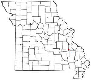
Doe Run is an unincorporated community and census-designated place in St. Francois County, Missouri, United States. It is located on Routes 221 and B, approximately three miles southwest of Farmington.

Knob Lick is an unincorporated community in southern Saint Francois County, Missouri, United States. It is located on Missouri Route DD, just east of U.S. Route 67, approximately eight miles south of Farmington.
Silver Mine is an unincorporated community in northwest Madison County, in the U.S. state of Missouri.
Brown Mountain is a summit in western St. Francois County in the U.S. state of Missouri. The peak has an elevation of 1,650 feet (500 m). The community of Iron Mountain Lake lies just west of the mountain. The mountain is named after Mr. Brown, a businessperson in the local charcoal producing industry.
De Lassus is an unincorporated community in St. Francois County, in the U.S. state of Missouri. Much of the community has been annexed by Farmington.
Doe Run Creek is a stream in St. Francois County in the U.S. state of Missouri. It is a tributary of the St. Francis River.
Hazel Run is an unincorporated community in northeastern St. Francois County, in the U.S. state of Missouri. The community is located one-half mile south of Hazel Run creek and approximately five miles east-northeast of Bonne Terre.
Indian Creek is a stream in St. Francois County in the U.S. state of Missouri. It is a tributary of the St. Francis River.
Libertyville is an unincorporated community in southeastern St. Francois County, in the U.S. state of Missouri. The community is located on Missouri Route DD, east of Knob Lick and north of Mine La Motte. The village is situated at the headwaters of the Little Saint Francis River.
Loughboro is an unincorporated community in St. Francois County, in the U.S. state of Missouri. The community is located on the St. Francis River floodplain along Missouri Route B. Elvins is approximately four miles to the north and Doe Run is about three miles to the south-southeast.
Mud Creek is a stream in St. Francois County in the U.S. state of Missouri.
Oak Mountain is a summit in the southwestern corner of St. Francois County in the U.S. state of Missouri. The summit has an elevation of 1,631 feet (497 m). The peak is on a north-south trending ridge that extends south into Iron County and the city of Pilot Knob lies just southwest of the mountain. The community of Middlebrook is to the northwest and Iron Mountain Lake is to the north. The source area of Knob Creek is on the west flank of the mountain.
Ogborn is an unincorporated community in St. Francois County, in the U.S. state of Missouri.
Pine Mountain is a summit in St. Francois County in the U.S. state of Missouri. The summit has an elevation of 1,499 feet (457 m). The mountain is about 3.5 miles (5.6 km) south of Bismarck along Missouri Route N. The peak rises just south of the confluence of Indian Creek with the St. Francis River.
Silver Springs is an unincorporated community in St. Francois County, in the U.S. state of Missouri.
Stono Mountain is a summit in St. Francois County in the U.S. state of Missouri. The mountain rises to an elevation of 1,644 feet (501 m). Mineral City lies along the headwaters of Doe Run Creek just to the east on Missouri Route W and Little Stono Mountain lies to the north.

Syenite is an unincorporated community in southern St. Francois County, in the U.S. state of Missouri. The community lies on Missouri Route DD, west of U.S. Route 67. Knob Lick lies approximately 1.5 miles to the east and the St. Francis River valley is to the north and west. Knob Lick Mountain lies about one mile to the south-southeast.
Wortham is a census-designated place in St. Francois County, in the U.S. state of Missouri.
Iron Township is an inactive township in St. Francois County, in the U.S. state of Missouri.
Cross Roads is an unincorporated community in St. Francois County, in the U.S. state of Missouri.


