
St. Francois County is a county in the Lead Belt region in the U.S. state of Missouri. At the 2020 census, the population was 66,922. The largest city and county seat is Farmington. The county was officially organized on December 19, 1821. It was named after the St. Francis River. The origin of the river's name is unclear. It may refer to St. Francis of Assisi. Another possibility is that Jacques Marquette, a Jesuit who explored the region in 1673, named the river for the Jesuit missionary Francis Xavier; Marquette had spent some time at the mission of St. François Xavier before his voyage and, as a Jesuit, was unlikely to have given the river a name honoring the Franciscans.
Iron Mountain is an unincorporated community in southwestern St. Francois County, Missouri, United States. It is located approximately six miles south of Bismarck. The community was founded in 1836 as a mining site and it was named for nearby Iron Mountain, once thought to be made completely of iron ore. A post office called Iron Mountain was established in 1846, and remained in operation until 1978.

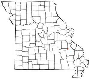
Knob Lick is an unincorporated community in southern Saint Francois County, Missouri, United States. It is located on Missouri Route DD, just east of U.S. Route 67, approximately eight miles south of Farmington.
Oak Grove is an unincorporated community in St. Francois Township in Madison County, Missouri, United States. It is located on Route 72, approximately six miles west of Fredericktown.
Terre du Lac is an unincorporated community and census-designated places in St. Francois and Washington counties in the U.S. state of Missouri. It uses zip code 63628, from neighboring Bonne Terre.
Brown Mountain is a summit in western St. Francois County in the U.S. state of Missouri. The peak has an elevation of 1,650 feet (500 m). The community of Iron Mountain Lake lies just west of the mountain. The mountain is named after Mr. Brown, a businessperson in the local charcoal producing industry.
De Lassus is an unincorporated community in St. Francois County, in the U.S. state of Missouri. Much of the community has been annexed by Farmington.
Doe Run Creek is a stream in St. Francois County in the U.S. state of Missouri. It is a tributary of the St. Francis River.
Hazel Run is an unincorporated community in northeastern St. Francois County, in the U.S. state of Missouri. The community is located one-half mile south of Hazel Run creek and approximately five miles east-northeast of Bonne Terre.
Indian Creek is a stream in St. Francois County in the U.S. state of Missouri. It is a tributary of the St. Francis River.
Libertyville is an unincorporated community in southeastern St. Francois County, in the U.S. state of Missouri. The community is located on Missouri Route DD, east of Knob Lick and north of Mine La Motte. The village is situated at the headwaters of the Little Saint Francis River.
Loughboro is an unincorporated community in St. Francois County, in the U.S. state of Missouri. The community is located on the St. Francis River floodplain along Missouri Route B. Elvins is approximately four miles to the north and Doe Run is about three miles to the south-southeast.
Mineral City is an unincorporated community in southern St. Francois County, in the U.S. state of Missouri. The community lies on Missouri Route W, southwest of Doe Run. Stono Mountain and the headwaters of Doe Run Creek lie to the west.
Pike Run is a stream in St. Francois County in the U.S. state of Missouri. It is a tributary of Terre Bleue Creek just upstream of that stream's confluence with Big River.
Silver Springs is an unincorporated community in St. Francois County, in the U.S. state of Missouri.
Stono Mountain is a summit in St. Francois County in the U.S. state of Missouri. The mountain rises to an elevation of 1,644 feet (501 m). Mineral City lies along the headwaters of Doe Run Creek just to the east on Missouri Route W and Little Stono Mountain lies to the north.
Tetley Hill is a summit in St. Francois County in the U.S. state of Missouri. It has an elevation of 984 feet (300 m). The hill is at the southeast end of a ridge between the St. Francis River to the east and Doe Run Creek to the west. Route H passes the north and east side of the hill and route AA crosses the ridge northwest of the peak. Farmington is about four miles to the north and Doe Run is about four miles to the northwest.
Wachita Creek is a stream in Madison and St. Francois counties in the U.S. state of Missouri. It is a tributary of the St. Francis River.
Wortham is a census-designated place in St. Francois County, in the U.S. state of Missouri.
Cross Roads is an unincorporated community in St. Francois County, in the U.S. state of Missouri.


