
St. Francois County is a county in the Lead Belt region in the U.S. state of Missouri. At the 2020 census, the population was 66,922. The largest city and county seat is Farmington. The county was officially organized on December 19, 1821. It was named after the St. Francis River. The origin of the river's name is unclear. It may refer to St. Francis of Assisi. Another possibility is that Jacques Marquette, a Jesuit who explored the region in 1673, named the river for the Jesuit missionary Francis Xavier; Marquette had spent some time at the mission of St. François Xavier before his voyage and, as a Jesuit, was unlikely to have given the river a name honoring the Franciscans.

Cedar Hill is an unincorporated community and census-designated place (CDP) in northwest Jefferson County, Missouri, United States. The population was 1,721 at the 2010 census.

High Ridge is an unincorporated community and census-designated place (CDP) in Jefferson County, Missouri, United States. The population was 4,305 at the 2010 census. At 927 feet (283 m) above sea level, High Ridge is the second-highest point in Jefferson County, second only to Sun Ridge, north of Hillsboro, according to data from the House Springs/Hillsboro 7.5 minute topographic quadrangles. The Beaumont Scout Reservation, a property of the Greater St. Louis Area Council, Boy Scouts of America, is 4 miles (6 km) north of High Ridge.

Troy is a city in Lincoln County, Missouri, United States. As of 2019, the estimated population was 12,820. It is the county seat of Lincoln County. Troy is an exurb of St. Louis, and is part of the St. Louis Metropolitan Statistical Area.
St. Elizabeth or Saint Elizabeth is a village in Miller County, Missouri, United States. The population was 336 at the 2010 census.

New Melle is a small country community in St. Charles County, Missouri, United States. It is located approximately 38 miles west of St. Louis. The population was 475 at the 2010 census.

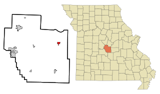
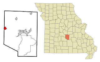
Farmington is a city in St. Francois County located about 75 miles (121 km) southwest of St. Louis in the Lead Belt region in Missouri. As of the 2020 census, the population was 18,217. It is the county seat of St. Francois County. Farmington was established in 1822 as Murphy's Settlement, named for William Murphy of Kentucky, who first visited the site in 1798. When St. Francois County was organized, the town was briefly called St. Francois Court House and later renamed to Farmington.
Richland is a city in Camden, Laclede, and Pulaski counties in the U.S. state of Missouri. The population was 1,863 at the 2010 census.

Stanton is an unincorporated community in southern Franklin County, Missouri, United States. It lies on Interstate 44 at the junction with Missouri Supplemental Route W, which provides access to Meramec Caverns, located approximately two miles southeast along the Meramec River.
Montier is a census-designated place in southwestern Shannon County, Missouri, United States. As of the 2020 census, the population was 49.
Blackwell is an unincorporated community in a small part of Washington County and the extreme northern section of St. Francois County, Missouri, United States. It is located approximately seven and a half miles south of De Soto.
Doe Run is an unincorporated community and census-designated place in St. Francois County, Missouri, United States. It is located on Routes 221 and B, approximately three miles southwest of Farmington.
Iron Mountain is an unincorporated community in southwestern St. Francois County, Missouri, United States. It is located approximately six miles south of Bismarck. The community was founded in 1836 as a mining site and it was named for nearby Iron Mountain, once thought to be made completely of iron ore. A post office called Iron Mountain was established in 1846, and remained in operation until 1978.

Knob Lick is an unincorporated community in southern Saint Francois County, Missouri, United States. It is located on Missouri Route DD, just east of U.S. Route 67, approximately eight miles south of Farmington.
Philadelphia is an unincorporated community and census-designated place in western Marion County, Missouri, United States. It is located approximately ten miles west of Palmyra on Route 168. The community is part of the Hannibal Micropolitan Statistical Area.

Old Jamestown is a census-designated place (CDP) in St. Louis County, Missouri, United States. The population was 19,184 at the 2010 census. Old Jamestown is northwest of the city of St. Louis and borders the Missouri River.

Syenite is an unincorporated community in southern St. Francois County, in the U.S. state of Missouri. The community lies on Missouri Route DD, west of U.S. Route 67. Knob Lick lies approximately 1.5 miles to the east and the St. Francis River valley is to the north and west. Knob Lick Mountain lies about one mile to the south-southeast.
Wortham is a census-designated place in St. Francois County, in the U.S. state of Missouri.
Goose Creek Lake is an unincorporated community and census-designated place (CDP) in St. Francois and Ste. Genevieve counties, Missouri, United States. The community is built around a lake of the same name, a reservoir impounding Goose Creek, an east-flowing tributary of Fourche Du Clos and part of the Establishment Creek watershed leading to the Mississippi River.
Lake Timberline is an unincorporated community and census-designated place (CDP) in St. Francois County, Missouri, United States. The community is built around several reservoirs built in the valleys of Bee Run and Primrose Creek, southwest-flowing tributaries of the Big River, which in turn flows northwest to the Meramec River.

