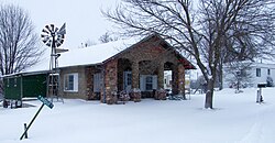
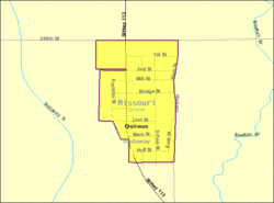
Quitman, Missouri

Last updated
Quitman, Missouri
Quitman-mo.jpg
Quitman in 2009
Nodaway County Missouri Incorporated and Unincorporated areas Quitman Highlighted.svg
Location of Quitman, Missouri
Quitman-mo-map.gif
U.S. Census Map
Coordinates: 40°22′24″N95°04′37″W / 40.37333°N 95.07694°W / 40.37333; -95.07694 Coordinates: 40°22′24″N95°04′37″W / 40.37333°N 95.07694°W / 40.37333; -95.07694
Country United States
State Missouri
County Nodaway
Area
[1]
  Total0.16 sq mi (0.41 km2)
  Land0.16 sq mi (0.41 km2)
  Water0.00 sq mi (0.00 km2)
Elevation
[2]
965 ft (294 m)
Population
 (2020)
  Total42
  Density267.52/sq mi (103.35/km2)
Time zone UTC-6 (Central (CST))
  Summer (DST) UTC-5 (CDT)
ZIP code
64478
Area code 660
FIPS code 29-60410 [3]
GNIS feature ID2787909 [2]

Quitman is an unincorporated community in west central Nodaway County, Missouri, United States. The population was 45 at the 2010 census.

Contents

History

Originally it was called Russellville which was first platted in 1856 by R. R. Russell. Later, the name was changed to Quitman in honor of John A. Quitman, a strongly pro-slavery former governor of Mississippi, leader of the Fire Eaters, and veteran in the Mexican–American War. [4] The city was incorporated on February 8, 1881 when it was a stop on the Nodaway Valley Railroad (which was building the railroad for the Kansas City, St. Joseph and Council Bluffs Railroad that eventually became part of the Burlington Northern network. [5] The railroad no longer continues.

In November 2012, the Nodaway County Commission voted to disincorporate Quitman after local residents asked for it. [6] [7]

Geography

The community is located on Missouri Route 113 between Skidmore 5.5 miles to the south and Burlington Junction, Missouri 4.5 miles to the north. The Nodaway River flows past the west side of the community and the Bilby Ranch Lake Conservation Area is three miles to the west. [8]

According to the United States Census Bureau, the city has a total area of 0.13 square miles (0.34 km2), all land. [9]

Demographics

Historical population
CensusPop.Note
1880 335
1890 332−0.9%
1900 3567.2%
1910 231−35.1%
1920 195−15.6%
1930 144−26.2%
1940 19535.4%
1950 135−30.8%
1960 113−16.3%
1970 95−15.9%
1980 66−30.5%
1990 47−28.8%
2000 46−2.1%
2010 45−2.2%
2020 42−6.7%
U.S. Decennial Census [10]

2010 census

As of the census [11] of 2010, there were 45 people, 23 households, and 11 families living in the city. The population density was 346.2 inhabitants per square mile (133.7/km2). There were 27 housing units at an average density of 207.7 per square mile (80.2/km2). The racial makeup of the city was 100.0% White.

There were 23 households, of which 26.1% had children under the age of 18 living with them, 39.1% were married couples living together, 8.7% had a female householder with no husband present, and 52.2% were non-families. 43.5% of all households were made up of individuals, and 17.3% had someone living alone who was 65 years of age or older. The average household size was 1.96 and the average family size was 2.73.

The median age in the city was 44.5 years. 20% of residents were under the age of 18; 4.4% were between the ages of 18 and 24; 26.7% were from 25 to 44; 37.7% were from 45 to 64; and 11.1% were 65 years of age or older. The gender makeup of the city was 48.9% male and 51.1% female.

2000 census

As of the census [3] of 2000, there were 46 people, 21 households, and 11 families living in the town. The population density was 331.1 inhabitants per square mile (127.8/km2). There were 24 housing units at an average density of 172.7 per square mile (66.7/km2). Everybody in the town was white.

There were 21 households, out of which six had children under the age of 18 living with them, ten were married couples living together, one had a female householder with no husband present, and nine were non-families. Nine of all households were made up of individuals, and three had someone living alone who was 65 years of age or older. The average household size was 2.19 and the average family size was 3.00.

In the town the population was spread out, with thirteen people under the age of 18, one between 18 and 24, ten from 25 to 44, seventeen from 45 to 64, and five who were 65 years of age or older. The median age was 44 years. In town, there were twenty-three males (of whom sixteen were over age 18), and twenty-three females (of whom seventeen were over age 18).

The median income for a household in the town was $29,375, and the median income for a family was $31,250. Males had a median income of $21,250 versus $16,500 for females. The per capita income for the town was $11,644. There were 10.5% of families and 21.0% of the population living below the poverty line, including 36.8% of under eighteens and none of those over 64.

Notable people

Related Research Articles

<span class="mw-page-title-main">Bridgewater, Iowa</span> City in Iowa, United States

Bridgewater is a city in Jackson Township, Adair County, Iowa, United States. The population was 148 at the time of the 2020 census. Bridgewater was founded in 1885.

<span class="mw-page-title-main">Nodaway, Iowa</span> City in Iowa, United States

Nodaway is a city in Nodaway Township, Adams County, Iowa, United States. The population was 74 at the time of the 2020 census. Nodaway was incorporated in 1900.

<span class="mw-page-title-main">Braddyville, Iowa</span> City in Iowa, United States

Braddyville is a city in Page County, Iowa, United States. The population was 147 at the 2020 census.

<span class="mw-page-title-main">Marks, Mississippi</span> City in Mississippi, United States

Marks is a city in and the county seat of Quitman County, Mississippi. As of the 2010 census, the city population was 1,735.

<span class="mw-page-title-main">Maitland, Missouri</span> City in Missouri, United States

Maitland is a city in Holt County, Missouri, United States. The population was 276 at the 2020 census. At one point the city billed itself as the "Bluegrass Mecca"—home to the largest bluegrass farm in the world.

<span class="mw-page-title-main">Lewistown, Missouri</span> City in Missouri, United States

Lewistown is a city in Lewis County, Missouri, United States. The population was 521 at the 2020 census. It is part of the Quincy, IL–MO Micropolitan Statistical Area. It is located on Missouri Route 6 near the junction of Route 6 with Missouri Route 16. Lewistown is in the Lewis County C-1 school district.

<span class="mw-page-title-main">Arkoe, Missouri</span> Village in Missouri, United States

Arkoe is a village in Nodaway County, Missouri, United States. The population was 68 at the 2010 census.

<span class="mw-page-title-main">Barnard, Missouri</span> City in Missouri, United States

Barnard is a city in Nodaway County, Missouri, United States. As of the 2010 census, the city population was 221.

<span class="mw-page-title-main">Burlington Junction, Missouri</span> City in Missouri, United States

Burlington Junction is a city in Nodaway County, Missouri, United States. The population was 537 at the 2010 census.

<span class="mw-page-title-main">Clearmont, Missouri</span> City in Missouri, United States

Clearmont is a city in northwest Nodaway County, Missouri, United States. The population was 170 at the 2010 census.

<span class="mw-page-title-main">Clyde, Missouri</span> Village in Missouri, United States

Clyde is a village in eastern Nodaway County, Missouri, United States. The population was 82 at the 2010 census.

<span class="mw-page-title-main">Conception Junction, Missouri</span> City in Missouri, United States

Conception Junction is a city in Nodaway County, Missouri, United States, near the Platte River. The population was 198 at the 2010 census, at which time it was a town.

<span class="mw-page-title-main">Elmo, Missouri</span> City in Missouri, United States

Elmo is a city in Nodaway County, Missouri, United States. The population was 168 at the 2010 census.

<span class="mw-page-title-main">Graham, Missouri</span> City in Missouri, United States

Graham is a city in Nodaway County, Missouri, United States. The population was 171 at the 2010 census.

<span class="mw-page-title-main">Guilford, Missouri</span> Village in Missouri, United States

Guilford is a village in Nodaway County, Missouri, United States, near the Platte River. The population was 85 at the 2010 census.

<span class="mw-page-title-main">Hopkins, Missouri</span> City in Missouri, United States

Hopkins is a city in northern Nodaway County, Missouri, United States. The population was 532 at the 2010 Census.

<span class="mw-page-title-main">Parnell, Missouri</span> City in Missouri, United States

Parnell is a city in northeast Nodaway County, Missouri, United States, near the Platte River. The population was 191 at the 2010 Census. It was home to the father-son horse trainers Ben and Jimmy Jones, whose horses won eight Kentucky Derbies and two Triple Crowns.

<span class="mw-page-title-main">Pickering, Missouri</span> Village in Missouri, United States

Pickering is a city in Nodaway County, Missouri, United States. The population was 160 at the 2010 census.

<span class="mw-page-title-main">Ravenwood, Missouri</span> City in Missouri, United States

Ravenwood is a city in eastern Nodaway County, Missouri, United States, near the Platte River. The population was 440 at the 2010 census, at which time it was a town.

<span class="mw-page-title-main">Skidmore, Missouri</span> City in Missouri, United States

Skidmore is a city in western Nodaway County, Missouri, United States. The population was 245 at the 2020 Census. The small farming community is known for the unsolved murder of Ken Rex McElroy. Skidmore also has a yearly "Punkin' Show."

References

  1. "ArcGIS REST Services Directory". United States Census Bureau. Retrieved August 28, 2022.
  2. 1 2 U.S. Geological Survey Geographic Names Information System: Quitman, Missouri
  3. 1 2 "U.S. Census website". United States Census Bureau . Retrieved 2008-01-31.
  4. "Nodaway County Place Names, 1928–1945". The State Historical Society of Missouri. Archived from the original on June 24, 2016. Retrieved November 24, 2016.
  5. Past and Present of Nodaway County Missouri – B.F. Owen & Co. – 1910
  6. Tiny northwest Missouri town calls it quits after 150 years; The Kansas City Star; November 17, 2012.
  7. No trustees, no tax spells end for Quitman, Maryvilledailyforum.com November 13, 2012
  8. Missouri Atlas & Gazetteer, DeLorme, 1998, First edition, p. 15, ISBN   0-89933-224-2
  9. "US Gazetteer files 2010". United States Census Bureau. Archived from the original on January 12, 2012. Retrieved 2012-07-08.
  10. "Census of Population and Housing". Census.gov. Retrieved June 4, 2015.
  11. "U.S. Census website". United States Census Bureau . Retrieved 2012-07-08.