Green Township | |
|---|---|
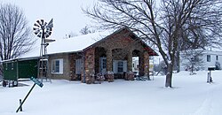 Building in Quitman | |
 | |
| Coordinates: 40°21′19″N95°05′28″W / 40.3552756°N 95.0912316°W | |
| Country | United States |
| State | Missouri |
| County | Nodaway |
| Erected | 1866 |
| Area | |
• Total | 67.33 sq mi (174.4 km2) |
| • Land | 67.17 sq mi (174.0 km2) |
| • Water | 0.16 sq mi (0.4 km2) 0.24% |
| Elevation | 902 ft (275 m) |
| Population | |
• Total | 246 |
| • Density | 3.7/sq mi (1.4/km2) |
| FIPS code | 29-14729008 [1] |
| GNIS feature ID | 767086 [2] |
Green Township is a township in Nodaway County, Missouri, United States. [2] At the 2020 census, its population was 246. [3] It contains about 67 sections of land. [4] The now disincorporated village of Quitman lies in its center and a small hamlet named Fairview was located four miles southwest. [4] All of Bilby Ranch Lake Conservation Area lies in its southwest.
