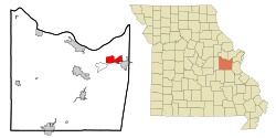
Gray Summit, Missouri

Last updated
Gray Summit, Missouri
Franklin County Missouri Incorporated and Unincorporated areas Gray Summit Highlighted.svg
Location of Gray Summit, Missouri
Coordinates: 38°29′42″N90°48′55″W / 38.49500°N 90.81528°W / 38.49500; -90.81528 Coordinates: 38°29′42″N90°48′55″W / 38.49500°N 90.81528°W / 38.49500; -90.81528
Country United States
State Missouri
County Franklin
Area
[1]
  Total7.74 sq mi (20.05 km2)
  Land7.72 sq mi (20.00 km2)
  Water0.02 sq mi (0.05 km2)
Elevation
[2]
673 ft (205 m)
Population
 (2020)
  Total3,055
  Density395.62/sq mi (152.74/km2)
Time zone UTC-6 (Central (CST))
  Summer (DST) UTC-5 (CDT)
ZIP code
63039
Area code(s) 636
FIPS code 29-28918 [3]
GNIS feature ID0731576 [2]

Gray Summit is an unincorporated community and census-designated place (CDP) in Franklin County, Missouri, United States. The population was 2,701 at the 2010 census. [4] Also called "Gray's Summit", it was founded by Daniel Gray of New York, who built a hotel here in 1845. [5] It is located on Missouri Route 100 just north of Interstate 44. [6]

Contents

Geography

Gray Summit is located in northeastern Franklin County along Missouri Route 100 and just north of Interstate 44. Missouri Route 100 leads northwest approximately 11 miles (18 km) to Washington from the west end of Gray Summit. [7]

According to the United States Census Bureau, the CDP has a total area of 7.27 square miles (18.83 km2), of which 7.25 square miles (18.78 km2) is land and 0.02 square miles (0.05 km2), or 0.28%, is water. [4]

Demographics

Historical population
CensusPop.
1990 2,505
2000 2,6405.4%
2010 2,7012.3%
2020 3,05513.1%
U.S. Decennial Census

As of the census [3] of 2000, there were 2,640 people, 953 households, and 739 families residing in the CDP. The population density was 355.1 inhabitants per square mile (137.1/km2). There were 1,032 housing units at an average density of 138.8 per square mile (53.6/km2). The racial makeup of the CDP was 97.80% White, 0.38% African American, 0.23% Native American, 0.15% Asian, 0.08% Pacific Islander, 0.38% from other races, and 0.98% from two or more races. Hispanic or Latino people of any race were 0.34% of the population.

There were 953 households, out of which 37.5% had children under the age of 18 living with them, 64.3% were married couples living together, 8.4% had a female householder with no husband present, and 22.4% were non-families. 17.3% of all households were made up of individuals, and 5.9% had someone living alone who was 65 years of age or older. The average household size was 2.77 and the average family size was 3.12.

In the CDP, the population was spread out, with 27.8% under the age of 18, 8.1% from 18 to 24, 34.0% from 25 to 44, 21.2% from 45 to 64, and 9.0% who were 65 years of age or older. The median age was 35 years. For every 100 females, there were 98.5 males. For every 100 females age 18 and over, there were 97.0 males.

The median income for a household in the CDP was $46,648, and the median income for a family was $53,875. Males had a median income of $38,810 versus $21,723 for females. The per capita income for the CDP was $17,503. About 4.8% of families and 5.1% of the population were below the poverty line, including 5.2% of those under age 18 and 15.5% of those age 65 or over.

Related Research Articles

Summit, Arizona CDP in Pima County, Arizona

Summit is a census-designated place (CDP) in Pima County, Arizona, United States. The population was 3,702 at the 2000 census.

<span class="mw-page-title-main">Gadsden, Arizona</span> CDP in Yuma County, Arizona

Gadsden is a census-designated place (CDP) in Yuma County, Arizona, United States. The population was 953 at the 2000 census. It is part of the Yuma Metropolitan Statistical Area.

Samsula-Spruce Creek, Florida CDP in Florida, United States

Samsula-Spruce Creek is a census-designated place (CDP) in Volusia County, Florida, United States. The population was 5,047 at the 2010 census. While many households reside here, it is principally an agricultural area west of the cities of Port Orange and New Smyrna Beach.

<span class="mw-page-title-main">Villa Ridge, Missouri</span> Census-designated place in Missouri, United States

Villa Ridge is an unincorporated community and census-designated place (CDP) in Franklin County, Missouri, United States. The population was 2,636 at the 2010 census, up from 2,417 at the 2000 census.

<span class="mw-page-title-main">Glasgow Village, Missouri</span> CDP in Missouri, United States

Glasgow Village is a census-designated place (CDP) in St. Louis County, Missouri, United States. The population was 5,429 at the 2010 census.

Moorestown-Lenola, New Jersey Census-designated place in New Jersey, United States

Moorestown-Lenola is an unincorporated community and census-designated place (CDP) located within Moorestown Township in Burlington County, New Jersey, United States. As of the 2010 United States Census, the CDP's population was 14,217.

Greentree, New Jersey Census-designated place in New Jersey, United States

Greentree is an unincorporated community and census-designated place (CDP) located within Cherry Hill Township, in Camden County, New Jersey, United States. As of the 2010 United States Census, the CDP's population was 11,367.

Portage Lakes, Ohio CDP in Ohio, United States

Portage Lakes is a census-designated place (CDP) in Summit County, Ohio, United States. The population was 9,870 at the 2000 census. The city of Green is adjacent to the southeast and Akron on the north. The nearby Portage Lakes of the area include but are not limited to Turkeyfoot Lake, Nimisila Reservoir, Mud Lake, and Long Lake. The lakes are connected by a series of "channels". There is a Portage Lakes State Park with boat launching ramps and seasonal beach swimming.

Roseburg North, Oregon CDP in Oregon, United States

Roseburg North is a census-designated place (CDP) in Douglas County, Oregon, United States. The population was 5,912 at the 2010 census. Winchester, Oregon is included as part of Roseburg North.

Schlusser pronounced (Skloosher) is a census-designated place (CDP) in North Middleton and Middlesex townships, Cumberland County, Pennsylvania, United States. The population was 5,265 at the 2010 census. It is part of the Harrisburg–Carlisle Metropolitan Statistical Area.

Rouzerville is an unincorporated community and census-designated place (CDP) in Franklin County, Pennsylvania, United States. The population was 917 at the 2010 census.

Wayne Heights is a census-designated place (CDP) in Franklin County, Pennsylvania, United States. The population was 2,545 at the 2010 census.

Glenburn is a census-designated place (CDP) in Glenburn Township, Lackawanna County, Pennsylvania, United States. The population was 953 at the 2010 census. It is approximately 10 miles (16 km) north of downtown Scranton, in the growing suburban area known as the "Abingtons". Glenburn is located north of Clarks Summit and south of Dalton.

Lakewood is a census-designated place (CDP) in Sumter County, South Carolina, United States. The population was 2,603 at the 2000 census. It is included in the Sumter, South Carolina Metropolitan Statistical Area.

Grayland, Washington CDP in Washington, United States

Grayland is a census-designated place (CDP) in Grays Harbor County, Washington, United States. The population was 953 at the 2010 census.

Summit, Washington CDP in Washington, United States

Summit is a census-designated place (CDP) in Pierce County, Washington, United States. The population was 8,041 at the 2000 census.

Waller, Washington CDP in Washington, United States

Waller is a census-designated place (CDP) in Pierce County, Washington, United States. The population was 9,200 at the 2000 census.

Picnic Point-North Lynnwood, Washington Former CDP in Washington, United States

Picnic Point-North Lynnwood is a former census-designated place (CDP) in Snohomish County, Washington, United States. The population was 22,953 at the 2000 census. For the 2010 census, the CDP was separated into Picnic Point and North Lynnwood, with a small part going to the new Meadowdale CDP.

Lake Wazeecha, Wisconsin CDP in Wisconsin, United States

Lake Wazeecha is a census-designated place (CDP) in the town of Grand Rapids, Wood County, Wisconsin, United States. The population was 2,651 at the 2010 census.

<span class="mw-page-title-main">Topsfield (CDP), Massachusetts</span> Census-designated place in Massachusetts, United States

Topsfield is a census-designated place (CDP) in the town of Topsfield in Essex County, Massachusetts, United States. The population was 2,717 at the 2010 census.

References

  1. "ArcGIS REST Services Directory". United States Census Bureau. Retrieved August 28, 2022.
  2. 1 2 U.S. Geological Survey Geographic Names Information System: Gray Summit, Missouri
  3. 1 2 "U.S. Census website". United States Census Bureau . Retrieved 2008-01-31.
  4. 1 2 "Geographic Identifiers: 2010 Census Summary File 1 (G001), Gray Summit CDP, Missouri". American FactFinder. U.S. Census Bureau. Archived from the original on February 13, 2020. Retrieved June 5, 2016.
  5. Franklin County Place Names, 1928-1945
  6. Gray Summit, MO, 7.5 Minute Topographic Quadrangle, USGS, 1969
  7. Missouri Atlas & Gazetteer, Delorme, 1st ed., 1998, p.40 ISBN   0899332242