Related Research Articles
Catawissa is a small unincorporated community in Franklin County, Missouri, United States, on the St. Louis & San Francisco Railroad, 39 miles from St. Louis and four miles south-southwest of Pacific. It is located at the junction of Route N and Route O, southwest of Pacific. Winch Creek flows past the eastern margin of the community.
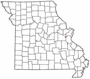
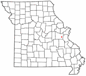
Robertsville is an unincorporated community in eastern Franklin County, Missouri, United States. It is located approximately six miles (10 km) southwest of Pacific on Missouri Route O and is home to the 1,225-acre (4.96 km2) Robertsville State Park.

Moselle is an unincorporated community in Franklin County, Missouri, United States. It is located approximately five miles northeast of St. Clair.
Lonedell is an unincorporated community in southeastern Franklin County, Missouri, United States. It is at the intersection of Route 30 and routes N and FF and approximately eight miles east of St. Clair. The Little Meramac River flows just south of the community.

Luebbering is an unincorporated community in eastern Franklin County, Missouri, United States. It is located on Missouri Route FF, approximately ten miles southeast of St. Clair and about 2.5 miles south of Lonedell.
Beemont is an unincorporated community in western Franklin County, in the U.S. state of Missouri. The community is located on Missouri Route ZZ on the west side of Boeuf Creek one half mile east of the Franklin-Gasconade county line.
Boles is an unincorporated community in northern Franklin County, in the U.S. state of Missouri.
Calvey Creek is a stream in Franklin and Jefferson counties in the U.S. state of Missouri. It is a tributary to the Meramec River.
Campbellton is an unincorporated community in northern Franklin County, in the U.S. state of Missouri. The community lies on Missouri Route 185 between Lyon to the southwest and Dundee to the northeast. Campbellton School is approximately 1.5 miles northeast on Route 185. Boeuf Creek drains the area to the north and the small stream, Slaughter Branch, flows past the village to the south.
Casco is an extinct town in Franklin County, in the U.S. state of Missouri.
Clover Bottom is an unincorporated community in Franklin County, in the U.S. state of Missouri. The community is at the intersection of routes YY and AJ approximately 3.5 miles west of Krakow.
Dissen is an unincorporated community in western Franklin County, in the U.S. state of Missouri. The community is located on the north side of Boeuf Creek along Missouri Route Y and four miles southwest of New Haven.
George is an extinct town in Franklin County, in the U.S. state of Missouri.
Gildehouse is an unincorporated community in Franklin County, in the U.S. state of Missouri.
Hemker (Hemkerville) was an unincorporated community in Franklin County, in the U.S. state of Missouri, but was dissolved in 1970 after the last residents moved out. The community is now considered part of Robertsville, MO.
Huff is an unincorporated community in Franklin County, in the U.S. state of Missouri.
Maupin is an unincorporated community in Franklin County, in the U.S. state of Missouri.
Mount Hope (also spelled is an unincorporated community in southeastern Franklin County, in the U.S. state of Missouri.
Oetters is an unincorporated community in Franklin County, in the U.S. state of Missouri. The community sits above the Missouri River floodplain along Missouri Route T. Fiddle Creek passes adjacent to the community as it enters the Missouri River floodplain.
Calvey Township is an unincorporated township in Franklin County, in the U.S. state of Missouri.
References
- ↑ U.S. Geological Survey Geographic Names Information System: Calvey (historical)
- ↑ "Post Offices". Jim Forte Postal History. Archived from the original on October 6, 2014. Retrieved September 29, 2016.
- ↑ "Franklin County Place Names, 1928–1945 (archived)". The State Historical Society of Missouri. Archived from the original on June 24, 2016. Retrieved September 29, 2016.
- ↑ "Franklin County | The State Historical Society of Missouri". collections.shsmo.org. Archived from the original on May 26, 2021. Retrieved July 4, 2021.
Municipalities and communities of Franklin County, Missouri, United States | ||
|---|---|---|
| Cities |  | |
| Villages | ||
| Townships | ||
| CDPs | ||
| Other communities |
| |
| Ghost towns | ||
| Footnotes | ‡This populated place also has portions in an adjacent county or counties | |
38°20′51″N90°47′46″W / 38.3475526°N 90.7962437°W
| | This United States ghost town-related article is a stub. You can help Wikipedia by expanding it. |
| | This Franklin County, Missouri state location article is a stub. You can help Wikipedia by expanding it. |