This is a list of urban areas in California as defined by the U.S. Census Bureau, ordered according to their 2020 census populations. The list includes urban areas with a population of at least 10,000. Rows in green indicate that part of the area lies outside of California. Rows without a rank indicate that the center of the area is outside of California.
Contents


| Rank | Name [Note 1] | Population (2020 census) [1] |
|---|---|---|
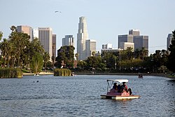
| 1 | Los Angeles-Long Beach-Anaheim | 12,237,376 |
| 2 | San Francisco-Oakland | 3,515,933 |
| 3 | San Diego | 3,070,300 |
| 4 | Riverside-San Bernardino | 2,276,703 |
| 5 | Sacramento | 1,946,618 |
| 6 | San Jose | 1,837,446 |
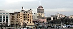
| 7 | Fresno | 717,589 |
| 8 | Mission Viejo-Lake Forest-Laguna Niguel | 646,843 |
| 9 | Bakersfield | 570,235 |
| 10 | Concord-Walnut Creek | 538,583 |
| 11 | Temecula-Murrieta-Menifee | 528,991 |
| - | Reno, NV-CA | 446,529 |
| 12 | Stockton | 414,847 |
| 13 | Oxnard-Ventura | 376,117 |
| 14 | Indio-Palm Desert-Palm Springs | 361,075 |
| 15 | Palmdale-Lancaster | 359,559 |
| 16 | Modesto | 357,301 |
| 17 | Victorville-Hesperia-Apple Valley | 355,816 |
| 18 | Antioch | 326,205 |
| 19 | Santa Rosa | 297,329 |
| 20 | Santa Clarita | 278,031 |
| 21 | Livermore-Pleasanton-Dublin | 240,381 |
| 22 | Thousand Oaks | 213,986 |
| 23 | Santa Barbara | 202,197 |
| 24 | Salinas | 177,532 |
| 25 | Vallejo | 175,132 |
| 26 | Hemet | 173,194 |
| 27 | Santa Cruz | 169,038 |
| 28 | Visalia | 160,578 |
| 29 | Fairfield | 150,122 |
| 30 | Merced | 150,052 |
| 31 | Santa Maria | 143,609 |
| - | Yuma, AZ-CA | 135,717 |
| 32 | Simi Valley | 127,364 |
| 33 | Yuba City | 125,706 |
| 34 | Seaside-Monterey-Pacific Grove | 123,495 |
| 35 | Tracy-Mountain House | 120,912 |
| 36 | Redding | 120,602 |
| 37 | Gilroy-Morgan Hill | 114,833 |
| 38 | Chico | 111,411 |
| 39 | Vacaville | 101,027 |
| 40 | Manteca | 86,674 |
| 41 | Napa | 84,619 |
| 42 | Madera | 81,635 |
| 43 | Turlock | 79,203 |
| 44 | Davis | 77,034 |
| 45 | Camarillo | 76,338 |
| 46 | El Centro | 74,376 |
| 47 | Lodi | 73,090 |
| 48 | Tulare | 70,628 |
| 49 | Porterville | 69,862 |
| 50 | Watsonville | 68,668 |
| 51 | Paso Robles-Atascadero | 67,804 |
| 52 | Hanford | 66,638 |
| 53 | Petaluma | 65,227 |
| 54 | Woodland | 61,133 |
| 55 | San Luis Obispo | 56,904 |
| 56 | Lompoc | 54,287 |
| 57 | Arroyo Grande-Grover Beach-Pismo Beach | 50,885 |
| 58 | Reedley--Dinuba | 49,614 |
| 59 | Hollister | 49,611 |
| 60 | Eureka | 45,951 |
| 61 | Desert Hot Springs | 45,767 |
| 62 | Los Banos | 45,533 |
| 63 | Delano | 44,410 |
| 64 | Fallbrook | 41,305 |
| 65 | Oroville | 40,190 |
| 66 | Calexico | 38,491 |
| 67 | Grass Valley | 36,720 |
| 68 | Selma | 32,546 |
| 69 | Sonoma | 31,479 |
| 70 | Auburn | 31,371 |
| 71 | South Lake Tahoe, CA-NV | 31,363 |
| 72 | Santa Paula | 30,675 |
| 73 | Barstow | 30,522 |
| 74 | Ridgecrest | 29,307 |
| 75 | Sonora-Twain Harte | 29,013 |
| 76 | Ukiah | 28,987 |
| 77 | Sanger | 27,325 |
| 78 | Lemoore | 26,957 |
| 79 | Galt | 26,618 |
| 80 | Brawley | 26,270 |
| 81 | Oakdale | 25,408 |
| 82 | Patterson | 23,660 |
| 83 | Placerville-Diamond Springs | 23,291 |
| 84 | Corcoran | 22,377 |
| 85 | Crestline-Lake Arrowhead | 22,272 |
| 86 | Wasco | 22,235 |
| 87 | Half Moon Bay | 21,688 |
| 88 | Nipomo | 20,303 |
| 89 | Red Bluff | 19,826 |
| 90 | Arcata | 19,714 |
| - | Incline Village, NV-CA | 19,441 |
| 91 | Arvin | 19,385 |
| 92 | Shafter | 19,278 |
| 93 | Soledad | 18,946 |
| 94 | Dixon | 18,876 |
| 95 | Greenfield | 18,858 |
| 96 | Sebastopol | 18,734 |
| 97 | Yucca Valley | 18,293 |
| 98 | Rosamond | 17,538 |
| 99 | Clearlake | 17,351 |
| 100 | Tehachapi-Golden Hills | 17,298 |
| 101 | Big Bear City | 16,498 |
| 102 | Fillmore | 16,397 |
| 103 | Kerman | 16,002 |
| 104 | Discovery Bay | 15,939 |
| 105 | Ripon | 15,829 |
| 106 | Crescent City | 15,620 |
| 107 | Lamont | 15,271 |
| 108 | Taft | 15,022 |
| 109 | McKinleyville | 14,981 |
| 110 | Ramona | 14,837 |
| 111 | Parlier | 14,522 |
| 112 | Livingston | 14,255 |
| 113 | McFarland | 14,149 |
| 114 | Los Osos | 13,978 |
| 115 | Lindsay | 13,942 |
| 116 | King City | 13,760 |
| 117 | Mendota | 13,382 |
| 118 | Alpine | 13,307 |
| 119 | Avenal | 13,304 |
| 120 | Chowchilla | 13,196 |
| 121 | Morro Bay | 13,163 |
| 122 | Coalinga | 13,049 |
| 123 | Twentynine Palms | 12,881 |
| 124 | Orosi | 12,795 |
| 125 | Fortuna | 12,784 |
| 126 | Truckee | 12,756 |
| 127 | Kingsburg | 12,602 |
| 128 | Newman | 12,387 |
| 129 | Castroville-Prunedale | 12,334 |
| 130 | Blythe, CA-AZ | 11,780 |
| 131 | Twentynine Palms North | 11,665 |
| 132 | Bishop | 11,013 |
| 133 | Exeter | 10,973 |
| 134 | Fort Bragg | 10,668 |
| 135 | Solvang-Santa Ynez | 10,295 |
| 136 | Delhi | 10,274 |