Seibert, Colorado | |
---|---|
![]() View from the south (2009) | |
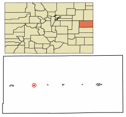
![]() Location within Kit Carson County and Colorado | |
Coordinates: 39°17′58″N102°52′13″W / 39.29944°N 102.87028°W [1] | |
Country | United States |
State | Colorado |
County [2] | Kit Carson |
Incorporated | June 21, 1917 [3] |
Government | |
• Type | Statutory Town [2] |
Area | |
• Total | 0.34 sq mi (0.89 km2) |
• Land | 0.34 sq mi (0.89 km2) |
• Water | 0.00 sq mi (0.00 km2) |
Elevation | 4,712 ft (1,436 m) |
Population | |
• Total | 172 |
• Density | 510/sq mi (190/km2) |
Time zone | UTC−7 (MST) |
• Summer (DST) | UTC−6 (MDT) |
ZIP Code [6] | 80834 |
Area code | 970 |
FIPS code | 08-69040 [1] |
GNIS ID | 195118 [1] |
Seibert is a statutory town in Kit Carson County, Colorado, United States. [1] The population was 172 at the 2020 census. [5]
A post office called Seibert has been in operation since 1888. [7] The community was named after Henry Seibert, a railroad agent. [8]
Seibert is located at 39°17′58″N102°52′13″W / 39.29944°N 102.87028°W (39.299456, -102.870204). [9]
According to the United States Census Bureau, the town has a total area of 0.3 square miles (0.78 km2), all of it land.
Climate data for Seibert, Colorado, 1991–2020 normals, extremes 2004–2022 | |||||||||||||
---|---|---|---|---|---|---|---|---|---|---|---|---|---|
Month | Jan | Feb | Mar | Apr | May | Jun | Jul | Aug | Sep | Oct | Nov | Dec | Year |
Record high °F (°C) | 76 (24) | 80 (27) | 83 (28) | 88 (31) | 93 (34) | 107 (42) | 105 (41) | 100 (38) | 97 (36) | 90 (32) | 80 (27) | 73 (23) | 107 (42) |
Mean maximum °F (°C) | 66.3 (19.1) | 66.5 (19.2) | 76.5 (24.7) | 82.9 (28.3) | 88.9 (31.6) | 98.1 (36.7) | 98.9 (37.2) | 96.5 (35.8) | 93.3 (34.1) | 84.9 (29.4) | 75.0 (23.9) | 66.3 (19.1) | 100.0 (37.8) |
Mean daily maximum °F (°C) | 42.5 (5.8) | 44.8 (7.1) | 55.0 (12.8) | 62.5 (16.9) | 71.4 (21.9) | 83.0 (28.3) | 89.1 (31.7) | 85.0 (29.4) | 78.4 (25.8) | 65.0 (18.3) | 51.7 (10.9) | 42.6 (5.9) | 64.3 (17.9) |
Daily mean °F (°C) | 28.8 (−1.8) | 30.6 (−0.8) | 39.9 (4.4) | 47.3 (8.5) | 57.1 (13.9) | 67.9 (19.9) | 74.0 (23.3) | 71.3 (21.8) | 63.6 (17.6) | 50.8 (10.4) | 38.1 (3.4) | 29.5 (−1.4) | 49.9 (9.9) |
Mean daily minimum °F (°C) | 15.2 (−9.3) | 16.3 (−8.7) | 24.9 (−3.9) | 32.1 (0.1) | 42.9 (6.1) | 52.8 (11.6) | 59.0 (15.0) | 57.5 (14.2) | 48.8 (9.3) | 36.6 (2.6) | 24.4 (−4.2) | 16.3 (−8.7) | 35.6 (2.0) |
Mean minimum °F (°C) | −3.3 (−19.6) | −2.1 (−18.9) | 8.9 (−12.8) | 19.0 (−7.2) | 29.9 (−1.2) | 42.8 (6.0) | 50.9 (10.5) | 49.6 (9.8) | 35.5 (1.9) | 18.9 (−7.3) | 10.3 (−12.1) | −3.8 (−19.9) | −10.1 (−23.4) |
Record low °F (°C) | −17 (−27) | −24 (−31) | −10 (−23) | 6 (−14) | 23 (−5) | 36 (2) | 46 (8) | 45 (7) | 27 (−3) | 1 (−17) | −13 (−25) | −18 (−28) | −24 (−31) |
Average precipitation inches (mm) | 0.28 (7.1) | 0.49 (12) | 1.01 (26) | 1.44 (37) | 2.69 (68) | 2.05 (52) | 2.64 (67) | 2.70 (69) | 1.10 (28) | 1.22 (31) | 0.39 (9.9) | 0.60 (15) | 16.61 (422) |
Average snowfall inches (cm) | 3.8 (9.7) | 4.2 (11) | 5.8 (15) | 4.6 (12) | 0.8 (2.0) | 0.0 (0.0) | 0.0 (0.0) | 0.0 (0.0) | 0.0 (0.0) | 2.1 (5.3) | 2.4 (6.1) | 5.9 (15) | 29.6 (76.1) |
Average precipitation days (≥ 0.01 in) | 2.9 | 3.0 | 3.9 | 5.2 | 8.0 | 5.0 | 7.4 | 7.2 | 4.4 | 4.2 | 2.8 | 3.5 | 57.5 |
Average snowy days (≥ 0.1 in) | 2.6 | 2.5 | 2.6 | 2.0 | 0.2 | 0.0 | 0.0 | 0.0 | 0.0 | 0.7 | 2.0 | 3.2 | 15.8 |
Source 1: NOAA [10] | |||||||||||||
Source 2: National Weather Service (mean maxima/minima 2006–2020) [11] |
Census | Pop. | Note | %± |
---|---|---|---|
1920 | 311 | — | |
1930 | 273 | −12.2% | |
1940 | 249 | −8.8% | |
1950 | 346 | 39.0% | |
1960 | 210 | −39.3% | |
1970 | 192 | −8.6% | |
1980 | 180 | −6.2% | |
1990 | 181 | 0.6% | |
2000 | 180 | −0.6% | |
2010 | 181 | 0.6% | |
2020 | 172 | −5.0% | |
U.S. Decennial Census |