Stratton, Colorado | |
---|---|
Looking north along Colorado Avenue (2019) | |
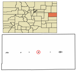
![]() Location within Kit Carson County and Colorado | |
Coordinates: 39°18′11″N102°36′15″W / 39.30306°N 102.60417°W [1] | |
Country | United States |
State | Colorado |
County [2] | Kit Carson |
Incorporated | April 15, 1917 [3] |
Government | |
• Type | Statutory Town [2] |
• Mayor | Matthew Brachtenbach |
Area | |
• Total | 0.51 sq mi (1.33 km2) |
• Land | 0.51 sq mi (1.33 km2) |
• Water | 0.00 sq mi (0.00 km2) |
Elevation | 4,413 ft (1,345 m) |
Population | |
• Total | 656 |
• Density | 1,300/sq mi (490/km2) |
Time zone | UTC−7 (MST) |
• Summer (DST) | UTC−6 (MDT) |
ZIP Code [6] | 80836 |
Area code | 719 |
FIPS code | 08-74485 [1] |
GNIS ID | 204821 [1] |
Website | townofstratton.colorado.gov |
Stratton is a statutory town in Kit Carson County, Colorado, United States. [1] The population was 656 at the 2020 census. [5] Stratton was named in honor of the gold miner and philanthropist Winfield Scott Stratton.
Stratton is located at 39°18′11″N102°36′15″W / 39.30306°N 102.60417°W (39.302976, -102.604272). [7]
According to the United States Census Bureau, the town has a total area of 0.5 square miles (1.3 km2), all of it land.
Climate data for Stratton, Colorado, 1991–2020 normals, extremes 1934–2012 | |||||||||||||
---|---|---|---|---|---|---|---|---|---|---|---|---|---|
Month | Jan | Feb | Mar | Apr | May | Jun | Jul | Aug | Sep | Oct | Nov | Dec | Year |
Record high °F (°C) | 77 (25) | 80 (27) | 85 (29) | 93 (34) | 99 (37) | 106 (41) | 108 (42) | 105 (41) | 101 (38) | 94 (34) | 83 (28) | 83 (28) | 108 (42) |
Mean maximum °F (°C) | 66.3 (19.1) | 67.4 (19.7) | 78.3 (25.7) | 84.8 (29.3) | 90.3 (32.4) | 98.0 (36.7) | 101.0 (38.3) | 98.3 (36.8) | 94.6 (34.8) | 86.2 (30.1) | 75.0 (23.9) | 66.4 (19.1) | 101.5 (38.6) |
Mean daily maximum °F (°C) | 43.0 (6.1) | 46.1 (7.8) | 56.0 (13.3) | 63.2 (17.3) | 73.2 (22.9) | 84.2 (29.0) | 89.6 (32.0) | 87.5 (30.8) | 79.7 (26.5) | 66.7 (19.3) | 52.6 (11.4) | 43.7 (6.5) | 65.5 (18.6) |
Daily mean °F (°C) | 30.4 (−0.9) | 32.8 (0.4) | 41.3 (5.2) | 48.5 (9.2) | 58.8 (14.9) | 69.6 (20.9) | 75.1 (23.9) | 73.3 (22.9) | 64.7 (18.2) | 51.8 (11.0) | 39.5 (4.2) | 31.3 (−0.4) | 51.4 (10.8) |
Mean daily minimum °F (°C) | 17.7 (−7.9) | 19.6 (−6.9) | 26.5 (−3.1) | 33.7 (0.9) | 44.5 (6.9) | 54.9 (12.7) | 60.7 (15.9) | 59.1 (15.1) | 49.6 (9.8) | 36.9 (2.7) | 26.4 (−3.1) | 18.8 (−7.3) | 37.4 (3.0) |
Mean minimum °F (°C) | −0.9 (−18.3) | −0.3 (−17.9) | 9.0 (−12.8) | 19.1 (−7.2) | 30.7 (−0.7) | 41.4 (5.2) | 51.5 (10.8) | 50.7 (10.4) | 35.9 (2.2) | 21.2 (−6.0) | 9.9 (−12.3) | −0.3 (−17.9) | −9.0 (−22.8) |
Record low °F (°C) | −22 (−30) | −26 (−32) | −19 (−28) | 3 (−16) | 16 (−9) | 30 (−1) | 40 (4) | 40 (4) | 20 (−7) | 6 (−14) | −6 (−21) | −24 (−31) | −26 (−32) |
Average precipitation inches (mm) | 0.41 (10) | 0.58 (15) | 0.81 (21) | 2.24 (57) | 2.72 (69) | 2.68 (68) | 3.34 (85) | 2.87 (73) | 0.93 (24) | 1.18 (30) | 0.62 (16) | 0.43 (11) | 18.81 (479) |
Average snowfall inches (cm) | 4.1 (10) | 5.2 (13) | 6.0 (15) | 5.6 (14) | 0.0 (0.0) | 0.0 (0.0) | 0.0 (0.0) | 0.0 (0.0) | 0.4 (1.0) | 2.7 (6.9) | 6.1 (15) | 3.8 (9.7) | 33.9 (84.6) |
Average precipitation days (≥ 0.01 in) | 3.3 | 3.4 | 4.5 | 6.3 | 9.0 | 8.3 | 9.9 | 8.6 | 4.7 | 5.2 | 3.9 | 3.2 | 70.3 |
Average snowy days (≥ 0.1 in) | 3.5 | 3.3 | 3.4 | 2.1 | 0.0 | 0.0 | 0.0 | 0.0 | 0.2 | 1.0 | 3.0 | 3.2 | 19.7 |
Source 1: NOAA [8] | |||||||||||||
Source 2: National Weather Service (mean maxima/minima 1981–2010) [9] |
Census | Pop. | Note | %± |
---|---|---|---|
1920 | 421 | — | |
1930 | 507 | 20.4% | |
1940 | 623 | 22.9% | |
1950 | 720 | 15.6% | |
1960 | 680 | −5.6% | |
1970 | 790 | 16.2% | |
1980 | 705 | −10.8% | |
1990 | 649 | −7.9% | |
2000 | 669 | 3.1% | |
2010 | 658 | −1.6% | |
2020 | 656 | −0.3% | |
U.S. Decennial Census |
The community is served by Stratton Senior High School.