Hooper, Colorado | |
|---|---|
| Town of Hooper [1] | |
 Howard Store (shown) now serves as the town hall | |
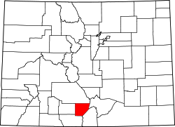
 Location of the Town of Hooper in the Alamosa County, Colorado. | |
| Coordinates: 37°44′45″N105°52′37″W / 37.74583°N 105.87694°W | |
| Country | |
| State | |
| County | Alamosa County |
| Incorporated (town) | May 20, 1898 [2] |
| Government | |
| • Type | Statutory Town [1] |
| Area | |
• Total | 0.25 sq mi (0.65 km2) |
| • Land | 0.25 sq mi (0.65 km2) |
| • Water | 0 sq mi (0.00 km2) |
| Elevation | 7,559 ft (2,304 m) |
| Population | |
• Total | 81 |
| • Density | 320/sq mi (120/km2) |
| Time zone | UTC-7 (MST) |
| • Summer (DST) | UTC-6 (MDT) |
| ZIP code [6] | 81136 |
| Area code | 719 |
| FIPS code | 08-37380 |
| GNIS feature ID | 2412766 [4] |
| Website | Official website |
The Town of Hooper is a Statutory Town located in the San Luis Valley in Alamosa County, Colorado, United States. The population was 81 at the 2020 census. [5]