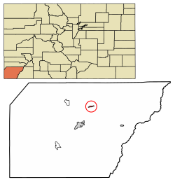
Dolores, Colorado

Last updated

Dolores, Colorado
Dolores, Colorado.JPG
Railroad Avenue, Dolores' main street.
Montezuma County Colorado Incorporated and Unincorporated areas Dolores Highlighted 0820770.svg
Location of the Town of Dolores in Montezuma County, Colorado.
Usa edcp location map.svg
Red pog.svg
Dolores
Location of the Town of Dolores in the United States.
Coordinates: 37°28′26″N108°29′59″W / 37.473990°N 108.499824°W / 37.473990; -108.499824 [2]
Country Flag of the United States.svg  United States
State Flag of Colorado.svg  Colorado
County Montezuma County [1]
Incorporated July 19, 1900 [3]
Government
  Type Statutory Town [1]
Area
[4]
  Total0.664 sq mi (1.721 km2)
  Land0.664 sq mi (1.721 km2)
  Water0.000 sq mi (0.000 km2)
Elevation
[5]
6,936 ft (2,114 m)
Population
 (2020) [4]
  Total885
  Density1,332/sq mi (514/km2)
Time zone UTC−07:00 (MST)
  Summer (DST) UTC−06:00 (MDT)
ZIP code [6]
81323
Area code 970
FIPS code 08-20770
GNIS feature ID 0202607
Website townofdolores.colorado.gov

Dolores is a Statutory Town located in Montezuma County, Colorado, United States. [1] The town population was 885 at the 2020 United States Census. [4]

Contents

Description

Dolores (Spanish for "sorrows" and named for the river on which it is located) is located at the mouth of the Dolores Valley and the upper reaches of McPhee Reservoir, approximately 40 miles (64 km) from the Four Corners Monument. Established as a station on the Rio Grande Southern Railroad, it replaced the earlier town, Big Bend, now covered by McPhee Reservoir. McPhee Reservoir is named for a company town founded by New Mexico Lumber Company, that is now covered by the reservoir.

History

The following are Dolores area historic sites of the Ancient Pueblo People:

Other historic sites added to the Colorado State Register of Historic Properties and National Register of Historic Places include: [7] [8]

Geography

Dolores is located at 37°28′28″N108°29′54″W / 37.47444°N 108.49833°W / 37.47444; -108.49833 (37.474540, -108.498294). [9]

At the 2020 United States Census, the town had a total area of 425 acres (1.721 km2), all of it land. [4]

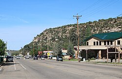
The town is confined to a narrow valley bottom along the Dolores River near the point where the river turns from flowing southward out of the San Juan Mountains to the north. Built-up areas outside the town limits include extensive residential, commercial, and minor-industrial areas upstream in the valley floor, on Summit Ridge to the south-southwest, and on high ground to the west, at the intersections of Colorado Highways 145 and 184.

Demographics

Historical population
CensusPop.Note
1900 108
1910 320196.3%
1920 46545.3%
1930 55719.8%
1940 80444.3%
1950 729−9.3%
1960 80510.4%
1970 8201.9%
1980 802−2.2%
1990 8668.0%
2000 857−1.0%
2010 9369.2%
2020 885−5.4%
U.S. Decennial Census

As of the census [10] of 2010, there were 936 people, 431 households, and 236 families residing in the town. The population density was 1,337.1 inhabitants per square mile (516.3/km2). There were 501 housing units at an average density of 715.7 per square mile (276.3/km2). The racial makeup of the town was 90.38% White, 2.14% Native American, 0.11% Asian, 0.21% Pacific Islander, 3.42% from other races, and 3.74% from two or more races. Hispanic or Latino of any race were 10.90% of the population.

There were 431 households, out of which 25.3% had children under the age of 18 living with them, 38.5% were married couples living together, 12.1% had a female householder with no husband present, and 45.2% were non-families. 39.7% of all households were made up of individuals, and 13.9% had someone living alone who was 65 years of age or older. The average household size was 2.15 and the average family size was 2.92.

In the town, the population was spread out, with 22.5% under the age of 18, 7.5% from 18 to 24, 26.0% from 25 to 44, 28.6% from 45 to 64, and 16.3% who were 65 years of age or older. The median age was 44.7 years. For every 100 females, there were 99.6 males. For every 100 females age 18 and over, there were 99.7 males.

The median income for a household in the town was $30,417, and the median income for a family was $32,188. Males had a median income of $27,404 versus $19,286 for females. The per capita income for the town was $14,912. About 16.6% of families and 17.3% of the population were below the poverty line, including 24.1% of those under age 18 and 11.6% of those age 65 or over.

Transportation

Dolores is part of Colorado's Bustang network. It is on the Durango-Grand Junction Outrider line. [11]

See also

Related Research Articles

<span class="mw-page-title-main">Pueblo County, Colorado</span> County in Colorado, United States

Pueblo County is a county located in the U.S. state of Colorado. As of the 2020 census, the population was 168,162. The county seat is Pueblo. The county was named for the historic city of Pueblo which took its name from the Spanish language word meaning "town" or "village". Pueblo County comprises the Pueblo, CO Metropolitan Statistical Area.

<span class="mw-page-title-main">Montezuma County, Colorado</span> County in Colorado, United States

Montezuma County is a county located in the U.S. state of Colorado. As of the 2020 census, the population was 25,849. The county seat is Cortez.

<span class="mw-page-title-main">La Plata County, Colorado</span> County in Colorado, United States

La Plata County is a county located in the U.S. state of Colorado. As of the 2020 census, the population was 55,638. The county seat is Durango. The county was named for the La Plata River and the La Plata Mountains. "La plata" means "the silver" in Spanish.

<span class="mw-page-title-main">Dolores County, Colorado</span> County in Colorado, United States

Dolores County is a county located in the U.S. state of Colorado. As of the 2020 census, the population was 2,326. The county seat is Dove Creek.

<span class="mw-page-title-main">Las Animas, Colorado</span> City in Colorado, United States

Las Animas is the statutory city that is the county seat, the most populous community, and the only incorporated municipality in Bent County, Colorado, United States. The city population was 2,300 at the 2020 United States Census. Las Animas is located on the Arkansas River, just west of its confluence with the Purgatoire River, in southeast Colorado east of Pueblo, near the historic Bent's Fort.

<span class="mw-page-title-main">Dove Creek, Colorado</span> Town in Colorado, United States

Dove Creek is a statutory town that is the county seat and the most populous municipality of Dolores County, Colorado, United States. The town population was 635 at the 2020 United States Census. The community takes its name from the nearby Dove Creek. Dove Creek is the self-proclaimed Pinto Bean Capital of the World.

<span class="mw-page-title-main">Penrose, Colorado</span> Unincorporated community in Fremont County, Colorado, United States

Penrose is a census-designated place (CDP) and post office located in and governed by Fremont County, Colorado, United States. The CDP is a part of the Cañon City, CO Micropolitan Statistical Area. The Penrose post office has the ZIP Code 81240. At the United States Census 2020, the population of the Penrose CDP was 3,685.

<span class="mw-page-title-main">Aguilar, Colorado</span> Town in Colorado, United States

Aguilar is a Statutory Town located in Las Animas County, Colorado, United States. The town population was 456 at the 2020 United States Census. Cattleman and prominent pioneer José Ramón Aguilar founded the town in 1894.

<span class="mw-page-title-main">Cortez, Colorado</span> City in Colorado, United States

Cortez is a home rule municipality that is the county seat and the most populous municipality of Montezuma County, Colorado, United States. The city population was 8,766 at the 2020 United States Census.

<span class="mw-page-title-main">Mancos, Colorado</span> Town in Colorado, United States

Mancos is a statutory town in Montezuma County, Colorado, United States. The population was 1,196 at the 2020 census, down from 1,336 in 2010.

<span class="mw-page-title-main">Nucla, Colorado</span> Town in Colorado, United States

Nucla is a statutory town in Montrose County, Colorado, United States. The population was 585 as of the 2020 census, down from 711 in 2010. Its name comes from the town founders' intent that it serve as a "nucleus" for the surrounding farms and mines, although it has since come to be associated with the growth of uranium mining in the region.

<span class="mw-page-title-main">Fowler, Colorado</span> Town in Colorado, United States

Fowler is a statutory town located in northwestern Otero County, Colorado, United States. The town population was 1,253 at the 2020 United States Census.

<span class="mw-page-title-main">Manzanola, Colorado</span> Town in Otero County, Colorado, United States

Manzanola is a Statutory Town in Otero County, Colorado, United States. The town population was 341 at the 2020 United States Census.

<span class="mw-page-title-main">Rocky Ford, Colorado</span> City in Otero County, Colorado, United States

Rocky Ford is a statutory city located in Otero County, Colorado, United States. The population was 3,876 at the 2020 census.

<span class="mw-page-title-main">Swink, Colorado</span> Town in Otero County, Colorado, United States

Swink is a Statutory Town in Otero County, Colorado, United States. The population was 604 at the 2020 census.

<span class="mw-page-title-main">Moffat, Colorado</span> Town in Saguache County, Colorado, United States

The Town of Moffat is a statutory town in Saguache County, Colorado, United States. The town population was 108 at the 2020 United States Census.

<span class="mw-page-title-main">Frisco, Colorado</span> Town in Colorado, United States

Frisco is a home rule municipality located in Summit County, Colorado, United States. The town population was 2,913 at the 2020 United States Census. Frisco is a part of the Breckenridge, CO Micropolitan Statistical Area. It is a popular town among skiers from around the world. Four major ski resorts are located in close proximity to Frisco: Copper Mountain, Breckenridge, Keystone, and Arapahoe Basin.

<span class="mw-page-title-main">Zuni Pueblo, New Mexico</span> Census-designated place in New Mexico, United States

Zuni Pueblo is a census-designated place (CDP) in McKinley County, New Mexico, United States. The population was 6,302 as of the 2010 Census. It is inhabited largely by members of the Zuni people (A:shiwi).

<span class="mw-page-title-main">Zia Pueblo, New Mexico</span> CDP in New Mexico, United States

Zia Pueblo is a census-designated place (CDP) in Sandoval County, New Mexico, United States. The population was 646 at the 2000 census, with 310 males and 336 females. The pueblo after which the CDP is named is included within the CDP; it is listed on the National Register of Historic Places.

<span class="mw-page-title-main">Pleasant View, Colorado</span> Unincorporated community in Colorado, United States

Pleasant View is an unincorporated community and a U.S. Post Office located in Montezuma County, Colorado, United States. The Pleasant View Post Office has the ZIP Code 81331.

References

  1. 1 2 3 4 "Active Colorado Municipalities". Colorado Department of Local Affairs . Retrieved October 16, 2021.
  2. "2014 U.S. Gazetteer Files: Places". United States Census Bureau. July 1, 2014. Retrieved January 5, 2015.
  3. "Colorado Municipal Incorporations". State of Colorado, Department of Personnel & Administration, Colorado State Archives. December 1, 2004. Retrieved September 2, 2007.
  4. 1 2 3 4 "Decennial Census P.L. 94-171 Redistricting Data". United States Census Bureau, United States Department of Commerce. August 12, 2021. Retrieved September 7, 2021.
  5. "US Board on Geographic Names". United States Geological Survey. October 25, 2007. Retrieved January 31, 2008.
  6. "ZIP Code Lookup". United States Postal Service. Archived from the original (JavaScript/HTML) on November 4, 2010. Retrieved September 8, 2007.
  7. 1 2 3 Colorado State Register of Historic Properties - Montezuma County. Archived April 24, 2012, at the Wayback Machine Colorado Historical Society Office of Archaeology and Historic Preservation. Retrieved 10-8-2011.
  8. 1 2 National Register of Historic Places in Montezuma County American Dreams, Inc. Retrieved 2011-10-7.
  9. "US Gazetteer files: 2010, 2000, and 1990". United States Census Bureau. February 12, 2011. Retrieved April 23, 2011.
  10. "U.S. Census website". United States Census Bureau . Retrieved January 31, 2008.
  11. "Bustang Schedule". RideBustang. CDOT.