Town of Sanford, Colorado | |
|---|---|
 The town hall and community center on Greenleaf Street. | |
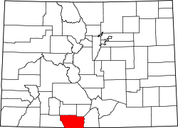
 Location of Sanford in Conejos County, Colorado. | |
| Coordinates: 37°15′25″N105°54′02″W / 37.25694°N 105.90056°W | |
| Country | |
| State | |
| County [1] | Conejos County |
| Incorporated | April 9, 1907 [2] |
| Government | |
| • Type | Statutory Town [1] |
| Area | |
• Total | 1.46 sq mi (3.78 km2) |
| • Land | 1.46 sq mi (3.78 km2) |
| • Water | 0.00 sq mi (0.00 km2) |
| Elevation | 7,599 ft (2,316 m) |
| Population | |
• Total | 879 |
| • Density | 600/sq mi (230/km2) |
| Time zone | UTC-7 (MST) |
| • Summer (DST) | UTC-6 (MDT) |
| ZIP code [6] | 81151 |
| Area code | 719 |
| FIPS code | 08-67830 |
| GNIS feature ID | 2413256 [4] |
| Website | townofsanford |
Sanford is a statutory town in Conejos County, Colorado, United States. The population was 879 at the 2020 census. [5]
Contents
A post office called Sanford has been in operation since 1888. [7] The town was named after Silas Sanford Smith, a Mormon pioneer. [8]