La Jara, Colorado | |
|---|---|
 The old La Jara railroad depot, now the town hall | |
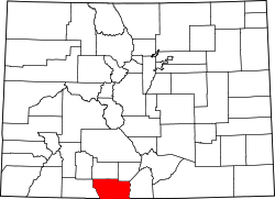
 Location of La Jara in Conejos County, Colorado. | |
| Coordinates: 37°16′25″N105°57′35″W / 37.27361°N 105.95972°W | |
| Country | United States |
| State | Colorado |
| County [1] | Conejos |
| Incorporated (town) | November 11, 1910 [2] |
| Government | |
| • Type | Statutory Town [1] |
| Area | |
• Total | 0.41 sq mi (1.06 km2) |
| • Land | 0.41 sq mi (1.06 km2) |
| • Water | 0.00 sq mi (0.00 km2) |
| Elevation | 7,605 ft (2,318 m) |
| Population | |
• Total | 730 |
| • Density | 1,800/sq mi (690/km2) |
| Time zone | UTC-7 (Mountain (MST)) |
| • Summer (DST) | UTC-6 (MDT) |
| ZIP code [6] | 81140 |
| Area code | 719 |
| FIPS code | 08-42055 |
| GNIS feature ID | 2412855 [4] |
| Website | townoflajara |
La Jara is a statutory town in Conejos County, Colorado, United States. The population was 730 at the 2020 United States census. [5]