The Denver and Rio Grande Western Railroad, often shortened to Rio Grande, D&RG or D&RGW, formerly the Denver & Rio Grande Railroad, was an American Class I railroad company. The railroad started as a 3 ft narrow-gauge line running south from Denver, Colorado, in 1870. It served mainly as a transcontinental bridge line between Denver and Salt Lake City, Utah. The Rio Grande was also a major origin of coal and mineral traffic.

Antonito is a Charter Town located in Conejos County, Colorado, United States. The town population was 647 at the 2020 United States Census. Antonito, Colorado, is classified as a charter city. Charter cities have the authority to create their own local government charter, which allows them more flexibility in governance and regulations compared to statutory cities.

Chama is a village in Rio Arriba County, New Mexico, United States. The population was 917 at the 2020 census. The village is located in the Rocky Mountains about 7 miles (11 km) south of the Colorado-New Mexico border.

A horseshoe curve is a class of climbing curve in a roadbed that reverses turn direction (inflection) twice on either side of a single tight curve that varies through an angle of about 180 degrees or more.

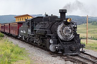
The Cumbres and Toltec Scenic Railroad, often abbreviated as the C&TSRR, is a 3 ft narrow-gauge heritage railroad that operates on 64 miles (103 km) of track between Antonito, Colorado, and Chama, New Mexico, in the United States. The railroad is named for two geographical features along the route: the 10,015-foot (3,053 m)-high Cumbres Pass and the Toltec Gorge. Originally part of the Denver and Rio Grande Western Railroad's narrow-gauge network, the line has been jointly owned by the states of Colorado and New Mexico since 1970.

The San Juan Skyway Scenic and Historic Byway is a 236-mile (380 km) All-American Road, National Forest Scenic Byway, and Colorado Scenic and Historic Byway located in Dolores, La Plata, Montezuma, San Juan, and San Miguel counties, Colorado, United States. The byway forms a loop in southwestern Colorado traversing the heart of the San Juan Mountains. The San Juan Skyway reaches its zenith at Red Mountain Pass at elevation 11,018 feet (3,358 m). Mesa Verde National Park was one of the original UNESCO World Heritage Sites. The Silverton Historic District and the Telluride Historic District are National Historic Landmarks.

The Colorado Pacific Rio Grande Railroad is a class III railroad operating in south-central Colorado. It runs on 154 miles (248 km) of former Denver and Rio Grande Western Railroad tracks on three lines radiating from Alamosa and interchanges with the Union Pacific Railroad in Walsenburg. Much of the railroad is located in the San Luis Valley. In 2022, it was purchased by Stefan Soloviev.

Cumbres Pass, elevation 10,022 ft (3,055 m), is a mountain pass in the San Juan Mountains in Colorado, United States. The pass is traversed by State Highway 17 and the Cumbres and Toltec Scenic Railroad. The highway has a moderate 5.8% approach on the north side and a gentler, 4% approach on the south side. It is rarely closed in winter and does not normally cause problems for vehicles, since the road is not a major through highway.
La Manga Pass, elevation 10,230 ft (3,120 m), is a mountain pass in the San Juan Mountains of Colorado. The pass is situated in Rio Grande National Forest.

The Denver and Rio Grande Western K-36 is a class of ten 3 ft narrow gauge 2-8-2 "Mikado" type steam locomotives built for the Denver and Rio Grande Western Railroad (D&RGW) by Baldwin Locomotive Works. They were shipped to the Rio Grande in 1925 and were first used along the Monarch Branch and Marshall Pass, but were later sent to the Third Division out of Alamosa. Of the original ten, four are owned by the Durango and Silverton Narrow Gauge Railroad (D&SNG) and five by the Cumbres and Toltec Scenic Railroad (C&TSRR). Number 485 fell into the turntable pit at Salida and was scrapped in Pueblo in 1955, with many parts being saved.

The Denver and Rio Grande Western K-37 is a class of 2-8-2 "Mikado" type narrow-gauge steam locomotives built for the Denver and Rio Grande Western Railroad. They were new steam locomotives built in the D&RGW Burnham Shops as a near copy of the Rio Grande class K-36. In-house production was chosen to preemptively address material shortages and personnel issues. Burnham Shops was assisted in the construction of the class by the Stearn-Rogers Manufacturing Company. The class recycled components from Baldwin Locomotive Works-built Class 19 2-8-0 locomotives used on the Rio Grande's standard gauge; re-using the boiler, tender and other components salvaged from the C-41's. The engine components were constructed new for the locomotive class.

The Rio Grande Scenic Railroad of Colorado was a heritage railway that operated from 2006 to 2019 in and around the San Luis Valley as a subsidiary of the San Luis and Rio Grande Railroad. The heritage railroad ceased operating excursions following a wildfire that damaged some of their facilities, as well as the parent company SLRG entering Chapter 11 bankruptcy in late 2019.

Cumbres and Toltec Scenic Railroad No. 463 is a 3-foot narrow-gauge class "K-27" 2-8-2 "Mikado" type steam locomotive built for the Denver and Rio Grande Railroad (D&RG) by the Baldwin Locomotive Works in 1903. It is one of two remaining Rio Grande K-27 locomotives, the other one being No. 464 at the Huckleberry Railroad in Genesee Township, Michigan. The class eventually became known by the nickname "Mudhens". Today, No. 463 is operational on the Cumbres and Toltec Scenic Railroad between Chama, New Mexico and Antonito, Colorado.

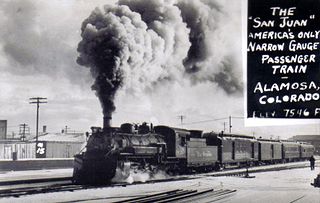
The San Juan Express was a narrow gauge train that ran on the 3 feet (0.91 m) Denver and Rio Grande Western Railroad (D&RGW) route from Durango, Colorado via Chama, New Mexico; Cumbres Pass; and Antonito, Colorado to Alamosa, Colorado. The train ran from February 11, 1937 until January 31, 1951 as train numbers 115 and 116, though towards the end of the passenger service it took on the number 215 and 216.
Sublette is a railroad ghost town in northern Rio Arriba County, New Mexico, United States, built as a section station in 1880. It is located north-east of Chama, just south of the Colorado state line and at milepost 306.1 of the former Denver and Rio Grande Western Railroad. When the Denver and Rio Grande abandoned its narrow gauge lines in the late 1960s, two parts of the system were preserved independently: the Cumbres & Toltec Scenic Railroad from Antonito to Chama, including Sublette itself, and the Durango and Silverton Narrow Gauge Railroad. Sublette sits at an elevation of 9,281 feet in the southeastern San Juan Mountains.

The Alamosa–Durango line or San Juan extension was a railroad line built by the Denver and Rio Grande Western Railroad, following the border between the U.S. states of Colorado and New Mexico, in the Rocky Mountains. The line was originally built as a 3 ft narrow-gauge line between Alamosa, Colorado, and Durango, Colorado. Portions of the route survive: the now standard-gauged segment from Alamosa to Antonito, Colorado, and a narrow-gauge portion from Antonito to Chama, New Mexico.
The Los Caminos Antiguos Scenic and Historic Byway is a 129-mile (208 km) Back Country Byway and Colorado Scenic and Historic Byway located in Alamosa, Conejos, and Costilla counties, Colorado, USA. The byway explores the historic San Luis Valley of south-central Colorado including Great Sand Dunes National Park and Preserve; the Old Spanish National Historic Trail; historic Fort Garland, San Luis (San Luis de la Culebra), the oldest town in Colorado; and the Cumbres and Toltec Scenic Railroad.
The Tracks Across Borders Scenic and Historic Byway is an 89-mile (143 km) Colorado Scenic and Historic Byway located in La Plata and Archuleta counties, Colorado, USA. From Durango, Colorado, the southern terminal of the Durango and Silverton Narrow Gauge Railroad, a National Historic Landmark, the byway follows the roadbed of the historic narrow-gauge Denver and Rio Grande Western Railroad through the Southern Ute Indian Reservation to the New Mexico state line. At the state line, the byway connects with the 9.9-mile (16 km) Narrow-Gauge Scenic Byway which continues on through the Jicarilla Apache Indian Reservation to Dulce, New Mexico. New Mexico plans to continue the byway on to Chama, New Mexico, the southern terminal of the Cumbres and Toltec Scenic Railroad, another National Historic Landmark, reconnecting the historic railway between Antonito, Colorado and Silverton, Colorado.

The Rio de los Pinos is a river in southern Colorado and northern New Mexico.


