Capulin, Colorado

Last updated

Capulin, Colorado
Capulin, Colorado.JPG
Looking west on Colorado State Highway 15 in Capulin.
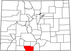
USA Colorado location map.svg
Red pog.svg
Capulin
Location in Colorado
Coordinates: 37°16′55″N106°06′18″W / 37.28194°N 106.10500°W / 37.28194; -106.10500 [1]
Country Flag of the United States.svg  United States
State Flag of Colorado.svg  Colorado
County Conejos County
Established1867 [2]
Government
  Type Unincorporated area
Area
[3]
  Total0.947 sq mi (2.453 km2)
  Land0.947 sq mi (2.453 km2)
  Water0.000 sq mi (0.000 km2)
Elevation
[1]
7,805 ft (2,379 m)
Population
 (2020) [4]
  Total134
  Density140/sq mi (55/km2)
Time zone UTC-7 (MST)
  Summer (DST) UTC-6 (MDT)
ZIP Code [5]
81124 (PO Box)
Area code 719
GNIS feature ID 2583218 [1]

Capulin is an unincorporated town, a post office, and a census-designated place (CDP) located in and governed by Conejos County, Colorado, United States. The Capulin post office has the ZIP Code 81124. [5] At the United States Census 2020, the population of the Capulin CDP was 134. [4]

Contents

History

The town of Capulin was established by settlers from Ojo Caliente, New Mexico, in 1867. [2] "Capulin" is a regional word for chokecherry. [2] The Capulin Post Office opened on August 10, 1881. [6]

Geography

Capulin is located in northern Conejos County. Colorado State Highway 15 leads east 8 miles (13 km) to U.S. Route 285, just north of La Jara, and west then north 22 miles (35 km) to Monte Vista.

The Capulin CDP has an area of 606 acres (2.453 km2), all land. [3]

Demographics

The United States Census Bureau initially defined the Capulin CDP for the United States Census 2010.

Capulin CDP, Colorado
YearPop.±%
2010 200    
2020 134−33.0%
Source: United States Census Bureau

Notable residents

See also

Related Research Articles

<span class="mw-page-title-main">Arboles, Colorado</span> Census Designated Place in Colorado, United States

Arboles is an unincorporated town, and a census-designated place (CDP) located in and governed by Archuleta County, Colorado, United States. The Arboles post office has the ZIP code 81121. At the United States Census 2020, the population of the Arboles CDP was 308. The town's name means "trees" in Spanish.

<span class="mw-page-title-main">La Jara, Colorado</span> Town in Colorado, United States

La Jara is a statutory town in Conejos County, Colorado, United States. The population was 730 at the 2020 United States Census.

<span class="mw-page-title-main">Louviers, Colorado</span> Census Designated Place in Colorado, United States

Louviers is an unincorporated town, a post office, and a census-designated place (CDP) located in and governed by Douglas County, Colorado, United States. The CDP is a part of the Denver–Aurora–Lakewood, CO Metropolitan Statistical Area. The Louviers post office has the ZIP Code 80131. At the United States Census 2020, the population of the Louviers CDP was 293.

<span class="mw-page-title-main">Sedalia, Colorado</span> Census Designated Place in Colorado, United States

Sedalia is an unincorporated town, a post office, and a census-designated place (CDP) located in and governed by Douglas County, Colorado, United States. The CDP is a part of the Denver–Aurora–Lakewood, CO Metropolitan Statistical Area. The Sedalia post office has the ZIP Code 80135. At the United States Census 2020, the population of the Sedalia CDP was 177.

<span class="mw-page-title-main">Edwards, Colorado</span> Census Designated Place in Colorado, United States

Edwards is an unincorporated town, a post office, and a census-designated place (CDP) located in and governed by Eagle County, Colorado, United States. Edwards is the principal town of the Edwards, CO Micropolitan Statistical Area. The Edwards post office has the ZIP Code 81632. At the United States Census 2020, the population of the Edwards CDP was 11,246. The Edwards Metropolitan District provides services.

<span class="mw-page-title-main">Atwood, Colorado</span> Census Designated Place in Colorado, United States

Atwood is an unincorporated town, a post office, and a census-designated place (CDP) located in and governed by Logan County, Colorado, United States. The CDP is a part of the Sterling, CO Micropolitan Statistical Area. The Atwood post office has the ZIP Code 80722. At the United States Census 2020, the population of the Atwood CDP was 138.

<span class="mw-page-title-main">Padroni, Colorado</span> Census Designated Place in Colorado, United States

Padroni is an unincorporated town, a census-designated place (CDP), and a post office located in and governed by Logan County, Colorado, United States. The CDP is a part of the Sterling, CO Micropolitan Statistical Area. The Padroni post office has the ZIP Code 80745. At the United States Census 2020, the population of the Padroni CDP was 75.

<span class="mw-page-title-main">Conejos, Colorado</span> Census Designated Place in Colorado, United States

Conejos is an unincorporated town, a post office, a census-designated place (CDP), and the county seat of Conejos County, Colorado, United States. The Conejos post office has the ZIP Code 81129. At the United States Census 2020, the population of the Conejos CDP was 46. Conejos is the only unincorporated county seat in the State of Colorado.

<span class="mw-page-title-main">Brandon, Colorado</span> Censuu-designated place in Kiowa County, Colorado, United States

Brandon is a census-designated place (CDP) in and governed by Kiowa County, Colorado, United States. The population of the Brandon CDP was 21 at the United States Census 2020. The Sheridan Lake post office serves Brandon postal addresses.

<span class="mw-page-title-main">Howard, Colorado</span> Census-designated place in Fremont County, Colorado, United States

Howard is a census-designated place (CDP) and post office in and governed by Fremont County, Colorado, United States. The CDP is a part of the Cañon City, CO Micropolitan Statistical Area. The Howard post office has the ZIP Code 81233. At the United States Census 2020, the population of the Howard CDP was 852.

<span class="mw-page-title-main">McCoy, Colorado</span> Census Designated Place in Colorado, United States

McCoy is an unincorporated town, a census-designated place (CDP), and a post office located in and governed by Eagle County, Colorado, United States. The CDP is a part of the Edwards, CO Micropolitan Statistical Area. The McCoy post office has the ZIP Code 80463. At the United States Census 2020, the population of the McCoy CDP was 30.

<span class="mw-page-title-main">Weston, Colorado</span> Census Designated Place in Colorado, United States

Weston is an unincorporated town, a post office, and a census-designated place (CDP) located in and governed by Las Animas County, Colorado, United States. The Weston post office has the ZIP Code 81091. At the United States Census 2020, the population of the Weston CDP was 53.

<span class="mw-page-title-main">Wolcott, Colorado</span> Census Designated Place in Colorado, United States

Wolcott is an unincorporated town, a post office, and a census-designated place (CDP) located in and governed by Eagle County, Colorado, United States. The CDP is a part of the Edwards, CO Micropolitan Statistical Area. The Wolcott post office has the ZIP Code 81655. At the United States Census 2020, the population of the Wolcott CDP was 20.

<span class="mw-page-title-main">Jansen, Colorado</span> Census Designated Place in Colorado, United States

Jansen is an unincorporated community and a census-designated place (CDP) located in and governed by Las Animas County, Colorado, United States. The population of the Jansen CDP was 101 at the United States Census 2020. The Trinidad post office serves the Jansen postal addresses.

<span class="mw-page-title-main">San Acacio, Colorado</span> Census Designated Place in Colorado, United States

San Acacio is an unincorporated community and a census-designated place (CDP) located in and governed by Costilla County, Colorado, United States. The population of the San Acacio CDP was 56 at the 2020 United States census. The Sanford post office serves San Acacio postal addresses.

<span class="mw-page-title-main">Segundo, Colorado</span> Census Designated Place in Colorado, United States

Segundo is an unincorporated community and a census-designated place (CDP) located in and governed by Las Animas County, Colorado, United States. The population of the Segundo CDP was 100 at the United States Census 2020. The Trinidad post office serves the area.

<span class="mw-page-title-main">Piedra, Colorado</span> Census Designated Place in Colorado, United States

Piedra is an unincorporated community and a census-designated place (CDP) located in and governed by Hinsdale County, Colorado, United States. The population of the Piedra CDP was 31 at the United States Census 2020. The Pagosa Springs post office serves the area.

<span class="mw-page-title-main">Catherine, Colorado</span> Census-designated place in Garfield County, Colorado, United States

Catherine is a census-designated place (CDP) in and governed by Garfield County, Colorado, United States. The CDP is a part of the Glenwood Springs, CO Micropolitan Statistical Area. The population of the Catherine CDP was 235 at the United States Census 2020. The Glenwood Springs post office serves the area.

<span class="mw-page-title-main">Mulford, Colorado</span> Census-designated place in Garfield County, Colorado, United States

Mulford is a Census-designated place (CDP) in and governed by Garfield County, Colorado, United States. The CDP is a part of the Glenwood Springs, CO Micropolitan Statistical Area. The population of the Mulford CDP was 259 at the United States Census 2020. The Carbondale post office serves the area.

<span class="mw-page-title-main">Lynn, Colorado</span> Census Designated Place in Colorado, United States

Lynn is an unincorporated community and a census-designated place (CDP) located in and governed by Las Animas County, Colorado, United States. The population of the Lynn CDP was 11 at the United States Census 2020. The Aguilar post office serves the area.

References

  1. 1 2 3 U.S. Geological Survey Geographic Names Information System: Capulin, Colorado
  2. 1 2 3 Eichler, Geo. R. (1977). Colorado Place Names. Boulder, Colo.: Johnson Publishing Company. LCCN   77-89726.
  3. 1 2 "State of Colorado Census Designated Places - BAS20 - Data as of January 1, 2020". United States Census Bureau . Retrieved December 21, 2020.
  4. 1 2 United States Census Bureau. "Capulin CDP, Colorado" . Retrieved March 30, 2023.
  5. 1 2 "Look Up a ZIP Code". United States Postal Service . Retrieved December 15, 2020.
  6. Bauer, William H.; James L. Ozment; John H. Willard (1990). Colorado Post Offices 1859-1989. Denver, Co.: The Colorado Railroad Museum. ISBN   0-918654-42-4. LCCN   90-034759.
  7. Oswald, Mark (April 14, 2014). "Eppie Archuleta, master weaver, dies at age 92". Albuquerque Journal . Retrieved May 10, 2014.