Bountiful, Colorado | |
|---|---|
 Entering from the south along Highway 285. | |
 Bountiful Location of Bountiful, Colorado.  Bountiful Bountiful (Colorado) | |
| Coordinates: 37°13′45″N105°58′37″W / 37.2292°N 105.9770°W [1] | |
| Country | United States |
| State | Colorado |
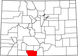
| County | Conejos [2] |
| Government | |
| • Type | unincorporated community |
| • Body | Conejos County [2] |
| Elevation | 7,645 ft (2,330 m) |
| Time zone | UTC−07:00 (MST) |
| • Summer (DST) | UTC−06:00 (MDT) |
| GNIS pop ID | 192987 |
Bountiful is an unincorporated community in Conejos County, in the U.S. state of Colorado. [3]
Contents
The community is on the Colorado Pacific Rio Grande Railroad, between Romeo to the south and La Jara to the north. [4]