Sawpit, Colorado

Last updated

Sawpit, Colorado
Sawpit, Colorado.JPG
Sawpit Mercantile in Sawpit
San Miguel County Colorado Incorporated and Unincorporated areas Sawpit Highlighted 0868655.svg
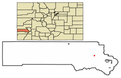
Location of Sawpit in San Miguel County, Colorado.
Coordinates: 37°59′41″N108°00′04″W / 37.99472°N 108.00111°W / 37.99472; -108.00111
Country Flag of the United States (23px).png  United States
State Flag of Colorado.svg  State of Colorado
County [1] San Miguel County
Incorporated 1896[ citation needed ]
Government
  Type Statutory Town [1]
Area
[2]
  Total
0.03 sq mi (0.08 km2)
  Land0.03 sq mi (0.08 km2)
  Water0.00 sq mi (0.00 km2)
Elevation
[3]
7,563 ft (2,305 m)
Population
 (2020) [4]
  Total
38
  Density1,300/sq mi (480/km2)
Time zone UTC-7 (MST)
  Summer (DST) UTC-6 (MDT)
ZIP codes [5]
81430, 81435
Area code 970
FIPS code 08-68655
GNIS feature ID2413263 [3]

Sawpit is a Statutory Town in San Miguel County, Colorado, United States. The town population was 38 at the 2020 census, making Sawpit the fifth least populous incorporated town in the state of Colorado. [4] The Telluride Post Office (ZIP Code 81435) serves Sawpit. [5]

Contents

Geography

According to the United States Census Bureau, the town has a total area of 0.031 square miles (0.080 km2), all land.

Demographics

Historical population
CensusPop.Note
1900 94
1910 12128.7%
1960 30
1970 26−13.3%
1980 4157.7%
1990 36−12.2%
2000 25−30.6%
2010 4060.0%
2020 38−5.0%

See also

References

  1. 1 2 "Active Colorado Municipalities". State of Colorado, Department of Local Affairs. Archived from the original on December 12, 2009. Retrieved September 1, 2007.
  2. "2019 U.S. Gazetteer Files". United States Census Bureau. Retrieved July 1, 2020.
  3. 1 2 U.S. Geological Survey Geographic Names Information System: Sawpit, Colorado
  4. 1 2 United States Census Bureau. "Sawpit town, Colorado" . Retrieved April 5, 2023.
  5. 1 2 "ZIP Code Lookup" (JavaScript/HTML). United States Postal Service. December 14, 2006. Retrieved December 14, 2006.