Hayden, Colorado | |
|---|---|
| Town of Hayden [1] | |
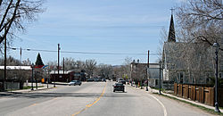 Jefferson Avenue (U.S. Route 40) in Hayden | |
 Location of the Town of Hayden in Routt County, Colorado. | |
 Hayden Location of the Town of Hayden in the United States. | |
| Coordinates: 40°29′13″N107°15′19″W / 40.48694°N 107.25528°W | |
| Country | |
| State | |
| County | Routt County [1] |
| Established | 1894 |
| Incorporated (town) | May 5, 1906 [2] |
| Government | |
| • Type | Home Rule Municipality [1] |
| Area | |
• Total | 3.278 sq mi (8.490 km2) |
| • Land | 3.278 sq mi (8.490 km2) |
| • Water | 0 sq mi (0.000 km2) |
| Elevation | 6,585 ft (2,007 m) |
| Population | |
• Total | 1,941 |
| • Density | 592/sq mi (229/km2) |
| • Metro | 24,829 |
| • CSA | 38,121 |
| Time zone | UTC−07:00 (MST) |
| • Summer (DST) | UTC−06:00 (MDT) |
| ZIP code [5] | 81639 |
| Area code | 970 |
| FIPS code | 08-35070 |
| GNIS feature ID | 2412740 [4] |
| Website | www |
The Town of Hayden is a home rule municipality located in Routt County, Colorado, United States. [1] The town population was 1,941 at the 2020 United States census. [3] Hayden is a part of the Steamboat Springs, CO Micropolitan Statistical Area. The town sits along U.S. Highway 40 in the Yampa River Valley between Craig and Steamboat Springs. Hayden is located near the Yampa Valley Regional Airport, by which Hayden is one of the smallest communities in the U.S. to have mainline passenger jet service provided by American Airlines, Delta Air Lines, Southwest Airlines, Alaska Airlines, JetBlue and United Airlines on a scheduled basis (some of these airlines fly there only seasonally).

