Naturita, Colorado

Last updated

Naturita, Colorado
Naturita, Colorado town hall.JPG
Town Hall on East Main Street
Montrose County Colorado Incorporated and Unincorporated areas Naturita Highlighted 0853120.svg
Location in Montrose County, Colorado
Usa edcp location map.svg
Red pog.svg
Naturita
Location in the United States
Coordinates: 38°13′06″N108°34′00″W / 38.21833°N 108.56667°W / 38.21833; -108.56667 [1]
Country United States
State Colorado
County [2] Montrose
Incorporated (town) November 30, 1951 [3]
Government
  Type Statutory town [2]
  State Representative Marc Catlin [4]
Area
[5]
  Total0.615 sq mi (1.594 km2)
  Land0.615 sq mi (1.594 km2)
  Water0.00 sq mi (0.00 km2)
Elevation
[1]
5,397 ft (1,645 m)
Population
 (2020) [6]
  Total485
  Density788.6/sq mi (304.5/km2)
Time zone UTC-7 (Mountain (MST))
  Summer (DST) UTC-6 (MDT)
ZIP code [7]
81422
Area code 970
FIPS code 08-53120
GNIS feature ID2413035 [1]
Website townofnaturita.org/ubweb/

Naturita is a statutory town in Montrose County, Colorado, United States. The population was 485 at the 2020 census, [6] down from 546 in 2010. [6]

Contents

The post office in Naturita was opened on October 21, 1881, under the name "Chipeta"; the name was changed to Naturita September 15, 1882, and has used that name since then. [8] [9] Naturita is a name derived from Spanish meaning "little nature". [10]

Geography

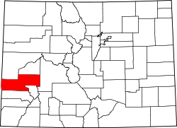
The community is located in southwest Montrose County within the San Miguel River valley. The community is served by Colorado State Highways 97 and 141. [11] Telluride is 52 miles (84 km) to the southeast via Highways 141 and 145. Montrose, the Montrose county seat, is 41 miles (66 km) to the northeast in air distance across the Uncompahgre Plateau but 86 miles (138 km) by paved roads.

According to the United States Census Bureau, the town has a total area of 0.6 square miles (1.6 km2), all of it land. [5] The San Miguel River flows northwest from Naturita to the Dolores River, which continues northwest to the Colorado River in Utah.

Climate

The average low in January is 16 °F (−9 °C), while the average high in July rises to 96 °F (36 °C). The record low temperature for the town is −23 °F (−31 °C), while the hottest temperature recorded is 115 °F (46 °C) [12]

Demographics

Historical population
CensusPop.Note
1960 979
1970 820−16.2%
1980 819−0.1%
1990 434−47.0%
2000 63546.3%
2010 546−14.0%
2020 485−11.2%
U.S. Decennial Census [13]

As of the census [14] of 2000, there were 635 people, 257 households, and 164 families residing in the town. The population density was 865.5 inhabitants per square mile (334.2/km2). There were 314 housing units at an average density of 428.0 units per square mile (165.3 units/km2). The racial makeup of the town was 93.70% White, 2.36% Native American, 0.16% Asian, 1.73% from other races, and 2.05% from two or more races. Hispanic or Latino of any race were 5.04% of the population.

There were 257 households, out of which 35.4% had children under the age of 18 living with them, 44.7% were married couples living together, 12.8% had a female householder with no husband present, and 35.8% were non-families. 28.4% of all households were made up of individuals, and 13.6% had someone living alone who was 65 years of age or older. The average household size was 2.46 and the average family size was 3.06.

In the town, the population was spread out, with 29.6% under the age of 18, 7.9% from 18 to 24, 27.2% from 25 to 44, 21.7% from 45 to 64, and 13.5% who were 65 years of age or older. The median age was 36 years. For every 100 females, there were 95.4 males. For every 100 females age 18 and over, there were 105.0 males.

The median income for a household in the town was $28,977, and the median income for a family was $37,917. Males had a median income of $33,203 versus $15,625 for females. The per capita income for the town was $13,867. About 3.8% of families and 10.0% of the population were below the poverty line, including 6.1% of those under age 18 and 11.8% of those age 65 or over.

Amenities

Naturita has an inn, cafe, gas station, bank, grocery store, cannabis dispensary, and a few motels. To the west along Highway 90 in the community of Bedrock is the historic Bedrock Store, where scenes from movies such as Thelma & Louise were filmed. [15]

See also

Related Research Articles

<span class="mw-page-title-main">Phillips County, Colorado</span> County in Colorado, United States

Phillips County is a county located in the U.S. state of Colorado. As of the 2020 census, the population was 4,530. The county seat is Holyoke. The county was named in honor of R.O. Phillips, a secretary of the Lincoln Land Company, who organized several towns in Colorado.

<span class="mw-page-title-main">Ouray County, Colorado</span> County in Colorado, United States

Ouray County is a county located in the U.S. state of Colorado. As of the 2020 census, the population was 4,874. The county seat is Ouray. Because of its rugged mountain topography, Ouray County is also known as the "Switzerland of America".

<span class="mw-page-title-main">Otero County, Colorado</span> County in Colorado, United States

Otero County is a county located in the U.S. state of Colorado. As of the 2020 census, the population was 18,690. The county seat is La Junta. The county was named for Miguel Antonio Otero, one of the founders of the town of La Junta and a member of a prominent Hispanic family.

<span class="mw-page-title-main">Montrose County, Colorado</span> County in Colorado, United States

Montrose County is a county located in the U.S. state of Colorado. As of the 2020 census, the population was 42,679. The county seat is Montrose, for which the county is named.

<span class="mw-page-title-main">Mesa County, Colorado</span> County in Colorado, United States

Mesa County is a county located in the U.S. state of Colorado. As of the 2020 census, the population was 155,703. The county seat and most populous municipality is Grand Junction. The county was named for the many large mesas in the area, including the Grand Mesa, which is the largest flat-topped mountain in the world.

<span class="mw-page-title-main">Hinsdale County, Colorado</span> County in Colorado, United States

Hinsdale County is a county located in the U.S. state of Colorado. As of the 2020 census, the population was 788, making it the least-populous county in Colorado. With a population density of only 0.71 inhabitants per square mile (0.27/km2), it is also the least-densely populated county in Colorado. The county seat and only incorporated municipality in the county is Lake City. The county is named for George A. Hinsdale, a prominent pioneer and former Lieut. Governor of Colorado Territory.

<span class="mw-page-title-main">Gunnison County, Colorado</span> County in Colorado, United States

Gunnison County is a county located in the U.S. state of Colorado. As of the 2020 census, the population was 16,918. The county seat is Gunnison. The county was named for John W. Gunnison, a United States Army officer and captain in the Army Topographical Engineers, who surveyed for the transcontinental railroad in 1853.

<span class="mw-page-title-main">Delta County, Colorado</span> County in Colorado, United States

Delta County is a county located in the U.S. state of Colorado. As of the 2020 census, the population was 31,196. The county seat is Delta.

<span class="mw-page-title-main">Jamestown, Colorado</span> Town in Colorado, United States

The historic Town of Jamestown is a Statutory Town in Boulder County, Colorado, United States. The population was 256 at the 2020 United States Census, down from 274 in 2010. It was named for James Smith, an early discoverer of gold. Jamestown was hit hard by the September 2013 Colorado floods when the town was isolated due to road damage from the rains and the flooding of James Creek. Under a mandatory evacuation order, most residents were airlifted to safety under the direction of the Colorado National Guard to nearby Boulder.

<span class="mw-page-title-main">Ward, Colorado</span> Town in Colorado, United States

Ward is a home rule municipality in Boulder County, Colorado, United States. The population was 128 at the 2020 census. The town is a former mining settlement founded in 1860 in the wake of the discovery of gold at nearby Gold Hill. Once one of the richest towns in the state during the Colorado Gold Rush, it is located on a mountainside at the top of Left Hand Canyon, near the Peak to Peak Highway northwest of Boulder at an elevation of 9,450 feet (2,880 m) above sea level.

<span class="mw-page-title-main">Delta, Colorado</span> City in Colorado, United States

Delta is a home rule municipality that is the county seat and the most populous municipality of Delta County, Colorado, United States. The town population was 9,035 at the 2020 United States Census. The United States Forest Service headquarters of the Grand Mesa, Gunnison, and Uncompahgre National Forests are located in Delta.

<span class="mw-page-title-main">Dove Creek, Colorado</span> Town in Colorado, United States

Dove Creek is a statutory town that is the county seat and the most populous municipality of Dolores County, Colorado, United States. The town population was 635 at the 2020 United States Census. The community takes its name from the nearby Dove Creek. Dove Creek is the self-proclaimed Pinto Bean Capital of the World.

<span class="mw-page-title-main">Red Cliff, Colorado</span> Town in Colorado, United States

Red Cliff is a statutory town in Eagle County, Colorado, United States. The population was 257 at the 2020 census. The town is a former mining camp situated in the canyon of the upper Eagle River just off U.S. Highway 24 north of Tennessee Pass. The town site is concealed below the highway and is accessible by a side road leading to Shrine Pass in the Sawatch Range.

<span class="mw-page-title-main">Florence, Colorado</span> City in Colorado, United States

The City of Florence is a statutory city located in Fremont County, Colorado, United States. The city population was 3,822 at the 2020 United States Census. Florence is a part of the Cañon City, CO Micropolitan Statistical Area and the Front Range Urban Corridor.

<span class="mw-page-title-main">Montrose, Colorado</span> City in Colorado, United States

Montrose is a home rule municipality that is the county seat and the most populous municipality of Montrose County, Colorado, United States. The city population was 20,291 at the 2020 census, within a total area of 18.5 square miles. The main road that leads in and out of Montrose is U.S. Highway 50. The city is located in western Colorado, in the Uncompahgre Valley, and is an economic, labor, and transportation waypoint for the surrounding area. Montrose is the second-largest city in western Colorado, after Grand Junction.

<span class="mw-page-title-main">Nucla, Colorado</span> Town in Colorado, United States

Nucla is a statutory town in Montrose County, Colorado, United States. The population was 585 as of the 2020 census, down from 711 in 2010. Its name comes from the town founders' intent that it serve as a "nucleus" for the surrounding farms and mines, although it has since come to be associated with the growth of uranium mining in the region.

<span class="mw-page-title-main">Olathe, Colorado</span> Town in Montrose County, Colorado, United States

Olathe is a statutory town in Montrose County, Colorado, United States. The population was 2,019 as of the 2020 census, up from 1,849 at the 2010 census. A post office called Olathe has been in operation since 1896. The community was named after Olathe, Kansas.

<span class="mw-page-title-main">Ouray, Colorado</span> City in Colorado, United States

Ouray is a home rule municipality that is the county seat of Ouray County, Colorado, United States. The city population was 898 as of the 2020 census. The Ouray Post Office has the ZIP Code 81427. Located at an elevation of 7,792 feet (2,375 m), Ouray's climate, natural alpine environment, and scenery have earned it the nickname "Switzerland of America".

<span class="mw-page-title-main">Ridgway, Colorado</span> Town in Colorado, United States

The Town of Ridgway is the home rule municipality that is the most populous municipality in Ouray County, Colorado, United States. The town is a former railroad stop on the Uncompahgre River in the northern San Juan Mountains. The town population was 1,183 at the 2020 census.

<span class="mw-page-title-main">Platteville, Colorado</span> Town in Colorado, United States

Platteville is a Statutory Town in Weld County, Colorado, United States. The population was 2,955 at the 2020 census. It is adjacent to Fort Vasquez on U.S. Highway 85.

References

  1. 1 2 3 U.S. Geological Survey Geographic Names Information System: Naturita, Colorado
  2. 1 2 "Active Colorado Municipalities". State of Colorado, Department of Local Affairs. Archived from the original on December 12, 2009. Retrieved September 1, 2007.
  3. "Colorado Municipal Incorporations". State of Colorado, Department of Personnel & Administration, Colorado State Archives. December 1, 2004. Retrieved September 2, 2007.
  4. "State Representative". State of Colorado. Retrieved January 3, 2024.
  5. 1 2 "2022 U.S. Gazetteer Files: Colorado". United States Census Bureau. Retrieved December 1, 2022.
  6. 1 2 3 "P1. Race – Naturita CDP, Colorado: 2020 DEC Redistricting Data (PL 94-171)". U.S. Census Bureau. Retrieved December 1, 2022.
  7. "ZIP Code Lookup". United States Postal Service. Archived from the original (JavaScript/HTML) on January 1, 2008. Retrieved November 25, 2007.
  8. Class I Cultural Resource Overview of the Bureau of Land Management’s Uncompahgre Field Office, Western Colorado, Rand A. Greubel, Jaclyn Mullen, Matthew J. Landt, Jonathon C. Horn, and Alan D. Reed, Alpine Archaeological Consultants, Inc., Montrose, Colorado, 2010, p. 167
  9. "Post offices". Jim Forte Postal History. Retrieved July 1, 2016.
  10. Dawson, John Frank (1954). Place names in Colorado: why 700 communities were so named, 150 of Spanish or Indian origin. Denver, CO: The J. Frank Dawson Publishing Co. p. 37.
  11. Naturita, CO., 7.5 Minute Topographic Quadrangle, USGS, 1994
  12. "Monthly Weather-Naturita, CO". The Weather Channel. 2022. Retrieved August 30, 2022.
  13. "Census of Population and Housing". Census.gov. Retrieved June 4, 2015.
  14. "U.S. Census website". United States Census Bureau . Retrieved January 31, 2008.
  15. Naturita information from Colorado.com