Redvale, Colorado

Last updated

Redvale, Colorado
Redvale, Colorado.JPG
Entering Redvale from the northwest on Colorado State Highway 145
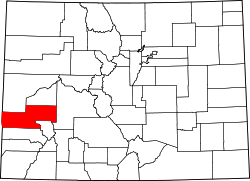
Montrose County Colorado Incorporated and Unincorporated areas Redvale Highlighted 0863705.svg
Usa edcp location map.svg
Red pog.svg
Redvale
Location in the United States
Coordinates: 38°10′34″N108°24′45″W / 38.17611°N 108.41250°W / 38.17611; -108.41250 (Redvale CDP, Colorado) [1]
Country Flag of the United States.svg  United States
State Flag of Colorado.svg  Colorado
County Montrose County
Government
[2]
  Type unincorporated community
Area
[1]
  Total4.680 sq mi (12.121 km2)
  Land4.680 sq mi (12.121 km2)
  Water0.000 sq mi (0.000 km2)
Elevation
[2]
6,500 ft (2,000 m)
Population
 (2020) [3]
  Total172
  Density37/sq mi (14.2/km2)
Time zone UTC-7 (MST)
  Summer (DST) UTC-6 (MDT)
ZIP Code [4]
81431
Area code 970
GNIS feature 2629992 [2]

Redvale is an unincorporated town, a post office, and a census-designated place (CDP) located in and governed by Montrose County, Colorado, United States. The CDP is a part of the Montrose, CO Micropolitan Statistical Area. The Redvale post office has the ZIP Code 81431. [4] At the 2020 census, the population of the Redvale CDP was 172, [3] down from 236 in 2010.

Contents

Geography

Redvale is in southern Montrose County near the eastern end of the Colorado Plateau. The community is bordered to the south by San Miguel County. It sits atop Wrights Mesa, bordered by Naturita Canyon to the southwest and Maverick Draw to the northeast. Colorado State Highway 145 passes through the community, leading northwest 10 miles (16 km) to Naturita and southeast 9 miles (14 km) to Norwood.

The Redvale CDP has an area of 4.7 square miles (12.1 km2), all land. [1] The community is in the watershed of the San Miguel River, leading northwest to the Dolores River which flows into the Colorado River in Utah.

Demographics

The United States Census Bureau initially defined the Redvale CDP for the United States Census 2010.

Redvale CDP, Colorado
YearPop.±%
2010 236    
2020 172−27.1%
Source: United States Census Bureau

See also

Related Research Articles

<span class="mw-page-title-main">Edwards, Colorado</span> Census Designated Place in Colorado, United States

Edwards is an unincorporated town, a post office, and a census-designated place (CDP) located in and governed by Eagle County, Colorado, United States. Edwards is the principal town of the Edwards, CO Micropolitan Statistical Area. The Edwards post office has the ZIP Code 81632. At the United States Census 2020, the population of the Edwards CDP was 11,246. The Edwards Metropolitan District provides services.

<span class="mw-page-title-main">El Jebel, Colorado</span> Census Designated Place in Colorado, United States

El Jebel is an unincorporated community and a census-designated place (CDP) located in and governed by Eagle County, Colorado, United States. The CDP is a part of the Edwards, CO Micropolitan Statistical Area. The population of the El Jebel CDP was 4,130 at the United States Census 2020. The Carbondale Post Office serves El Jebel postal addresses.

<span class="mw-page-title-main">Ponderosa Park, Colorado</span> Census Designated Place in Colorado, United States

Ponderosa Park is an unincorporated community and a census-designated place (CDP) located in and governed by Elbert County, Colorado, United States. The CDP is a part of the Denver–Aurora–Lakewood, CO Metropolitan Statistical Area. The population of the Ponderosa Park CDP was 3,334 at the United States Census 2020. Elbert County governs the unincorporated community. The Elizabeth post office serves the area.

<span class="mw-page-title-main">Padroni, Colorado</span> Census Designated Place in Colorado, United States

Padroni is an unincorporated town, a census-designated place (CDP), and a post office located in and governed by Logan County, Colorado, United States. The CDP is a part of the Sterling, CO Micropolitan Statistical Area. The Padroni post office has the ZIP Code 80745. At the United States Census 2020, the population of the Padroni CDP was 75.

<span class="mw-page-title-main">Orchard Mesa, Colorado</span> Census-designated places in Mesa County, United States

Orchard Mesa is a census-designated place (CDP) in and governed by Mesa County, Colorado, United States. It is part of the Grand Junction, CO Metropolitan Statistical Area. The population of the Orchard Mesa CDP was 6,688 at the 2020 census. The Grand Junction post office serves the area.

<span class="mw-page-title-main">Naturita, Colorado</span> Town in Colorado, United States

Naturita is a statutory town in Montrose County, Colorado, United States. The population was 485 at the 2020 census, down from 546 in 2010.

<span class="mw-page-title-main">Loghill Village, Colorado</span> Census-designated place in Ouray County, Colorado, United States

Loghill Village is a Census-designated place (CDP) in and governed by Ouray County, Colorado, United States. The CDP is a part of the Montrose, CO Micropolitan Statistical Area. The population of the Loghill Village CDP was 617 at the United States Census 2020. The Ridgway post office (Zip Code 81432) serves Loghill Village postal addresses.

<span class="mw-page-title-main">Woody Creek, Colorado</span> Census Designated Place in Colorado, United States

Woody Creek is an unincorporated town, a post office, and a census-designated place (CDP) located in and governed by Pitkin County, Colorado, United States. The Woody Creek post office has the ZIP Code 81656. At the United States Census 2020, the population of the Woody Creek CDP was 290. The Woody Creek Metropolitan District provides services. The CDP is a part of the Glenwood Springs, CO Micropolitan Statistical Area.

<span class="mw-page-title-main">Coaldale, Colorado</span> Census-designated place in Fremont County, Colorado, United States

Coaldale is a census-designated place (CDP) and post office located in and governed by Fremont County, Colorado, United States. The CDP is a part of the Cañon City, CO Micropolitan Statistical Area. The Coaldale post office has the ZIP Code 81222. At the United States Census 2020, the population of the Coaldale CDP was 343.

<span class="mw-page-title-main">Howard, Colorado</span> Census-designated place in Fremont County, Colorado, United States

Howard is a census-designated place (CDP) and post office in and governed by Fremont County, Colorado, United States. The CDP is a part of the Cañon City, CO Micropolitan Statistical Area. The Howard post office has the ZIP Code 81233. At the United States Census 2020, the population of the Howard CDP was 852.

<span class="mw-page-title-main">Maybell, Colorado</span> Census-designated place in Moffat County, Colorado, United States

Maybell is an unincorporated community and census-designated place (CDP) in and governed by Moffat County, Colorado, United States. The CDP is a part of the Craig, CO Micropolitan Statistical Area.

<span class="mw-page-title-main">McCoy, Colorado</span> Census Designated Place in Colorado, United States

McCoy is an unincorporated town, a census-designated place (CDP), and a post office located in and governed by Eagle County, Colorado, United States. The CDP is a part of the Edwards, CO Micropolitan Statistical Area. The McCoy post office has the ZIP Code 80463. At the United States Census 2020, the population of the McCoy CDP was 30.

<span class="mw-page-title-main">Orchard, Colorado</span> Unincorporated community in Colorado, United States

Orchard is an unincorporated town, a post office, and a census-designated place (CDP) located in and governed by Morgan County, Colorado, United States. The CDP is a part of the Fort Morgan, CO Micropolitan Statistical Area. The Orchard post office has the ZIP Code 80649. As of the 2020 census, the population of the Orchard CDP was 76.

<span class="mw-page-title-main">Snyder, Colorado</span> Census-designated place in Colorado, United States

Snyder is an unincorporated town, a post office, and a census-designated place (CDP) located in and governed by Morgan County, Colorado, United States. The CDP is a part of the Fort Morgan, CO Micropolitan Statistical Area. The Snyder post office has the ZIP Code 80750. As of the 2020 census, the population of the Snyder CDP was 136.

<span class="mw-page-title-main">Wolcott, Colorado</span> Census Designated Place in Colorado, United States

Wolcott is an unincorporated town, a post office, and a census-designated place (CDP) located in and governed by Eagle County, Colorado, United States. The CDP is a part of the Edwards, CO Micropolitan Statistical Area. The Wolcott post office has the ZIP Code 81655. At the United States Census 2020, the population of the Wolcott CDP was 20.

<span class="mw-page-title-main">Copper Mountain, Colorado</span> Census-designated place in Colorado, US

Copper Mountain is an unincorporated community and a census-designated place (CDP) located in and governed by Summit County, Colorado, United States. The CDP is a part of the Breckenridge, CO Micropolitan Statistical Area. The population of the Copper Mountain CDP was 650 at the United States Census 2020. The Copper Mountain Consolidated Metropolitan District provides services. The Frisco post office (Zip Code 80443) serves the area. The Copper Mountain CDP includes the Copper Mountain Ski Resort and Copper Mountain village.

<span class="mw-page-title-main">Catherine, Colorado</span> Census-designated place in Garfield County, Colorado, United States

Catherine is a census-designated place (CDP) in and governed by Garfield County, Colorado, United States. The CDP is a part of the Glenwood Springs, CO Micropolitan Statistical Area. The population of the Catherine CDP was 235 at the United States Census 2020. The Glenwood Springs post office serves the area.

<span class="mw-page-title-main">Cattle Creek, Colorado</span> Census-designated place in Garfield County, Colorado, United States

Cattle Creek is a census-designated place (CDP) in and governed by Garfield County, Colorado, United States. The CDP is a part of the Glenwood Springs, CO Micropolitan Statistical Area. The population of the Cattle Creek CDP was 662 at the United States Census 2020. The Glenwood Springs post office serves the area.

<span class="mw-page-title-main">Mulford, Colorado</span> Census-designated place in Garfield County, Colorado, United States

Mulford is a Census-designated place (CDP) in and governed by Garfield County, Colorado, United States. The CDP is a part of the Glenwood Springs, CO Micropolitan Statistical Area. The population of the Mulford CDP was 259 at the United States Census 2020. The Carbondale post office serves the area.

<span class="mw-page-title-main">Colona, Colorado</span> Census-designated place in Colorado, United States

Colona is a census-designated place (CDP) located in and governed by Ouray County, Colorado, United States. The CDP is a part of the Montrose, CO Micropolitan Statistical Area. The population of the Colona CDP was 36 at the United States Census 2020. The Montrose post office (Zip Code 81401) serves the area.

References

  1. 1 2 3 "2022 U.S. Gazetteer Files: Colorado". United States Census Bureau. Retrieved December 1, 2022.
  2. 1 2 3 U.S. Geological Survey Geographic Names Information System: Redvale, Colorado
  3. 1 2 "P1. Race – Redvale CDP, Colorado: 2020 DEC Redistricting Data (PL 94-171)". U.S. Census Bureau. Retrieved December 1, 2022.
  4. 1 2 "Look Up a ZIP Code". United States Postal Service . Retrieved December 24, 2020.