This article needs additional citations for verification .(February 2011) |
Uravan, Colorado | |
|---|---|
 The reclaimed Uravan townsite (at the base of sandstone outcrop) as it appeared in 2008 | |
 Uravan  Uravan | |
| Coordinates: 38°22′06″N108°44′11″W / 38.36833°N 108.73639°W | |
| Country | United States |
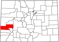
| State | Colorado |
| County | Montrose |
| Elevation | 4,990 ft (1,520 m) |
| Population (2010) | |
• Total | 0 |
| Time zone | UTC-7 (Mountain (MST)) |
| • Summer (DST) | UTC-6 (MDT) |
| GNIS feature ID | 203153 [1] |
Uravan (a contraction of uranium/vanadium [2] ) is a former uranium mining town [3] in western Montrose County, Colorado, United States, which still appears on some maps. The town was a company town established by U. S. Vanadium Corporation in 1936 to extract the rich vanadium ore in the region. As a byproduct of vanadium extraction, small amounts of uranium were also produced, at the time mostly used as a yellow pigment for ceramics.
Contents
The town was located approximately 90 miles (140 km) south-southwest of Grand Junction along the San Miguel River. At one time, over 800 people lived in Uravan, and the town housed a school, a trading center (store), medical facilities, tennis courts, a recreation center, and a pool. The school and some other facilities remained operational until at least 1983; however, Uravan was shut down by mid-1985, and no traces of its former buildings remain. Uravan is now an uninhabited, undeveloped Superfund site.