Bedrock, Colorado | |
|---|---|
 Bedrock's general store | |
 Bedrock Location of Bedrock, Colorado.  Bedrock Bedrock (Colorado) | |
| Coordinates: 38°18′54″N108°53′27″W / 38.3150°N 108.8909°W [1] | |
| Country | United States |
| State | Colorado |
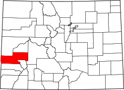
| County | Montrose [2] |
| Established | 1883 [3] |
| Government | |
| • Type | unincorporated community |
| • Body | Montrose County [2] |
| Elevation | 4,990 ft (1,520 m) |
| Time zone | UTC−07:00 (MST) |
| • Summer (DST) | UTC−06:00 (MDT) |
| ZIP Code | 81411 [4] |
| GNIS pop ID | 185822 |
Bedrock is an unincorporated community and U.S. post office in western Montrose County, Colorado, United States. The ZIP code of Bedrock is 81411. [4]