Merino, Colorado

Last updated
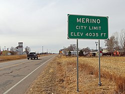
Town of Merino, Colorado
Merino, Colorado.JPG
Platte Street in Merino.
Logan County Colorado Incorporated and Unincorporated areas Merino Highlighted 0850040.svg
Location of Merino in Logan County, Colorado.
Coordinates: 40°29′4″N103°21′13″W / 40.48444°N 103.35361°W / 40.48444; -103.35361 Coordinates: 40°29′4″N103°21′13″W / 40.48444°N 103.35361°W / 40.48444; -103.35361
Country Flag of the United States.svg  United States
State Flag of Colorado.svg  Colorado
County [1] Logan
Incorporated (town) January 4, 1917 [2]
Government
  Type Statutory Town [1]
Area
[3]
  Total0.15 sq mi (0.39 km2)
  Land0.15 sq mi (0.39 km2)
  Water0.00 sq mi (0.00 km2)
Elevation
[4]
4,035 ft (1,230 m)
Population
 (2020) [5]
  Total281
  Density1,900/sq mi (720/km2)
Time zone UTC-7 (Mountain (MST))
  Summer (DST) UTC-6 (MDT)
ZIP code [6]
80741
Area code 970
FIPS code 08-50040
GNIS feature ID 0204720

The Town of Merino is a Statutory Town in Logan County, Colorado, United States. The town population was 281 at the 2020 United States Census. [5]

Contents

The town was named for the merino sheep which grazed there. [7] [8]

Geography

Merino is located at 40°29′4″N103°21′13″W / 40.48444°N 103.35361°W / 40.48444; -103.35361 (40.484418, -103.353691). [9]

According to the United States Census Bureau, the town has a total area of 0.152 square miles (0.39 km2), all of it land.

Demographics

Historical population
CensusPop.Note
1920 263
1930 230−12.5%
1940 25912.6%
1950 209−19.3%
1960 26828.2%
1970 260−3.0%
1980 255−1.9%
1990 238−6.7%
2000 2463.4%
2010 28415.4%
2020 281−1.1%
U.S. Decennial Census

Climate

According to the Köppen Climate Classification system, Merino has a semi-arid climate, abbreviated "BSk" on climate maps. [10]

Notable People

Radio and television host Ralph Edwards was born in Merino. [11] Ralph Edwards Avenue [12] was named in his memory.

See also

Related Research Articles

<span class="mw-page-title-main">Cheyenne Wells, Colorado</span> Town in Colorado, United States

Cheyenne Wells is the Statutory Town that is the county seat and the most populous municipality of Cheyenne County, Colorado, United States. The town population was 758 at the 2020 United States Census.

<span class="mw-page-title-main">Ordway, Colorado</span> Town in and county seat of Crowley County, Colorado, United States

Ordway is a Statutory Town in and the county seat of Crowley County, Colorado, United States, that is also the most populous community in the county. The population was 1,066 at the 2020 census.

<span class="mw-page-title-main">Sugar City, Colorado</span> Town in Colorado, United States

Sugar City is a Statutory Town in Crowley County, Colorado, United States. The population was 259 at the 2020 census.

<span class="mw-page-title-main">Gypsum, Colorado</span> Town in Colorado, United States

The Town of Gypsum is the home rule municipality that is the most populous municipality in Eagle County, Colorado, United States. The town population was 8,040 at the 2020 United States Census, a +24.13% increase since the 2010 United States Census. Gypsum is a part of the Edwards, CO Micropolitan Statistical Area. Gypsum is the home of an American Gypsum drywall plant and mine.

<span class="mw-page-title-main">Walden, Colorado</span> Town in Jackson County, Colorado, United States

Walden is the Statutory Town that is the county seat, the most populous community, and the only incorporated municipality in Jackson County, Colorado, United States. It is situated in the center of a large open valley called North Park. People from Walden and the surrounding area refer to themselves as "North Parkers". The town population was 606 at the 2020 census. The town sits at an elevation of 8,099 feet. It was established in 1889 and was incorporated 2 December 1890. Mark A. Walden, an early postmaster, gave the community his name.

<span class="mw-page-title-main">Kim, Colorado</span> Town in Colorado, United States

The Town of Kim is a Statutory Town in Las Animas County, Colorado, United States. The population was 63 at the time of the 2020 United States Census. As of 2014, the town included a complete school system, a post office, and a general store.

<span class="mw-page-title-main">Atwood, Colorado</span> Census Designated Place in Colorado, United States

Atwood is an unincorporated town, a post office, and a census-designated place (CDP) located in and governed by Logan County, Colorado, United States. The CDP is a part of the Sterling, CO Micropolitan Statistical Area. The Atwood post office has the ZIP Code 80722. At the United States Census 2020, the population of the Atwood CDP was 138.

<span class="mw-page-title-main">Crook, Colorado</span> Town in Colorado, United States

The Town of Crook is a Statutory Town in Logan County, Colorado, United States. The town population was 133 at the 2020 United States Census. Crook is a part of the Sterling, CO Micropolitan Statistical Area.

<span class="mw-page-title-main">Iliff, Colorado</span> Town in Colorado, United States

The Town of Iliff is a Statutory Town located in Logan County, Colorado, United States. The population was 246 at the 2020 United States Census.

<span class="mw-page-title-main">Peetz, Colorado</span> Town in Colorado, United States

Peetz is a Statutory Town in Logan County, Colorado, United States. The population was 213 at the 2020 census. Peetz is home to the RE-5 School District and Peetz K-12 School.

<span class="mw-page-title-main">Sterling, Colorado</span> City in Colorado, United States

Sterling is a home rule municipality and the county seat and most populous municipality of Logan County, Colorado, United States. Sterling is the principal city of the Sterling, CO Micropolitan Statistical Area. The city population was 13,735 at the 2020 census.

<span class="mw-page-title-main">Hillrose, Colorado</span> Town in Colorado, United States

The Town of Hillrose is a statutory town located in Morgan County, Colorado, United States. The town population was 312 at the 2020 United States Census, an 18.18% increase since the 2010 United States Census.

<span class="mw-page-title-main">Manzanola, Colorado</span> Town in Otero County, Colorado, United States

The Town of Manzanola is a Statutory Town in Otero County, Colorado, United States. The town population was 341 at the 2020 United States Census.

<span class="mw-page-title-main">Meeker, Colorado</span> Town in and county seat of Rio Blanco County, Colorado, United States

Meeker is the Statutory Town in and the county seat of Rio Blanco County, Colorado, United States, that is the most populous municipality in the county. The town population was 2,374 at the 2020 United States Census.

<span class="mw-page-title-main">Akron, Colorado</span> Town in Colorado, United States

Akron is the Statutory Town that is the county seat and the most populous municipality of Washington County, Colorado, United States. The town population was 1,757 at the 2020 United States Census.

<span class="mw-page-title-main">Otis, Colorado</span> Town in Colorado, United States

Otis is a Statutory Town in Washington County, Colorado, United States. The population was 511 at the 2020 census.

<span class="mw-page-title-main">LaSalle, Colorado</span> Town in Colorado, United States

The Town of LaSalle is a Statutory Town in Weld County, Colorado, United States. The town population was 2,359 at the 2020 United States Census.

<span class="mw-page-title-main">Raymer, Colorado</span> Town in Colorado, United States

The Town of Raymer is a Statutory Town located in Weld County, Colorado, United States. The population was 110 at the U.S. Census 2020.

<span class="mw-page-title-main">Eckley, Colorado</span> Town in Colorado, United States

The Town of Eckley is a statutory town located in Yuma County, Colorado, United States. The town population was 232 at the 2020 United States Census.

<span class="mw-page-title-main">Wray, Colorado</span> City in Colorado, United States

Wray is the home rule municipality that is the county seat of Yuma County, Colorado, United States. Located in the Colorado Plains, the city is 170 miles east of Denver, 9 miles west of the Nebraska state line, and 25 miles northwest of the Kansas state line. The population was 2,358 at the 2020 United States census.

References

  1. 1 2 "Active Colorado Municipalities". State of Colorado, Department of Local Affairs. Archived from the original on 2009-12-12. Retrieved 2007-09-01.
  2. "Colorado Municipal Incorporations". State of Colorado, Department of Personnel & Administration, Colorado State Archives. 2004-12-01. Retrieved 2007-09-02.
  3. "2019 U.S. Gazetteer Files". United States Census Bureau. Retrieved July 1, 2020.
  4. "US Board on Geographic Names". United States Geological Survey. 2007-10-25. Retrieved 2008-01-31.
  5. 1 2 United States Census Bureau. "Merino town; Colorado" . Retrieved April 21, 2023.
  6. "ZIP Code Lookup". United States Postal Service. Archived from the original (JavaScript/HTML) on January 1, 2008. Retrieved November 22, 2007.
  7. Dawson, John Frank. Place names in Colorado: why 700 communities were so named, 150 of Spanish or Indian origin. Denver, CO: The J. Frank Dawson Publishing Co. p. 34. Archived from the original on May 12, 2021.
  8. Exploring Colorado Highways: Trip Trivia. Exploring America's Highway. 2007. p. 109. ISBN   978-0-9777301-0-0.
  9. "US Gazetteer files: 2010, 2000, and 1990". United States Census Bureau. 2011-02-12. Retrieved 2011-04-23.
  10. Climate Summary for Merino, Colorado
  11. "Ralph Edwards". IMDb. Retrieved 2018-02-02.
  12. "Google Maps". Google Maps. Retrieved 2018-02-02.