Kit Carson, Colorado | |
|---|---|
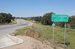 Kit Carson (2013) | |
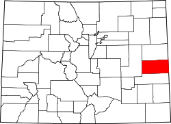
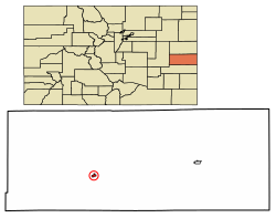 Location within Cheyenne County and Colorado | |
| Coordinates: 38°45′50″N102°47′38″W / 38.76389°N 102.79389°W [1] | |
| Country | United States |
| State | Colorado |
| County | Cheyenne [2] |
| Incorporated | July 13, 1931 [3] |
| Area | |
• Total | 0.58 sq mi (1.51 km2) |
| • Land | 0.58 sq mi (1.51 km2) |
| • Water | 0 sq mi (0.00 km2) |
| Elevation | 4,285 ft (1,306 m) |
| Population | |
• Total | 255 |
| • Density | 437/sq mi (169/km2) |
| Time zone | UTC−7 (MST) |
| • Summer (DST) | UTC−6 (MDT) |
| ZIP Code | 80825 [6] |
| Area code | 719 |
| FIPS code | 08-41010 [1] |
| GNIS ID | 195254 [1] |
| Major highways | |
| Website | townofkitcarson.com |
Kit Carson is a statutory town in Cheyenne County, Colorado, United States. [1] The population was 255 at the 2020 United States census. [5]