Arapahoe, Colorado | |
|---|---|
 View from U.S. Route 40 (2024) | |
 Arapahoe Location of Arapahoe, Colorado.  Arapahoe Arapahoe (Colorado) | |
| Coordinates: 38°51′00″N102°10′56″W / 38.8500°N 102.1821°W [1] | |
| Country | United States |
| State | Colorado |
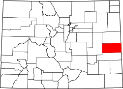
| County | Cheyenne [2] |
| Founded | 1870 [3] |
| Government | |
| • Type | unincorporated community |
| • Body | Cheyenne County [2] |
| Area | |
• Total | 0.718 km2 (0.277 sq mi) |
| • Land | 0.718 km2 (0.277 sq mi) |
| • Water | 0.000 km2 (0 sq mi) |
| Elevation | 1,221 m (4,006 ft) |
| Population | |
• Total | 102 |
| • Density | 142/km2 (368/sq mi) |
| Time zone | UTC−07:00 (MST) |
| • Summer (DST) | UTC−06:00 (MDT) |
| ZIP Code | 80802 [6] |
| Area code | 719 |
| GNIS pop ID | 196392 |
| GNIS CDP ID | 2804445 |
| FIPS code | 08-02850 |
Arapahoe is an unincorporated community and census-designated place (CDP) in Cheyenne County, Colorado, United States. [1] The population was 102 at the 2020 census. [5]