Firstview, Colorado | |
|---|---|
 Grain elevators along U.S. Route 40 (2024) | |
 Firstview Location of Firstview, Colorado.  Firstview Firstview (Colorado) | |
| Coordinates: 38°48′57″N102°32′23″W / 38.8158°N 102.5396°W [1] | |
| Country | United States |
| State | Colorado |
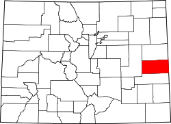
| County | Cheyenne [2] |
| Government | |
| • Type | unincorporated community |
| • Body | Cheyenne County [2] |
| Elevation | 1,395 m (4,577 ft) |
| Time zone | UTC−07:00 (MST) |
| • Summer (DST) | UTC−06:00 (MDT) |
| ZIP code [3] | Cheyenne Wells 80810 |
| Area code | 719 |
| GNIS place ID | 1947719 |
Firstview is an unincorporated community located in and governed by Cheyenne County, Colorado, United States. [1] It is located along U.S. Highway 40 west of county seat Cheyenne Wells.