Vilas, Colorado | |
|---|---|
 Former saloon on Main Street (2019) | |
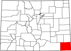
 Location within Baca County and Colorado | |
| Coordinates: 37°22′27″N102°26′51″W / 37.37417°N 102.44750°W [1] | |
| Country | United States |
| State | Colorado |
| County [2] | Baca County |
| Incorporated | June 25, 1888 [3] |
| Government | |
| • Type | Statutory Town [2] |
| Area | |
• Total | 0.13 sq mi (0.33 km2) |
| • Land | 0.13 sq mi (0.33 km2) |
| • Water | 0.00 sq mi (0.00 km2) |
| Elevation | 4,157 ft (1,267 m) |
| Population | |
• Total | 98 |
| • Density | 750/sq mi (300/km2) |
| Time zone | UTC−7 (MST) |
| • Summer (DST) | UTC−6 (MDT) |
| ZIP Code | |
| Area code | 719 |
| FIPS code | 08-81030 [1] |
| GNIS ID | 2413433 [1] |
| Website | Town of Vilas |
Vilas is a statutory town in Baca County, Colorado, United States. [1] The population was 98 at the 2020 census. [5]