The Deora, Colorado, post office operated from April 21, 1920, until March 1, 1974.[4] The Las Animas, Colorado, post office (ZIP code 81054) now serves Deora postal addresses.[3]
Deora was once a rail siding with a school and store, but little remains today.
Early 20th Century
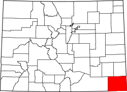
Baca County, Colorado, in 1921, showing the locations of Deora and Maxey in the northwestern part of the county
When a post office was established in 1920, the postmistress suggested naming the settlement deoro, meaning "of gold" in Spanish.[5] Examinations for rural carriers in Stonington and Deora took place in June 1921.[6] The excavation work for what the Springfield Democrat-Herald called a large post office building began in March 1922.[7] Construction began in August.[8]
A graded road between the county seats of Springfield and Las Animas, going through Deora, was completed in September 1923.[9] This was later called a "fine road" in the Democrat-Herald.[10] J.S. Dockum operated the Deora store in the 1920s.[11]
In 1933, the Big Rock chapter of the 4-H youth club was started in Deora, with 40 members. The chapter still operates, and is the largest 4-H club in the county, although the members now meet in Springfield.[14]
In 1937, the Atchinson, Topeka & Santa Fe Railroad (AT&SF) built a rail line connecting Baca County towns, including Springfield and Campo.[15] A rail siding on the AT&SF called Frick opened 0.7 miles (1.1km) north of the Deora townsite.[16]
Deora was a small, rural community. In the 1940s, the town of Deora and the Baca County communities of Graft, Edler, and Utleyville were described as "outlets for cream and produce and as centers for the distribution of staple groceries and gasoline."[17] Deora's population remained small, being listed as high as 10,[18] and as low as 4.[5][19]
Later years
In the 1950s, Deora still appeared in publications of the Colorado State Planning division, listed alongside Baca communities such as Lycan, Bartlett, and Utleyville.[20][21] Deora's population was 4 in 1960.[22] The Frick rail station was still operating in 1963.[23]
↑"Untitled". Springfield Democrat-Herald. May 27, 1921. p.1. Retrieved October 23, 2022.
↑"Rock Crossing". Springfield Democrat-Herald. March 31, 1922. p.4. Archived from the original on October 24, 2022. Retrieved October 23, 2022.
↑"Rock Crossing". Springfield Democrat-Herald. August 18, 1922. p.4. Retrieved October 23, 2022.
↑"Deora". The Democrat-Herald. Colorado Historic Newspapers Collection. September 14, 1923. Retrieved October 23, 2022.
↑"Deora". The Democrat-Herald. Colorado Historic Newspapers Collection. October 12, 1923. p.2. Archived from the original on October 23, 2022. Retrieved October 23, 2022.
↑"Deora". Springfield Democrat-Herald. September 14, 1923. p.3. Archived from the original on October 24, 2022. Retrieved October 23, 2022.
↑"Deora". The Democrat-Herald. Colorado Historic Newspapers Collection. July 20, 1923. Archived from the original on October 24, 2022. Retrieved October 24, 2022.
↑Colorado. Colorado State Planning Division. 1956. p.706.
↑Division, Colorado State Planning; Commission, Colorado State Planning (1956). Year Book of the State of Colorado. Colorado State Planning Division. p.706.
↑"Colorado". World Book Encyclopedia. Vol.C. Chicago: Field Enterprises Educational Corporation. 1960. pp.672–673.
This page is based on this Wikipedia article Text is available under the CC BY-SA 4.0 license; additional terms may apply. Images, videos and audio are available under their respective licenses.