Stonington, Colorado | |
|---|---|
 Methodist Church in Stonington (2015) | |
 Stonington  Stonington | |
| Coordinates: 37°17′37.07″N102°11′14.65″W / 37.2936306°N 102.1874028°W [1] | |
| Country | United States |
| State | Colorado |
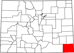
| County | Baca County |
| Elevation | 3,809 ft (1,161 m) |
| Time zone | UTC−7 (MST) |
| • Summer (DST) | UTC−6 (MDT) |
| ZIP Code | 81090 [2] |
| Area code | 719 |
| FIPS code | 08-74320 [1] |
| GNIS ID | 196221 [1] |
Stonington is an unincorporated community in eastern Baca County, Colorado, United States. [1] Stonington lies east of the Comanche National Grassland and is the southeasternmost community in Colorado.