Silver Plume, Colorado

Last updated

Town of Silver Plume, Colorado
Silver-Plume Train-Station 2012-10-20.JPG
Train station in Silver Plume
Clear Creek County Colorado Incorporated and Unincorporated areas Silver Plume Highlighted 0870360.svg
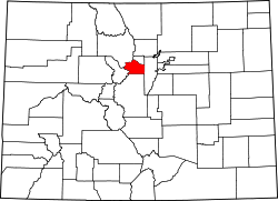
Location of Silver Plume in Clear Creek County, Colorado.
Coordinates: 39°41′45″N105°43′34″W / 39.69583°N 105.72611°W / 39.69583; -105.72611
Country Flag of the United States.svg  United States
State Flag of Colorado.svg  State of Colorado
County [1] Clear Creek County
Incorporated September 24, 1880 [2]
Government
  Type Statutory Town [1]
Area
[3]
  Total0.26 sq mi (0.68 km2)
  Land0.26 sq mi (0.67 km2)
  Water0.00 sq mi (0.01 km2)
Elevation
[4]
9,101 ft (2,774 m)
Population
 (2020) [5]
  Total207
  Density800/sq mi (300/km2)
Time zone UTC-7 (MST)
  Summer (DST) UTC-6 (MDT)
ZIP code [6]
80476
Area code(s) Both 303 and 720
FIPS code 08-70360
GNIS feature ID 0181905
Website silverplumetown.com/home/
Homes dot a mountainside at Silver Plume, Colorado. SilverPlume.jpg
Homes dot a mountainside at Silver Plume, Colorado.

Silver Plume is a Statutory Town located in Clear Creek County, Colorado, United States. Silver Plume is a former silver mining camp along Clear Creek in the Front Range of the Rocky Mountains. The federally designated Georgetown-Silver Plume Historic District comprises Silver Plume, the neighboring town of Georgetown, and the Georgetown Loop Historic Mining & Railroad Park between the two towns.

Contents

The town population was 207 at the 2020 census. [5] The Silver Plume Post Office has the ZIP code 80476. [6]

Geography

Silver Plume is located in the valley of Clear Creek at 39°41′45″N105°43′34″W / 39.69583°N 105.72611°W / 39.69583; -105.72611 (39.695919, -105.726066). [7] Interstate 70 and U.S. Route 6 pass through the town, with access from Exit 226. It is 20 miles (32 km) west across the Continental Divide to Silverthorne and 46 miles (74 km) east to Denver.

According to the United States Census Bureau, the town of Silver Plume has a total area of 0.2 square miles (0.6 km2), all of it land.

Climate

According to the Köppen Climate Classification system, Silver Plume has a subarctic climate, abbreviated "Dfc" on climate maps.

Climate data for Cabin Creek, Colorado, 19912020 normals, extremes 1968present
MonthJanFebMarAprMayJunJulAugSepOctNovDecYear
Record high °F (°C)56
(13)
55
(13)
65
(18)
64
(18)
75
(24)
81
(27)
85
(29)
78
(26)
78
(26)
76
(24)
63
(17)
57
(14)
85
(29)
Mean maximum °F (°C)48.4
(9.1)
47.0
(8.3)
53.1
(11.7)
58.0
(14.4)
66.9
(19.4)
75.4
(24.1)
77.0
(25.0)
74.6
(23.7)
71.9
(22.2)
65.6
(18.7)
54.6
(12.6)
48.1
(8.9)
77.7
(25.4)
Average high °F (°C)31.8
(−0.1)
31.5
(−0.3)
37.9
(3.3)
42.8
(6.0)
52.6
(11.4)
64.2
(17.9)
69.3
(20.7)
67.1
(19.5)
61.2
(16.2)
49.8
(9.9)
39.2
(4.0)
31.9
(−0.1)
48.3
(9.0)
Daily mean °F (°C)21.9
(−5.6)
21.5
(−5.8)
27.4
(−2.6)
32.8
(0.4)
41.9
(5.5)
52.2
(11.2)
57.4
(14.1)
55.6
(13.1)
49.4
(9.7)
39.2
(4.0)
28.9
(−1.7)
22.0
(−5.6)
37.5
(3.1)
Average low °F (°C)12.0
(−11.1)
11.5
(−11.4)
16.9
(−8.4)
22.8
(−5.1)
31.3
(−0.4)
40.1
(4.5)
45.5
(7.5)
44.0
(6.7)
37.6
(3.1)
28.5
(−1.9)
18.6
(−7.4)
12.2
(−11.0)
26.8
(−2.9)
Mean minimum °F (°C)−8.1
(−22.3)
−8.5
(−22.5)
−2.4
(−19.1)
4.6
(−15.2)
16.2
(−8.8)
28.5
(−1.9)
37.2
(2.9)
35.8
(2.1)
24.3
(−4.3)
8.4
(−13.1)
−2.7
(−19.3)
−8.9
(−22.7)
−13.6
(−25.3)
Record low °F (°C)−28
(−33)
−28
(−33)
−20
(−29)
−14
(−26)
2
(−17)
18
(−8)
27
(−3)
24
(−4)
9
(−13)
−9
(−23)
−21
(−29)
−23
(−31)
−28
(−33)
Average precipitation inches (mm)0.99
(25)
1.23
(31)
2.04
(52)
2.79
(71)
2.15
(55)
1.55
(39)
2.77
(70)
2.63
(67)
1.63
(41)
1.40
(36)
1.31
(33)
1.16
(29)
21.65
(549)
Average snowfall inches (cm)15.9
(40)
19.3
(49)
24.9
(63)
28.4
(72)
11.9
(30)
0.3
(0.76)
0.0
(0.0)
0.1
(0.25)
2.1
(5.3)
10.4
(26)
20.1
(51)
20.3
(52)
153.7
(389.31)
Average precipitation days (≥ 0.01 in)7.78.69.010.49.08.113.214.39.37.47.17.8111.9
Average snowy days (≥ 0.1 in)7.88.98.99.63.80.30.00.00.64.86.67.658.9
Source 1: NOAA [8]
Source 2: National Weather Service [9]

History

The town of Silver Plume has a very rich history. That history can be viewed by the general public either at the George Rowe Museum, which is in the original school house of the town, or by walking the 7:30 Mine Trail, which gives the individual a grand view of the Silver Plume valley and the town nestled at its base.

Many tales circulate about the town. One involves its naming. According to records and legends, Louis Dupuy, the owner of the Hotel De Paris, was also a newspaper editor for the town. When miners from Silver Plume brought him samples of the town's ore and asked him what they should name the small camp, he allegedly wrote a short poem on the spot:

Knights today are miners bold,
Who delve in deep mines' gloom,
To honor men who dig for gold,
For ladies whom their arms enfold,
We'll name the town Silver Plume!

Many other legends abound about the small "Living Ghost Town". One involves a much-beloved citizen from the mining days, Clifford Griffin. According to legend, Mr. Griffin came from the state of New York, where he was raised. Griffin became engaged in New York, but his fiancée tragically, and mysteriously, died the night before their wedding. Her death was contributed to unnameable "natural causes", and to escape the painful memories of his beloved, he moved to Colorado with his brother, who eventually became the owner of the 7:30 Mine (so named because their day shift started a generous hour later than the other mines, who started at 6:30 AM). Clifford became the manager of the 7:30, and was much loved by his miners for his kindness. According to local legend, every Christmas he bought all his miners a goose for their families, and every Fourth of July, he paid off every bar between Silver Plume and current-day Bakerville 4 miles (6 km) to the west, so his miners could enjoy their holiday without spending their family's money. Not only did he take care of his miners, every evening he provided them with entertainment as well. Since he could not bear the daily sight of his men with their wives and families after his tragedy, he spent a great deal of time near the entrance to the 7:30, which sits about 1,500 feet (460 m) above the town of Silver Plume. Every evening he would sit near the edge of a nearby cliff and play his violin. Due to the incredible acoustics of the valley, the entire town could step outside and listen to his concerts. According to local legend, one evening, after a particularly beautiful recital, the residents heard a gunshot. Assuming the worst, the miners of the 7:30 raced up the trail to the entrance, and there they found Clifford Griffin, shot through the heart, in a grave he'd dug himself. A note in the nearby Manager's Office told the tale. It asked the residents of Silver Plume to leave him where he lay, because that's where he'd experienced the most happiness since his wife died. Not only did they follow his request, the town erected a 10-foot-tall Gunnison Granite monument in his honor, directly on top of his grave site. The monument can still be seen today, on the cliffs directly in front of the 7:30 Mine.

Demographics

Historical population
CensusPop.Note
1890 908
1900 775−14.6%
1910 460−40.6%
1920 272−40.9%
1930 126−53.7%
1940 13910.3%
1950 136−2.2%
1960 86−36.8%
1970 16490.7%
1980 140−14.6%
1990 134−4.3%
2000 20351.5%
2010 170−16.3%
2020 20721.8%
U.S. Decennial Census

See also

Related Research Articles

<span class="mw-page-title-main">Leadville, Colorado</span> City in Colorado, United States

Leadville is a statutory city that is the county seat, the most populous community, and the only incorporated municipality in Lake County, Colorado, United States. The city population was 2,633 at the 2020 census. It is situated at an elevation of 10,158 feet (3,096 m). Leadville is the third highest incorporated city in the United States behind Alma and Montezuma and is surrounded by two of the tallest peaks in the state.

<span class="mw-page-title-main">Idaho Springs, Colorado</span> City in Colorado, United States

The City of Idaho Springs is the statutory city that is the most populous municipality in Clear Creek County, Colorado, United States. Idaho Springs is a part of the Denver–Aurora–Lakewood, CO Metropolitan Statistical Area. As of the 2020 census it had a population of 1,782. Idaho Springs is located in Clear Creek Canyon, in the mountains upstream from Golden, some 30 miles (50 km) west of Denver.

<span class="mw-page-title-main">Clear Creek County, Colorado</span> County in Colorado, United States

Clear Creek County is a county located in the U.S. state of Colorado. As of the 2020 census, the population was 9,397. The county seat is Georgetown.

<span class="mw-page-title-main">Sheridan, Colorado</span> City in Colorado, United States

The City of Sheridan is a home rule municipality located in Arapahoe County, Colorado, United States. Sheridan is a part of the Denver–Aurora–Lakewood, CO Metropolitan Statistical Area. The population was 6,105 at the 2020 census.

<span class="mw-page-title-main">Erie, Colorado</span> Town in Colorado, United States

The Town of Erie is a Statutory Town located in Weld and Boulder counties, Colorado, United States. The town population was 30,038 at the 2020 United States Census, a +65.64% increase since the 2010 United States Census. At the 2020 census, 17,387 (58%) Erie residents lived in Weld County and 12,651 (42%) lived in Boulder County. Erie is a part of the Denver-Aurora, CO Combined Statistical Area and the Front Range Urban Corridor.

<span class="mw-page-title-main">Lafayette, Colorado</span> City in Colorado, United States

The City of Lafayette is a home rule municipality located in southeastern Boulder County, Colorado, United States. The city population was 30,411 at the 2020 United States Census.

<span class="mw-page-title-main">Nederland, Colorado</span> Town in Colorado, United States

Nederland is a statutory town located near Barker Meadow Reservoir in the foothills of southwest Boulder County, Colorado, United States. As of the 2020 United States Census it had a population of 1,471.

<span class="mw-page-title-main">Empire, Colorado</span> Town in Colorado, United States

The historic Town of Empire is a Statutory Town located in Clear Creek County, Colorado, United States. The town population was 345 at the 2020 United States Census, a +22.34% increase since the 2010 United States Census. The town is a former mining settlement that flourished during the Colorado Silver Boom in the late 19th century. Empire is now a part of the Denver–Aurora–Lakewood, CO Metropolitan Statistical Area and the Front Range Urban Corridor.

<span class="mw-page-title-main">Georgetown, Colorado</span> Town in Colorado, United States

Georgetown is the territorial charter municipality that is the county seat of Clear Creek County, Colorado, United States. The town population was 1,118 at the 2020 United States Census. The former silver mining camp along Clear Creek in the Front Range of the Rocky Mountains was established in 1859 during the Pike's Peak Gold Rush. The federally designated Georgetown-Silver Plume Historic District comprises Georgetown, the neighboring town of Silver Plume, and the Georgetown Loop Historic Mining & Railroad Park between the two towns. The Georgetown Post Office has the ZIP code 80444.

<span class="mw-page-title-main">Silver Cliff, Colorado</span> Town in Custer County, Colorado, United States

The Town of Silver Cliff is the Statutory Town that is the most populous municipality in Custer County, Colorado, United States. The population was 609 at the 2020 census, up from 587 in 2010.

<span class="mw-page-title-main">Gypsum, Colorado</span> Town in Colorado, United States

The Town of Gypsum is the home rule municipality that is the most populous municipality in Eagle County, Colorado, United States. The town population was 8,040 at the 2020 United States Census, a +24.13% increase since the 2010 United States Census. Gypsum is a part of the Edwards, CO Micropolitan Statistical Area. Gypsum is the home of an American Gypsum drywall plant and mine.

<span class="mw-page-title-main">La Veta, Colorado</span> Town in Colorado, United States

La Veta is a statutory town in Huerfano County, Colorado, United States. The town population was 862 as of the 2020 United States Census.

<span class="mw-page-title-main">Trinidad, Colorado</span> City in Colorado, United States

Trinidad is the home rule municipality that is the county seat and the most populous municipality of Las Animas County, Colorado, United States. The population was 8,329 as of the 2020 census. Trinidad lies 21 mi (34 km) north of Raton, New Mexico, and 195 mi (314 km) south of Denver. It is on the historic Santa Fe Trail.

<span class="mw-page-title-main">Silverton, Colorado</span> The only incorporated Town and county seat of San Juan County, Colorado, United States

Silverton is a statutory town that is the county seat, the most populous community, and the only incorporated municipality in San Juan County, Colorado, United States. The town is located in a remote part of the western San Juan Mountains, a range of the Rocky Mountains. The first mining claims were made in mountains above the Silverton in 1860, near the end of the Colorado Gold Rush and when the land was still controlled by the Utes. Silverton was established shortly after the Utes ceded the region in the 1873 Brunot Agreement, and the town boomed from silver mining until the Panic of 1893 led to a collapse of the silver market, and boomed again from gold mining until the recession caused by the Panic of 1907. The entire town is included as a federally designated National Historic Landmark District, the Silverton Historic District.

<span class="mw-page-title-main">Montezuma, Colorado</span> Town in Colorado, United States

The Town of Montezuma is a statutory town located in eastern Summit County, Colorado, United States. The town population was 74 at 2020 United States Census. The town is a former mining camp that sits at an elevation of 10,200 feet (3,110 m), just west of the Continental Divide, nestled among mountains that reach an elevation of 12,000-13,000 feet around it. It is situated in the upper valley of the Snake River above the ski resort of Keystone in the Rocky Mountains.

<span class="mw-page-title-main">Victor, Colorado</span> City in Colorado, United States

The City of Victor is a Statutory City in Teller County, Colorado, United States. Gold was discovered in Victor in the late 19th century, an omen of the future of the town. With Cripple Creek, the mining district became the second largest gold mining district in the country and realized approximately $10 billion of mined gold in 2010 dollars. It reached its peak around the turn of the century when there were about 18,000 residents in the town. Depleted ore in mines, labor strife and the exodus of miners during World War I caused a steep decline in the city's economy, from which it has never recovered. The population was 379 at the 2020 census. There is a resumed mining effort on Battle Mountain.

<span class="mw-page-title-main">Georgetown Loop Railroad</span>

The Georgetown Loop Railroad is a 3 ft narrow gauge United States heritage railroad located in the Rocky Mountains in Clear Creek County, adjacent to Interstate 70 in Colorado.

<span class="mw-page-title-main">North Central Colorado Urban Area</span> Metropolitan area of Colorado

The North Central Colorado Urban Area comprises the four contiguous metropolitan statistical areas in the north central region of the State of Colorado: the Denver–Aurora Metropolitan Statistical Area, the Boulder Metropolitan Statistical Area, the Fort Collins-Loveland Metropolitan Statistical Area, and the Greeley Metropolitan Statistical Area. With the exception of southeastern Elbert County, southeastern Park County, and tiny portions of southern Douglas County, the entire North Central Colorado Urban Area is drained by the South Platte River and its tributaries. The North Central Colorado Urban Area is the central, and the most populous, of the three primary subregions of the Front Range Urban Corridor.

<span class="mw-page-title-main">Georgetown–Silver Plume Historic District</span> Historic district in Colorado, United States

The Georgetown–Silver Plume National Historic Landmark District is a federally designated United States National Historic Landmark that comprises the Town of Georgetown, the Town of Silver Plume, and the Georgetown Loop Historic Mining & Railroad Park between the two silver mining towns along Clear Creek in the Front Range of the Rocky Mountains in Clear Creek County, Colorado, United States.

Silver mining in Colorado has taken place since the 1860s. In the past, Colorado called itself the Silver State.

References

  1. 1 2 "Active Colorado Municipalities". State of Colorado, Department of Local Affairs. Archived from the original on December 12, 2009. Retrieved September 1, 2007.
  2. "Colorado Municipal Incorporations". State of Colorado, Department of Personnel & Administration, Colorado State Archives. December 1, 2004. Retrieved September 2, 2007.
  3. "2019 U.S. Gazetteer Files". United States Census Bureau. Retrieved July 1, 2020.
  4. "US Board on Geographic Names". United States Geological Survey. October 25, 2007. Retrieved January 31, 2008.
  5. 1 2 United States Census Bureau. "Silver Plume town; Colorado" . Retrieved April 28, 2023.
  6. 1 2 "ZIP Code Lookup" (JavaScript/HTML). United States Postal Service. May 25, 2007. Retrieved May 25, 2007.</
  7. "US Gazetteer files: 2010, 2000, and 1990". United States Census Bureau. February 12, 2011. Retrieved April 23, 2011.
  8. "U.S. Climate Normals Quick Access". National Oceanic and Atmospheric Administration. Retrieved October 1, 2022.
  9. "NOAA Online Weather Data". National Weather Service. Retrieved October 1, 2022.