Lawson, Colorado

Last updated

Lawson, Colorado
USA Colorado location map.svg
Red pog.svg
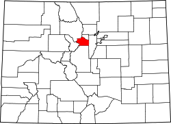
Lawson, Colorado
Location within the state of Colorado Location in Clear Creek County and the State of Colorado
Usa edcp location map.svg
Red pog.svg
Lawson, Colorado
Lawson, Colorado (the United States)
Coordinates: 39°45′50″N105°37′25″W / 39.76389°N 105.62361°W / 39.76389; -105.62361
Country Flag of the United States (23px).png  United States
State Flag of Colorado.svg State of Colorado
County Clear Creek County [1]
Elevation
[1]
8,107 ft (2,471 m)
Time zone UTC-7 (MST)
  Summer (DST) UTC-6 (MDT)
ZIP code
Dumont CO 80436
Area codes Both 303 and 720
GNIS feature ID 0204705

Lawson is a small unincorporated community situated along Clear Creek in Clear Creek County, Colorado, United States. Lawson is a part of the Downieville-Lawson-Dumont census-designated place.

Contents

History

A post office called Lawson was established in 1877, and remained in operation until 1966. [2] The community was named for Alexander Lawson, the proprietor of a local inn. [3] [4]

Geography

Lawson is located at 39°45′50″N105°37′25″W / 39.76389°N 105.62361°W / 39.76389; -105.62361 (39.76395,-105.623674).

See also

References

  1. 1 2 "US Board on Geographic Names". United States Geological Survey. October 25, 2007. Retrieved January 31, 2008.
  2. "Clear Creek County". Jim Forte Postal History. Retrieved June 14, 2015.
  3. Gannett, Henry (1905). The Origin of Certain Place Names in the United States. U.S. Government Printing Office. p.  183.
  4. Dawson, John Frank. Place names in Colorado: why 700 communities were so named, 150 of Spanish or Indian origin. Denver, CO: The J. Frank Dawson Publishing Co. p. 32.