Downieville-Lawson-Dumont CDP, Colorado | |
|---|---|
 The Dumont School in Dumont. | |
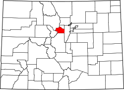
 Location of the Downieville-Lawson-Dumont CDP in Clear Creek County, Colorado. | |
 Downieville-Lawson-Dumont CDP Location of the Downieville-Lawson-Dumont CDP, Colorado.  Downieville-Lawson-Dumont CDP Downieville-Lawson-Dumont CDP (Colorado) | |
| Coordinates: 39°45′58″N105°36′45″W / 39.7662°N 105.6126°W [1] | |
| Country | United States |
| State | Colorado |
| County | Clear Creek [2] |
| Government | |
| • Type | unincorporated community |
| • Body | Clear Creek County [2] |
| Area | |
• Total | 0.798 sq mi (2.068 km2) |
| • Land | 0.778 sq mi (2.014 km2) |
| • Water | 0.021 sq mi (0.054 km2) |
| Elevation | 8,009 ft (2,441 m) |
| Population | |
• Total | 527 |
| • Density | 678/sq mi (262/km2) |
| Time zone | UTC−07:00 (MST) |
| • Summer (DST) | UTC−06:00 (MDT) |
| ZIP code [4] | Dumont 80436 |
| Area codes | 303/720/983 |
| GNIS IDs | Downieville 181423 Lawson 204705 Dumont 204707 |
| GNIS CDP ID | 2408685 |
| FIPS code | 08-21390 |
Downieville-Lawson-Dumont is a census-designated place (CDP) comprising the unincorporated communities of Downieville, Lawson, and Dumont located in, and governed by, Clear Creek County, Colorado, United States. At the United States Census 2020, the population of the Downieville-Lawson-Dumont CDP was 527. [3] The CDP is a part of the Denver-Aurora-Centennial, CO Metropolitan Statistical Area and the Front Range Urban Corridor. The Dumont post office ZIP code 80436 (post office boxes) serves the area. [4]