Floyd Hill, Colorado | |
|---|---|
 Interstate 70 passes through the community of Floyd Hill. | |
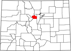
 Location of the Floyd Hill CDP in Clear Creek County, Colorado. | |
 Floyd Hill Location of the Floyd Hill CDP, Colorado.  Floyd Hill Floyd Hill (Colorado) | |
| Coordinates: 39°43′18″N105°25′53″W / 39.7217°N 105.4313°W [1] | |
| Country | United States |
| State | Colorado |
| County | Clear Creek [2] |
| Government | |
| • Type | unincorporated community |
| • Body | Clear Creek County [2] |
| Area | |
• Total | 6.293 sq mi (16.298 km2) |
| • Land | 6.290 sq mi (16.290 km2) |
| • Water | 0.0031 sq mi (0.008 km2) |
| Elevation | 9,095 ft (2,772 m) |
| Population | |
• Total | 1,048 |
| • Density | 166.6/sq mi (64.33/km2) |
| Time zone | UTC−07:00 (MST) |
| • Summer (DST) | UTC−06:00 (MDT) |
| ZIP code [5] | Evergreen 80439 |
| Area codes | 303/720/983 |
| GNIS CDP ID | 2583236 |
| FIPS code | 08-27175 |
Floyd Hill is an unincorporated community and a census-designated place (CDP) located in and governed by Clear Creek County, Colorado, United States. [1] Interstate 70 passes through the community. Floyd Hill is a part of the Denver-Aurora-Centennial, CO Metropolitan Statistical Area. The population of the Floyd Hill CDP was 1,048 at the United States Census 2020. [3]