Downieville, Colorado | |
|---|---|
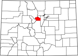
 Downieville Location of Downieville, Colorado.  Downieville Downieville (Colorado) | |
| Coordinates: 39°46′00″N105°36′52″W / 39.7667°N 105.6144°W [1] | |
| Country | United States |
| State | Colorado |
| County | Clear Creek [2] |
| Government | |
| • Type | unincorporated community |
| • Body | Clear Creek County [2] |
| Elevation | 8,032 ft (2,448 m) |
| Time zone | UTC−07:00 (MST) |
| • Summer (DST) | UTC−06:00 (MDT) |
| ZIP code [3] | Dumont 80436 |
| Area codes | 303/720/983 |
| GNIS place ID | 181423 |
| GNIS town ID | 2408685 |
| FIPS code | 08-21390 |
Downieville is a small unincorporated community situated along Clear Creek in Clear Creek County, Colorado, United States. Downieville is the principal community of the Downieville-Lawson-Dumont, CO Census Designated Place.