Alice, Colorado

Last updated
Alice, Colorado
Town
Alice, Colorado.JPG
Signs at the intersection of Fall River and Alice roads in Alice
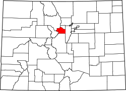
USA Colorado location map.svg
Red pog.svg
Alice, Colorado
Location within Colorado
Usa edcp location map.svg
Red pog.svg
Alice, Colorado
Location within the United States
Coordinates: 39°49′06″N105°38′34″W / 39.8183°N 105.6428°W / 39.8183; -105.6428 (Alice) [1]
Country United States
State Colorado
Counties Clear Creek [1]
Elevation
[1]
10,092 ft (3,076 m)
Time zone UTC-7 (MST)
  Summer (DST) UTC-6 (MDT)

Alice is an unincorporated community located in Clear Creek County, Colorado, United States. [1]

Contents

History

The Alice post office operated from August 20, 1898, until December 31, 1938. [2] [3] The community was named after Alice Taylor, the wife of a mine official. [4]

See also

Related Research Articles

<span class="mw-page-title-main">Hooper, Colorado</span> Town in Colorado, United States

The Town of Hooper is a Statutory Town located in the San Luis Valley in Alamosa County, Colorado, United States. The population was 81 at the 2020 census.

<span class="mw-page-title-main">Egnar, Colorado</span> Unincorporated community in San Midgel County, Colorado, United States

Egnar is an unincorporated community in San Miguel County, Colorado, United States. Egnar has a U.S. Post Office with the ZIP Code 81325.

<span class="mw-page-title-main">Caddoa, Colorado</span> Unincorporated community in State of Colorado, United States

Caddoa is an unincorporated community in Bent County, Colorado, United States. The community takes its name from nearby Caddoa Creek.

<span class="mw-page-title-main">Eureka, Colorado</span> Ghost town in San Juan County, Colorado, United States.

Eureka is an extinct mining town in San Juan County, Colorado, United States, along the Animas River, between Silverton and Animas Forks. The town derives its name from the Greek interjection Eureka! The Eureka post office operated from August 9, 1875, until April 30, 1942.

<span class="mw-page-title-main">Alder, Colorado</span> Town in Colorado, United States

Alder is an extinct town located in Saguache County, Colorado, United States.

<span class="mw-page-title-main">Allison, Colorado</span> Unincorporated community in La Plata County, Colorado, United States

Allison is an unincorporated community on the Southern Ute Indian Reservation in La Plata County, Colorado, United States.

<span class="mw-page-title-main">Goldfield, Colorado</span> Census Designated Place in Colorado, United States

Goldfield is an unincorporated community and a census-designated place (CDP) located in and governed by Teller County, Colorado, United States. The CDP is a part of the Colorado Springs, CO Metropolitan Statistical Area. The population of the Goldfield CDP was 63 at the United States Census 2020. The Cripple Creek post office (Zip Code 80813) serves the area.

Cameo is an extinct town in Mesa County, in the U.S. state of Colorado. The GNIS classifies it as a populated place.

Abeyta is an extinct town in Las Animas County, in the U.S. state of Colorado. The townsite is located at 37.0797°N 104.1864°W at an elevation of 5,725 feet (1,745 m).

Adena is an extinct town located in Morgan County, Colorado, United States. The townsite is located at 40.0083°N 103.8866°W at an elevation of 4,692 feet (1,430 m).

Axial is an extinct coal mining town located in Moffat County, Colorado, United States. The townsite is located at 40.2852°N 107.7919°W at an elevation of 6,454 feet (1,967 m).

Balzac is an extinct town located in Morgan County, Colorado, United States. The townsite is located at 40.4069°N 103.4713°W at an elevation of 4,105 feet (1,251 m).

Beshoar is an extinct town located in Las Animas County, Colorado, United States. The townsite is located at 37.2181°N 104.4066°W at an elevation of 5,922 feet (1,805 m).

<span class="mw-page-title-main">Bloom, Colorado</span>

Bloom is an extinct town located in Otero County, Colorado, United States. The townsite is located at 37.6875°N 103.9566°W at an elevation of 4,800 feet (1,500 m).

<span class="mw-page-title-main">Bowen, Las Animas County, Colorado</span>

Bowen is an extinct town in Las Animas County, in the U.S. state of Colorado. The 1911 Colorado Business Directory describes the town as "Coal mining town and station", population 200, on the Colorado and Southern Railway.

Buckingham is a ghost town in Weld County, in the U.S. state of Colorado.

<span class="mw-page-title-main">Delcarbon, Colorado</span> Ghost town in Huerfano County, Colorado, United States.

Delcarbon is an extinct town in Huerfano County, Colorado, United States.

Fondis is an unincorporated community in Elbert County, in the U.S. state of Colorado.

<span class="mw-page-title-main">Haybro, Colorado</span>

Haybro,, is an extinct town in Routt County, Colorado, United States.

Iola is an extinct town located in Gunnison County, Colorado, United States.. The community was inundated and destroyed by the creation of Blue Mesa Reservoir.

References

  1. 1 2 3 4 "US Board on Geographic Names". United States Geological Survey. 2007-10-25. Retrieved 2008-01-31.
  2. Bauer, William H.; Ozment, James L.; Willard, John H. (1990). Colorado Post Offices 1859–1989. Golden, Colorado: Colorado Railroad Historical Foundation. ISBN   0-918654-42-4.
  3. "Place Names of Colorado" (PDF). Colorado Council of Genealogical Societies. 1999. p. 7. Archived from the original (PDF) on 27 October 2017. Retrieved 1 July 2019.
  4. Dawson, John Frank (1954). Place names in Colorado: why 700 communities were so named, 150 of Spanish or Indian origin. Denver, CO: The J. Frank Dawson Publishing Co. p. 6.