Ward, Colorado | |
---|---|
Coordinates: 40°4′20″N105°30′36″W / 40.07222°N 105.51000°W | |
Country | United States |
State | Colorado |
County [1] | Boulder County |
Founded | 1860 |
Incorporated | June 9, 1896 [2] |
Government | |
• Type | Home rule municipality [1] |
Area | |
• Total | 0.54 sq mi (1.39 km2) |
• Land | 0.54 sq mi (1.39 km2) |
• Water | 0.00 sq mi (0.00 km2) |
Elevation | 9,144 ft (2,787 m) |
Population (2020) | |
• Total | 128 |
• Density | 300.37/sq mi (116.08/km2) |
Time zone | UTC-7 (Mountain (MST)) |
• Summer (DST) | UTC-6 (MDT) |
ZIP code [5] | 80481 |
Area code | 303 |
FIPS code | 08-82735 |
GNIS feature ID | 0178487 [4] |
Website | www |
Ward is a home rule municipality in Boulder County, Colorado, United States. The population was 128 at the 2020 census. The town is a former mining settlement founded in 1860 in the wake of the discovery of gold at nearby Gold Hill. Once one of the richest towns in the state during the Colorado Gold Rush, it is located on a mountainside at the top of Left Hand Canyon, near the Peak to Peak Highway (State Highway 72) northwest of Boulder at an elevation of 9,450 feet (2,880 m) above sea level.
The town was named for Calvin Ward, who prospected a claim in 1860 on the site known as Miser's Dream. [6] The town boomed the following year with the discovery by Cyrus W. Deardorff of the Columbia vein. Over the next several decades the population fluctuated, growing from several hundred to several thousand before declining once again. The mines in the area remained profitable for many decades, with one mine eventually producing over 2 million ounces (62 metric tons) of silver. A post office with the name Ward District was established January 13, 1863; the name was changed to Ward, September 11, 1894. [7] The city was incorporated in June 1896. The railroad reached the area in 1898, arriving over the Whiplash and Switzerland Trail, which climbed over 4,000 feet (1,220 m) from Boulder over the course of 26 miles (42 km). In January 1900 over 50 buildings were destroyed by a devastating fire, although the profitability of the mines led to the immediate rebuilding of the town. The town was largely deserted by the 1920s, but the construction of the Peak-to-Peak Highway in the 1930s led to a revival of the town. During WWII the town's year-round population dropped to four people. Then, in the 1960s, the town's population jumped from between 10-20 year-round residents to well over 100 due to the town's interest to hippies.[ citation needed ]
The town has several businesses along its main street, including a restaurant, a coffee shop, an art gallery, and general store.
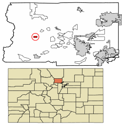
Ward is located at 40°4′20″N105°30′36″W / 40.07222°N 105.51000°W (40.072347, -105.510131). [8]
According to the United States Census Bureau, the town has a total area of 0.6 square miles (1.6 km2), all of it land.
Census | Pop. | Note | %± |
---|---|---|---|
1890 | 424 | — | |
1900 | 300 | −29.2% | |
1910 | 129 | −57.0% | |
1920 | 74 | −42.6% | |
1930 | 34 | −54.1% | |
1940 | 118 | 247.1% | |
1950 | 10 | −91.5% | |
1960 | 9 | −10.0% | |
1970 | 32 | 255.6% | |
1980 | 129 | 303.1% | |
1990 | 159 | 23.3% | |
2000 | 169 | 6.3% | |
2010 | 150 | −11.2% | |
2020 | 128 | −14.7% | |
U.S. Decennial Census [9] |
As of the census [10] of 2010, there were 150 people, 75 households, and 36 families residing in the town. The population density was 296.9 inhabitants per square mile (114.6/km2). There were 82 housing units at an average density of 144.1 per square mile (55.6/km2). The racial makeup of the town was 98.82% White, and 1.18% from two or more races.
There were 75 households, out of which 26.7% had children under the age of 18 living with them, 34.7% were married couples living together, 5.3% had a female householder with no husband present, and 52% were non-families. 37.3% of all households were made up of individuals, and 8% had someone living alone who was 65 years of age or older. The average household size was 2 and the average family size was 2.67.
The age of the town's populace was spread out, with 19.3% under the age of 18, 5.3% from 18 to 24, 32% from 25 to 44, 35.3% from 45 to 64, and 8% who were 65 years of age or older. The median age was 43.5 years. For every 100 females, there were 154.2 males. For every 100 females age 18 and over, there were 132.7 males.
In 2000, the median income for a household in the town was $33,750, and the median income for a family was $50,313. Males had a median income of $26,250 versus $28,750 for females. The per capita income for the town was $14,900. None of the population or families were below the poverty line.
Central, commonly known as Central City, is a home rule municipality located in Gilpin and Clear Creek counties, Colorado, United States. Central City is the county seat and the most populous municipality of Gilpin County. The city population was 779, all in Gilpin County, at the 2020 United States census. The city is a historic mining settlement founded in 1859 during the Pike's Peak Gold Rush and came to be known as the "Richest Square Mile on Earth". Central City and the adjacent city of Black Hawk form the federally designated Central City/Black Hawk Historic District. The city is now a part of the Denver–Aurora–Lakewood, CO Metropolitan Statistical Area and the Front Range Urban Corridor.
Teller County is a county located in the U.S. state of Colorado. As of the 2020 census, the population was 24,710. The county seat is Cripple Creek, and the most populous city is Woodland Park.
San Juan County is a county located in the U.S. state of Colorado. As of the 2020 census, the population was 705, making it the least populous county in Colorado. The county seat and the only incorporated municipality in the county is Silverton. The county name is the Spanish language name for "Saint John", the name Spanish explorers gave to a river and the mountain range in the area. With a mean elevation of 11,240 feet, San Juan County is the highest county in the United States and also has the two highest elevation houses in the United States; the ‘Bonnie Belle’ above Animas Forks at 11,900’ – 11,950’ elevation and an unnamed house above Picayune Gulch at 12,000’ elevation.
Park County is a county located in the U.S. state of Colorado. As of the 2020 census, the population was 17,390. The county seat is Fairplay. The county was named after the large geographic region known as South Park, which was named by early fur traders and trappers in the area.
Larimer County is a county located in the U.S. state of Colorado. As of the 2020 census, the population was 359,066. The county seat and most populous city is Fort Collins. The county was named for William Larimer, Jr., the founder of Denver.
Grand County is a county located in the U.S. state of Colorado. As of the 2020 census, the population was 15,717. The county seat is Hot Sulphur Springs.
Gilpin County is a county located in the U.S. state of Colorado, smallest in land area behind only the City and County of Broomfield. As of the 2020 census, the population was 5,808. The county seat is Central City. The county was formed in 1861, while Colorado was still a territory, and was named after Colonel William Gilpin, the first territorial governor.
Clear Creek County is a county located in the U.S. state of Colorado. As of the 2020 census, the population was 9,397. The county seat is Georgetown.
The City of Federal Heights is a home rule municipality located in western Adams County, Colorado, United States. The city population was 14,382 at the 2020 United States Census, a +25.42% increase since the 2010 United States Census. Federal Heights is a part of the Denver–Aurora–Lakewood, CO Metropolitan Statistical Area and the Front Range Urban Corridor. The current Mayor is Linda S. Montoya, who was elected to a four-year term in 2019.
The historic Town of Jamestown is a Statutory Town in Boulder County, Colorado, United States. The population was 256 at the 2020 United States Census, down from 274 in 2010. It was named for James Smith, an early discoverer of gold. Jamestown was hit hard by the September 2013 Colorado floods when the town was isolated due to road damage from the rains and the flooding of James Creek. Under a mandatory evacuation order, most residents were airlifted to safety under the direction of the Colorado National Guard to nearby Boulder.
Nederland is a statutory town located near Barker Meadow Reservoir in the foothills of southwest Boulder County, Colorado, United States. As of the 2020 United States Census it had a population of 1,471.
The historic Town of Empire is a Statutory Town located in Clear Creek County, Colorado, United States. The town population was 345 at the 2020 United States Census, a +22.34% increase since the 2010 United States Census. The town is a former mining settlement that flourished during the Colorado Silver Boom in the late 19th century. Empire is now a part of the Denver–Aurora–Lakewood, CO Metropolitan Statistical Area and the Front Range Urban Corridor.
Blanca is a Statutory Town located in Costilla County, Colorado, United States. The town population was 322 at the 2020 census. Blanca is located in the enormous San Luis Valley.
The Town of Silver Cliff is the Statutory Town that is the most populous municipality in Custer County, Colorado, United States. The population was 609 at the 2020 census, up from 587 in 2010.
Cokedale is a Statutory Town located in Las Animas County, Colorado, United States. The town population was 127 at the 2020 United States Census.
Fairplay is the Statutory Town that is the county seat and the most populous municipality of Park County, Colorado, United States. The town population was 724 at the 2020 United States Census. Fairplay is located in South Park at an elevation of 9,953 feet (3,034 m). The town is the fifth-highest incorporated place in the State of Colorado. Fairplay is now a part of the Denver–Aurora–Lakewood, CO Metropolitan Statistical Area and the Front Range Urban Corridor.
The City of Victor is a Statutory City in Teller County, Colorado, United States. Gold was discovered in Victor in the late 19th century, an omen of the future of the town. With Cripple Creek, the mining district became the second largest gold mining district in the country and realized approximately $10 billion of mined gold in 2010 dollars. It reached its peak around the turn of the century when there were about 18,000 residents in the town. Depleted ore in mines, labor strife and the exodus of miners during World War I caused a steep decline in the city's economy, from which it has never recovered. The population was 379 at the 2020 census. There is a resumed mining effort on Battle Mountain.
The Town of Coal Creek is a Statutory Town located in Fremont County, Colorado, United States. The town population was 364 at the 2020 United States Census. Coal Creek is a part of the Cañon City, CO Micropolitan Statistical Area and the Front Range Urban Corridor.
Plattekill is a hamlet in Ulster County, New York, United States. The population was 1,296 at the 2020 census. The community, as is the town, is named after a local stream, the Platte Kill.