Sunshine, Colorado

Last updated

Sunshine, Colorado
Boulder County Colorado Incorporated and Unincorporated areas Sunshine Highlighted 0875585.svg
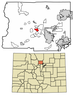
Location of the Sunshine CDP in Boulder County, Colorado
Usa edcp location map.svg
Red pog.svg
Sunshine
Location of the Sunshine CDP in the United States
Coordinates: 40°03′53″N105°22′34″W / 40.06472°N 105.37611°W / 40.06472; -105.37611 (Sunshine CDP, Colorado) [1]
Country Flag of the United States.svg United States
State Flag of Colorado.svg Colorado
County Boulder County
Government
[1]
  Type unincorporated community
Area
[2]
  Total
4.481 km2 (1.730 sq mi)
  Land4.481 km2 (1.730 sq mi)
  Water0.000 km2 (0.000 sq mi)
Elevation
[1]
2,239 m (7,346 ft)
Population
 (2020) [3]
  Total
198
  Density44/km2 (110/sq mi)
Time zone UTC-7 (MST)
  Summer (DST) UTC-6 (MDT)
ZIP Code [4]
Boulder 80302
Area codes 303 & 720
GNIS feature ID 2583302 [1]

Sunshine (also known as Sunshine Canyon) is an unincorporated community and a census-designated place (CDP) located in and governed by Boulder County, Colorado, United States. The CDP is a part of the Boulder, CO Metropolitan Statistical Area. The population of the Sunshine CDP was 198 at the United States Census 2020. [3] The Boulder post office (Zip Code 80302) serves the area. [4]

Contents

History

Gold ore was discovered in Sunshine in 1873, and many prospectors moved to the area to seek their fortunes. By 1876 Sunshine was a booming mining camp, with a population of 1,200. Sunshine had a post office, a schoolhouse, a newspaper, The Sunshine Courier, several hotels and boarding houses, two mercantile firms, three blacksmiths, and two saloons.

Sunshine built a stone schoolhouse in 1900, which is still in good condition and used for community events. Noted for its sophisticated construction and neoclassical design, the building was placed on the National Register of Historic Places in 1989.

As gold became harder to find and extract, most mines shut down, and by 1908 Sunshine's population dwindled to about 200. Ranching was prevalent after World War I, with just a few mines still operating. The remaining mines were closed in July, 1942, by a decree of President Franklin D. Roosevelt, as the United States geared up for production of wartime materials. [5]

Geography

Sunshine is located in central Boulder County, in the hills northwest of the city of Boulder. It is bordered by the Crisman CDP to the south, and the Glendale and Lazy Acres CDPs are to the north.

The Sunshine CDP has an area of 1,107 acres (4.481 km2), all land. [2]

Demographics

The United States Census Bureau initially defined the Sunshine CDP for the United States Census 2010.

Sunshine CDP, Colorado
YearPop.±%
2010 230    
2020 198−13.9%
Source: United States Census Bureau

See also

References

  1. 1 2 3 4 U.S. Geological Survey Geographic Names Information System: Sunshine, Colorado
  2. 1 2 "State of Colorado Census Designated Places - BAS20 - Data as of January 1, 2020". United States Census Bureau . Retrieved December 12, 2020.
  3. 1 2 United States Census Bureau. "Sunshine CDP, Colorado" . Retrieved April 18, 2023.
  4. 1 2 "Zip Code 80302 Map and Profile". zipdatamaps.com. 2020. Retrieved December 20, 2020.
  5. Howard, June Peterson (1994). Stories of Sunshine: Life in a Mining Camp. The Book Lode. ISBN   0-9617799-6-9.