Silverton, Colorado

Last updated

Silverton, Colorado
Silverton.jpg
San Juan County Colorado Incorporated and Unincorporated areas Silverton Highlighted 0870580.svg
Location of Silverton in San Juan County, Colorado.
Coordinates: 37°48′45″N107°39′47″W / 37.81250°N 107.66306°W / 37.81250; -107.66306
Country Flag of the United States (23px).png  United States
State Flag of Colorado.svg  State of Colorado
County [1] San Juan County - seat [2]
EstablishedSeptember 15, 1874
Incorporated November 15, 1885 [3]
Government
  Type Statutory Town [1]
   Mayor Shane Fuhrman
Area
[4]
  Total0.83 sq mi (2.16 km2)
  Land0.83 sq mi (2.16 km2)
  Water0.00 sq mi (0.00 km2)
Elevation
[5]
9,318 ft (2,840 m)
Population
 (2020) [6]
  Total622
  Density750/sq mi (290/km2)
Time zone UTC-7 (Mountain (MST))
  Summer (DST) UTC-6 (MDT)
ZIP code [7]
81433 (PO Box)
Area code 970
FIPS code 08-70580
GNIS feature ID 0204750
Website Town of Silverton

Silverton is a statutory town that is the county seat, the most populous community, and the only incorporated municipality in San Juan County, Colorado, United States. [1] [8] The town is located in a remote part of the western San Juan Mountains, a range of the Rocky Mountains. The first mining claims were made in mountains above the Silverton in 1860, near the end of the Colorado Gold Rush and when the land was still controlled by the Utes. [9] Silverton was established shortly after the Utes ceded the region in the 1873 Brunot Agreement, and the town boomed from silver mining until the Panic of 1893 led to a collapse of the silver market, and boomed again from gold mining until the recession caused by the Panic of 1907. [10] The entire town is included as a federally designated National Historic Landmark District, the Silverton Historic District.

Contents

Originally called "Bakers Park", Silverton sits in a flat area of the Animas River valley and is surrounded by steep peaks. Most of the peaks surrounding Silverton are thirteeners. The highest being Storm Peak, at 13,487 feet. [11] The town is less than 15 miles from 7 of Colorado's 53 fourteeners, and is known as one of the premier gateways into the Colorado backcountry.

Silverton's last operating mine closed in 1992, and the community now depends primarily on tourism and government remediation and preservation projects. Silverton is well known because of the Durango and Silverton Narrow Gauge Railroad, a former mine train that is now a National Historic Landmark, and internationally recognized events such as the Hardrock Hundred Mile Endurance Run. The town population was 622 at the 2020 census. [6]

History

Silverton Historic District
SilvertonHotel.jpg
Grand Imperial Hotel, Silverton Historic District
USA Colorado location map.svg
Red pog.svg
Usa edcp location map.svg
Red pog.svg
LocationSilverton, Colorado
Area695 acres (281 ha)
Built1882
Architectural styleLate Victorian
NRHP reference No. 66000255  (original)
97000247 [12]  (increase)
Significant dates
Added to NRHPOctober 15, 1966
Boundary increaseApril 3, 1997
Designated NHLDJuly 4, 1961 [13]

Mining era

An abandoned mine in Silverton Abandoned Mine at Silverton, Colorado.jpg
An abandoned mine in Silverton
An abandoned mine just above Silverton Abandoned mine in the San Juan Mountains, just above Silverton, Colorado.jpg
An abandoned mine just above Silverton
Remains of an abandoned mine's ore bin along the Million Dollar Highway between Durango & Silverton Remains of an Abandoned Mine's Ore Chute near Silverton, Colorado.jpg
Remains of an abandoned mine's ore bin along the Million Dollar Highway between Durango & Silverton

Settlements in the area surrounding present-day Silverton began in 1860 after a group of prospectors led by Charles Baker made their way into the San Juan Mountains searching for gold. The area was soon referred to as "Baker's Park", and the group found traces of placer gold nearby. [10]

Long before settlement, the area was regularly explored by the Anasazi, and later the Utes, who hunted and lived in the San Juans during the summer. [14] There is also speculation that Spanish explorers and fur traders ventured into the area before Baker's 1860 expedition. [14]

After the Brunot Agreement with the Utes in 1873, which exchanged four million acres (6,200 sq mi; 16,000 km2) for the Southern Ute Indian Reservation and $25,000 per year, several mining camps were constructed. [15] These would later become the communities of Howardsville, Eureka, and Silverton.

Silverton was founded by mining entrepreneurs William Kearnes, Dempsey Reese, and Thomas Blair in 1874. [10] The region boomed after George Howard and R. J. McNutt discovered the Sunnyside silver vein along Hurricane Peak. Gold was then discovered in 1882, which helped the region weather the Panic of 1893 far better than other mining communities, such as Aspen or Creede. [16] [10] The Sunnyside Mine would become one of Colorado's longest running and most productive mines. [9] The mine was shut down after the 1929 stock market crash, but was acquired by Standard Metals Corp. in 1959, and reopened, finding gold in 1973 with the Little Mary vein. The region's economy was dealt a devastating blow in 1992 when the mine and the corresponding Shenandoah-Dives mill, the last operating in the region, permanently closed. [17] [9] The closure meant the end of jobs for over one third of Silverton's workforce. [17]

Tourism era

The town has a long history of tourism and efforts to market tourism by the Silverton Commercial Club (now the Chamber of Commerce) dates back as early as 1913. [14] By the 1930s, interest in the “Old West” was already attracting tourists from around the world, for which the newly constructed U.S. Route 550 further enabled access. [18] Following World War II, the town's railroad, originally operated by the Denver & Rio Grande Western for the purpose of shipping ore to Durango, became a major tourist attraction after it was featured in several popular western films. [19] By the 1970s, with almost all mining operations in the region shuttered, the train was almost entirely operated for the purpose of tourism. [19]

1911 Brochure inviting tourists to Silverton An Invitation from San Juan County Silverton Colorado.jpg
1911 Brochure inviting tourists to Silverton

Tourism continued to increase in the latter part of the 20th century, but Silverton's harsh winters and isolation made it a summer-only attraction. [14] Following the closure of Sunnyside, Silverton lost much of its tax base as the town's population dwindled to just over 500, a quarter of its peak population one hundred years earlier. [20] [21] [9]

The town's population, buoyed by strong summer tourism and an emerging winter economy, has since recovered. [16] The construction of the expert-level ski area Silverton Mountain in 2002 marked the beginning of Silverton's year-round tourism. Another ski area, the Purgatory Resort, is marketed as being within the Durango Metropolitan Area but is actually closer to Silverton than it is to Durango. Winter festivals such as Skijoring have brought crowds that rival those in the summer, [22] and the potential for new winter activities such as the expansion of the town-operated ski hill could permanently improve Silverton's winter tourism. The town has also become well known for its winter backcountry activities such as snowmobiling, ice climbing, and backcountry skiing.

Both the town and the Durango and Silverton Narrow Gauge Railroad were designated a National Historic Landmark in 1961. In 1966, the entire town was placed on the National Register of Historic Places. These boundaries were expanded in 1997 with the addition of the Shenandoah-Dives mill and other historical structures. [9]

Notable disasters

The area surrounding Silverton has been the scene of several well-documented disasters, many of them due to avalanches and mining accidents.

1906 avalanches

Five miners perished in a slide at the Sunnyside mine in January 1906. Only a few months later, twelve miners were killed in another slide at the Shenandoah Mine, making it one of the most deadly slides in the history of Colorado. [23] [24]

1918 influenza pandemic

The Spanish Flu arrived in Silverton near the end of October, 1918, and quickly devastated the community. In a single week, 125 people, more than 5% of the town's population, perished from flu complications. [25] By the time the pandemic waned the following March, 246 people had died, accounting to more than 10% of the population. [26] This gave Silverton the dubious honor of having the highest mortality rate for the Spanish Flu in the entire nation. [26]

Lake Emma disaster

On 4 June 1978, when the water from Lake Emma collapsed into Sunnyside mine, shooting out of a portal with a force that toppled a 20-ton locomotive. [27] Fortunately, no injuries were reported as disaster occurred on a Sunday when nobody was present in the mine. [27]

Gold King Mine disaster

In 2015, the EPA and its contractors caused an environmental catastrophe when they accidentally destroyed the plug holding water trapped inside the Gold King Mine, which caused three million US gallons (eleven thousand cubic meters) of mine waste water and tailings, to flow into a tributary of the Animas River.

Demographics

Historical population
CensusPop.Note
1900 1,360
1910 2,15358.3%
1920 1,150−46.6%
1930 1,30113.1%
1940 1,127−13.4%
1950 1,37522.0%
1960 822−40.2%
1970 797−3.0%
1980 794−0.4%
1990 716−9.8%
2000 531−25.8%
2010 63720.0%
2020 622−2.4%

As of the census [16] of 2000, there were 531 people, 255 households, and 149 families residing in the town. The population density was 656.0 inhabitants per square mile (253.3/km2). There were 430 housing units at an average density of 531.2 per square mile (205.1/km2). The racial makeup of the town was 97.36% White, 0.75% Native American, 0.38% Pacific Islander, 0.75% from other races, and 0.75% from two or more races. Hispanic or Latino of any race were 7.72% of the population.

There were 255 households, out of which 24.7% had children under the age of 18 living with them, 43.5% were married couples living together, 9.4% had a female householder with no husband present, and 41.2% were non-families. 36.9% of all households were made up of individuals, and 4.7% had someone living alone who was 65 years of age or older. The average household size was 2.06 and the average family size was 2.63.

20.7% of town residents were under the age of 18, 4.0% from 18 to 24, 28.4% from 25 to 44, 39.9% from 45 to 64, and 7.0% who were 65 years of age or older. The median age was 44 years. For every 100 females, there were 108.2 males. For every 100 females age 18 and over, there were 110.5 males.

The median income for a household in the town was $30,486, and the median income for a family was $39,375. Males had a median income of $30,588 versus $19,886 for females. The per capita income for the town was $16,839. About 14.0% of families and 21.6% of the population were below the poverty line, including 29.4% of those under age 18 and 7.1% of those age 65 or over.

The local school system has a total of 53 K-through-12 students as of November 2006.

Geography

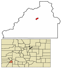
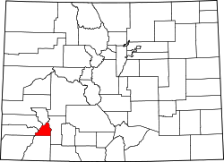
According to the United States Census Bureau, the town has a total area of 0.8 square miles (2.1 km2), all of it land. Silverton is one of the highest towns in the United States, at 9,318 feet (2,840 m) above sea level. The town is located in San Juan County, the highest county in the United States, with a mean elevation of 11,240 feet (3,430 meters). Silverton sits in a flat area of the Animas River valley and is surrounded by several thirteeners, the highest being Storm Peak, at 13,487 feet. The town is less than 15 miles from seven of Colorado's 53 "fourteeners", i.e., mountain peaks with a summit elevation of at least 14,000 feet (4,300 meters).

Climate

Silverton has an alpine subarctic climate (Köppen climate classification Dfc) with very cold, snowy winters and cool to warm summers with adequate precipitation year-round.

Climate data for Silverton, Colorado, 1991–2020 normals, 1904-2020 extremes: 9285ft (2830m)
MonthJanFebMarAprMayJunJulAugSepOctNovDecYear
Record high °F (°C)62
(17)
61
(16)
68
(20)
72
(22)
82
(28)
96
(36)
93
(34)
92
(33)
88
(31)
78
(26)
68
(20)
65
(18)
96
(36)
Mean maximum °F (°C)48.3
(9.1)
50.3
(10.2)
55.9
(13.3)
62.4
(16.9)
70.9
(21.6)
79.2
(26.2)
82.1
(27.8)
79.2
(26.2)
75.3
(24.1)
68.4
(20.2)
58.7
(14.8)
47.3
(8.5)
82.6
(28.1)
Mean daily maximum °F (°C)34.4
(1.3)
36.3
(2.4)
42.7
(5.9)
48.2
(9.0)
58.4
(14.7)
70.0
(21.1)
74.7
(23.7)
71.9
(22.2)
65.6
(18.7)
55.0
(12.8)
43.0
(6.1)
33.5
(0.8)
52.8
(11.6)
Daily mean °F (°C)14.3
(−9.8)
16.7
(−8.5)
24.4
(−4.2)
32.6
(0.3)
41.9
(5.5)
50.5
(10.3)
56.5
(13.6)
54.4
(12.4)
47.7
(8.7)
37.6
(3.1)
25.0
(−3.9)
14.4
(−9.8)
34.7
(1.5)
Mean daily minimum °F (°C)−5.9
(−21.1)
−2.8
(−19.3)
6.1
(−14.4)
17.0
(−8.3)
25.4
(−3.7)
31.0
(−0.6)
38.3
(3.5)
37.0
(2.8)
29.7
(−1.3)
20.1
(−6.6)
7.0
(−13.9)
−4.6
(−20.3)
16.5
(−8.6)
Mean minimum °F (°C)−21.1
(−29.5)
−18.4
(−28.0)
−11.3
(−24.1)
3.9
(−15.6)
16.7
(−8.5)
26.3
(−3.2)
32.3
(0.2)
31.7
(−0.2)
22.3
(−5.4)
9.5
(−12.5)
−11.0
(−23.9)
−19.3
(−28.5)
−23.8
(−31.0)
Record low °F (°C)−38
(−39)
−39
(−39)
−25
(−32)
−18
(−28)
0
(−18)
14
(−10)
20
(−7)
13
(−11)
5
(−15)
−12
(−24)
−24
(−31)
−35
(−37)
−39
(−39)
Average precipitation inches (mm)2.04
(52)
2.10
(53)
2.05
(52)
1.74
(44)
1.68
(43)
0.93
(24)
2.38
(60)
2.83
(72)
2.75
(70)
2.13
(54)
1.66
(42)
1.63
(41)
23.92
(607)
Average snowfall inches (cm)30.80
(78.2)
28.50
(72.4)
29.40
(74.7)
18.20
(46.2)
8.20
(20.8)
0.40
(1.0)
0.0
(0.0)
0.0
(0.0)
0.50
(1.3)
7.70
(19.6)
21.50
(54.6)
27.40
(69.6)
172.6
(438.4)
Source 1: NOAA [28]
Source 2: XMACIS (records & monthly max/mins) [29]
Climate data for 1906-2005 Silverton, Colorado.
MonthJanFebMarAprMayJunJulAugSepOctNovDecYear
Mean daily maximum °F (°C)34.0
(1.1)
36.6
(2.6)
40.6
(4.8)
47.3
(8.5)
57.6
(14.2)
67.9
(19.9)
73.1
(22.8)
70.5
(21.4)
64.7
(18.2)
55.1
(12.8)
43.2
(6.2)
35.1
(1.7)
52.2
(11.2)
Mean daily minimum °F (°C)−1.9
(−18.8)
1.0
(−17.2)
8.1
(−13.3)
18.5
(−7.5)
26.4
(−3.1)
31.9
(−0.1)
37.9
(3.3)
37.2
(2.9)
30.3
(−0.9)
22.0
(−5.6)
9.5
(−12.5)
0.2
(−17.7)
18.4
(−7.6)
Average precipitation inches (mm)1.68
(43)
1.75
(44)
2.30
(58)
1.72
(44)
1.46
(37)
1.39
(35)
2.72
(69)
3.10
(79)
2.81
(71)
2.34
(59)
1.49
(38)
1.73
(44)
24.50
(622)
Average snowfall inches (cm)25.8
(66)
25.3
(64)
28.4
(72)
17.3
(44)
4.3
(11)
0.3
(0.76)
0.0
(0.0)
0.0
(0.0)
0.9
(2.3)
8.5
(22)
20.0
(51)
24.0
(61)
154.9
(393)
Source: The Western Regional Climate Center [30]

Notable people

In the novel The Christopher Killer by Alane Ferguson, the main setting is in Silverton.

Country singer C. W. McCall recorded "The Silverton," about the Silverton and Durango Railroad, on his 1975 album Black Bear Road .

Night Passage (1957) was filmed in Silverton and Durango, Colorado. [32]

Shaun White's secret training facility for the Vancouver Olympics (2010) called "Project X" was located on Silverton Mountain. [33]

The board game Silverton by Mayfair Games is named after this location. [34]

For several years in the 1970s and 1980s, Silverton was the site for the International Speed-Skiing Championship. [35]

List of historic structures

NameYear BuiltComments
Teller House, 1250 Greene Street [36]
Teller-House.jpg
1896Brewery owner Charles Fischer built the Teller House as a hotel
Alma House, 220 East 10th Street [37]
Alma-House.jpg
1898Bridget Hughes opened the Alma House in 1902 as a boarding house for miners
Silverton Train Depot, corner of 10th and Cement Street [38]
Silverton-Train-Depot.jpg
1882Now the Durango and Silverton Narrow Gage Museum
Lode Theater, 1309 Greene Street [39]
Lode-Theater2.jpg
1909Originally constructed as a saloon; in 1916 converted to the Star Theatre; in 1925 became the Gem Theatre, and in 1938 became the Lode Theatre
Bausman's Merchandise, 1303 Greene Street [39]
Bausman's-Merchandise Building.jpg
1895
San Juan County Jail, 1557 Greene Street [39]
County-Jail.jpg
1902When the jail was completed it was the third jail in Silverton. It was never used extensively; by the 1930s it was a homeless shelter. It sat vacant for 25 years and then converted into a museum.
First Congregational Church, 1070 Reese Street [39]
Silverton-Congregational-Church.jpg
1880The steeple was added in 1892
San Juan County Water and Power Company substation/ Animas Power & Water Company [39] [40]
San Juan County Water and Power Company.jpg
1906Using hydroelectric power from Rockwood, Colorado, electricity was piped to this substation, where transformers distributed power to surrounding mines
Hillside Cemetery [41]
Hillside Cemetery Silverton, Colorado.jpg
1875A 20-acre site on the north side of Silverton, the first recorded burial is of Rachel Farrow, a young girl who died of pneumonia; James Briggs who died in 1878 from a snow slide is the first marked grave. Of 3300 documented burials, 2000 have no identifiable markers—wooden markers have deteriorated and disappeared.
Ye Old Livery, 1120 Greene Street [39] [42]
Old Livery.jpg
1897Built as a livery (stable for horses and mules). It had the first elevator in Silverton, and horses were lifted to the second floor while wagons were serviced on the first
County Club Saloon/Benson Block, 1208 Greene Street [39] [43]
Country Club.jpg
1901The corner of the building served as the County Club; since 1902 the building has served as a hotel, saloon, and one of the town's first garages.
Imperial Hotel/Grand Imperial [39] [43] [44]
Imperial Hotel, Silverton, Colorado.jpg
1882Originally a house with private and government offices upstairs. In 1883 the third floor was converted to hotel rooms. Englishman Charles S. Thomson built this grand hotel, a two-story Italianate building with a mansard third story and prominent battery of gabled dormers. Wrought iron columns separate first-floor plate glass storefronts. Above a first story of square-cut, irregularly coursed ashlar are a second story faced in brick with rhythmical rows of arched windows and a third story with rounded dormers set in diamond-patterned sheet metal. The county courthouse occupied the second floor for several years before the present courthouse was completed. In 1950 Winfield Morton of Dallas, Texas, bought the hotel for $60,000 and spent $369,000 to convert its fifty-six rooms and three bathrooms into forty-two rooms with baths. Resplendent with Victorian fixtures, it is now a forty-room hotel with first-floor lobby, shops, dining rooms, and a splendid saloon whose cherry back bar has diamond dust mirrors set in three ornate arches originating from Corinthian capitals.
San Juan County Miners Union Hospital, 1315 Snowden Street [45]
Miners-Hospital.jpg
1902Architect F.E. Edbrooke—whose works include the Colorado State Capitol building—designed the building in the Renaissance style
Public School, 1160 Snowden Street [46] [39] [43]
Public-School.jpg
1911This building replaced the original wooden structure, which was a fire hazard. It still functions as the school for Silverton, K-12.
St. Patrick's Church, 1005 Reese Street [39] [47]
St.-Patrick's-Church.jpg
1905This building replaced a frame church (1884) erected a block farther up 10th Street. Italian and Tyrolean miners donated much of the masonry work and helped construct the rectory (1906) next door. The large, square, open bell tower with a ball finial and Celtic cross and the corner minarets are unique features of this otherwise standard Romanesque Revival church with its round-arched openings, rose windows, buttresses, and rough stone foundation.
Carnegie Library, 1117 Reese Street, 1371 Greene Street [48] [43]
Carnegie-Library2.jpg
1905Between 1883 and 1929 Andrew Carnegie, an American industrialist and philanthropist, founded 2,509 Carnegie Libraries world-wide, and 1,689 in the United States alone, representing almost one-half the total number of libraries in the United States. Most were constructed in varying architectural styles, including Beaux-Arts, Italian Renaissance, Baroque, Classical Revival, and Spanish Colonial.
Silverton City Hall, 1360 Greene Street [43] [49] [50]
Silverton-City-Hall2.jpg
1908In 1908 the bell tower collapsed while under construction. Built of Silverton's distinctive local rosy-purple sandstone, it was restored in the 1970s, then re-restored after the Thanksgiving weekend fire in 1992 caused by a heating system that kept snow off the roof. During this fire the bell tower collapsed; reconstruction took three years. The dome caps the open bell tower of this two-story building with a second-story balcony under a Neoclassical pediment supported by paired Ionic columns.
Wyman Building, 1371 Greene Street [51] [39] [43]
Wyman-Hotel.jpg
1902Built by Louis Wyman who in part gained his fortune by gaining contracts to haul ore from the North Star Mine. On the top corner of the building you can see the image of a burro that he had chiseled into the stone to commemorate the animal that helped make his fortune.
Church on the Hill, 1101 Snowden Street [43]
Church-on-the-Hill.jpg
1898Originally built as St. John's Episcopal church, it was leased to schools for overflow classrooms until 1901. The belfry came from an old school house in the ghost town of Eureka, Colorado.
San Juan County Courthouse, 1557 Greene Street [43] [52]
County-Court-House.jpg
1907The dome sits atop this Georgian Revival monument. On the courthouse lawn is a monument imbedded with ore specimens from fifty-one local mines. Native gray sandstone was used for the foundation as well as the trim of this two-story structure of pressed gray brick, capped by a square tower with an elongated, open bell cupola. Paired Doric columns of cast stone support the entry porticos. The interior is pristine, with the original hexagonal tile mosaic floors, oak wood-work, high ceilings, signage, fixtures, and maps showing mining claims and the original town plat.
Old Arcade Trading Company, 1202 Blair Street [43] [53]
Old-Arcade.jpg
1929The last bordello to be constructed on Blair Street, it sold bootleg whiskey and employed prostitutes. It has served as a pool hall, saloon, and gambling house; it is still colored orange as it was in 1929.
Silverton Meat and Produce/Brown Bear Cafe, 1129 Greene Street [43]
Silverton-Meat-and-Produce.jpg
1893Was originally a butcher shop; lodging was provided upstairs. In 1933 it became the San Juan Bar. Most recently it became the Brown Bear Cafe, which has been closed.
Posey and Wingate Building, 1269 Greene Street [43] [54]
Posey-and-Wingate-Building.jpg
1880This is the oldest commercial building in western Colorado and has been a hardware store, a bank, and a pool and billiards hall. It housed the First National Bank Silverton from 1883 to 1934.
General Store, 1304 Greene Street [55]
General-Store2.jpg
1880Built of local gray granite for the walls and a stone false front with a tiny wooden bracketed cornice. Rough-cut granite blocks form the uncoursed walls, inside and out, of this one-story building with its original triple-arch plate glass storefront, hardwood floors, and 12-foot-high ceilings. It operated as a general store until 1900 when it was converted into a saloon; after prohibition it operated as a soda fountain and confectionary store.

See also

Related Research Articles

<span class="mw-page-title-main">San Juan Mountains</span> Mountain range in Colorado and New Mexico, United States

The San Juan Mountains is a high and rugged mountain range in the Rocky Mountains in southwestern Colorado and northwestern New Mexico. The area is highly mineralized and figured in the gold and silver mining industry of early Colorado. Major towns, all old mining camps, include Creede, Lake City, Silverton, Ouray, and Telluride. Large scale mining has ended in the region, although independent prospectors still work claims throughout the range. The last large-scale mines were the Sunnyside Mine near Silverton, which operated until late in the 20th century, and the Idarado Mine on Red Mountain Pass, which closed in the 1970s. Famous old San Juan mines include the Camp Bird and Smuggler Union mines, both located between Telluride and Ouray.

<span class="mw-page-title-main">Telluride, Colorado</span> Town in Colorado, United States

Telluride is the county seat and most populous town of San Miguel County in the southwestern portion of the U.S. state of Colorado. The town is a former silver mining camp on the San Miguel River in the western San Juan Mountains. The first gold mining claim was made in the mountains above Telluride in 1875, and early settlement of what is now Telluride followed. The town was founded in 1878 as "Columbia", but due to confusion with a California town of the same name, was renamed Telluride in 1887 for the gold telluride minerals found in other parts of Colorado. These telluride minerals were never found near Telluride, but the area's mines for some years provided zinc, lead, copper, silver, and other gold ores.

<span class="mw-page-title-main">San Juan County, Colorado</span> County in Colorado, United States

San Juan County is a county located in the U.S. state of Colorado. As of the 2020 census, the population was 705, making it the least populous county in Colorado. The county seat and the only incorporated municipality in the county is Silverton. The county name is the Spanish language name for "Saint John", the name Spanish explorers gave to a river and the mountain range in the area. With a mean elevation of 11,240 feet, San Juan County is the highest county in the United States and also has the two highest elevation houses in the United States; the ‘Bonnie Belle’ above Animas Forks at 11,900’ – 11,950’ elevation and an unnamed house above Picayune Gulch at 12,000’ elevation.

<span class="mw-page-title-main">La Plata County, Colorado</span> County in Colorado, United States

La Plata County is a county located in the U.S. state of Colorado. As of the 2020 census, the population was 55,638. The county seat is Durango. The county was named for the La Plata River and the La Plata Mountains. "La plata" means "the silver" in Spanish.

<span class="mw-page-title-main">Lake City, Colorado</span> Town in Colorado, United States

Lake City is a statutory town that is the county seat, the most populous community, and the only incorporated municipality in Hinsdale County, Colorado, United States. The population was 432 at the 2020 census. It is located in the San Juan Mountains in a valley formed by the convergence of Henson Creek and the headwaters of the Lake Fork of the Gunnison River about seven miles (11 km) east of Uncompahgre Peak, a Colorado fourteener. Lake City is named after nearby Lake San Cristobal. This area lies at the southern end of the Colorado Mineral Belt and when rich mineral deposits were discovered the native population was pushed from their tribal lands and the town of Lake City was incorporated in 1873.

<span class="mw-page-title-main">Durango, Colorado</span> City in Colorado, United States

Durango is a home rule municipality that is the county seat and the most populous municipality of La Plata County, Colorado, United States. The city population was 19,071 at the 2020 United States Census. Durango is the home of Fort Lewis College.

<span class="mw-page-title-main">Ouray, Colorado</span> City in Colorado, United States

Ouray is a home rule municipality that is the county seat of Ouray County, Colorado, United States. The city population was 898 as of the 2020 census. The Ouray Post Office has the ZIP Code 81427. Located at an elevation of 7,792 feet (2,375 m), Ouray's climate, natural alpine environment, and scenery have earned it the nickname "Switzerland of America".

<span class="mw-page-title-main">Animas River</span> Tributary of the San Juan River in the US states of Colorado and New Mexico

Animas River is a 126-mile-long (203 km) river in the western United States, a tributary of the San Juan River, part of the Colorado River System.

<span class="mw-page-title-main">U.S. Route 550</span> Highway in the United States

U.S. Route 550 (US 550) is a spur of U.S. Highway 50 that runs from Bernalillo, New Mexico to Montrose, Colorado in the western United States. The section from Silverton to Ouray is frequently called the Million Dollar Highway. It is one of the roads on the Trails of the Ancients Byway, one of the designated New Mexico Scenic Byways.

The San Juan Skyway Scenic and Historic Byway is a 236-mile (380 km) All-American Road, National Forest Scenic Byway, and Colorado Scenic and Historic Byway located in Dolores, La Plata, Montezuma, San Juan, and San Miguel counties, Colorado, United States. The byway forms a loop in southwestern Colorado traversing the heart of the San Juan Mountains. The San Juan Skyway reaches its zenith at Red Mountain Pass at elevation 11,018 feet (3,358 m). Mesa Verde National Park was one of the original UNESCO World Heritage Sites. The Silverton Historic District and the Telluride Historic District are National Historic Landmarks.

<span class="mw-page-title-main">Durango and Silverton Narrow Gauge Railroad</span> Heritage railroad in Colorado, US

The Durango and Silverton Narrow Gauge Railroad, often abbreviated as the D&SNG, is a 3 ft (914 mm) narrow-gauge heritage railroad that operates on 45.2 mi (72.7 km) of track between Durango and Silverton, in the U.S. state of Colorado. The railway is a federally-designated National Historic Landmark and was also designated by the American Society of Civil Engineers as a National Historic Civil Engineering Landmark in 1968.

<span class="mw-page-title-main">Rio Grande Southern Railroad</span> Former narrow-gauge railway in Colorado, US

The Rio Grande Southern Railroad was a 3 ft (914 mm) narrow-gauge railroad which ran in the southwestern region of the US state of Colorado, from the towns of Durango to Ridgway, routed via Lizard Head Pass. Built by Russian immigrant and Colorado toll road builder Otto Mears, the RGS operated from 1891 through 1951 and was built with the intent to transport immense amounts of silver mineral traffic that were being produced by the mining communities of Rico and Telluride. On both ends of the railroad, there were interchanges with The Denver and Rio Grande Railroad, which would ship the traffic the RGS hauled elsewhere like the San Juan Smelter in Durango.

<span class="mw-page-title-main">Weminuche Wilderness</span> Protected area in southwestern Colorado, US

The Weminuche Wilderness is a wilderness area in southwest Colorado managed by the United States Forest Service as part of the San Juan National Forest on the west side of the Continental Divide and the Rio Grande National Forest on the east side of the divide. The Weminuche Wilderness was designated by Congress in 1975, and expanded by the Colorado Wilderness Acts of 1980 and 1993. It is located 4 miles (6.4 km) southeast of the town of Silverton, 17 miles (27 km) northeast of Durango, and 8 miles (13 km) west of South Fork. At 499,771 acres (2,022.50 km2), it is the largest wilderness area in the state of Colorado. Elevation in the wilderness ranges from 7,700 feet (2,300 m) along the Animas River to 14,093 feet (4,296 m) at the summit of Windom Peak.

<span class="mw-page-title-main">Eureka, Colorado</span> Ghost town in San Juan County, Colorado, United States.

Eureka is an extinct mining town in San Juan County, Colorado, United States, along the Animas River, between Silverton and Animas Forks. The town derives its name from the Greek interjection Eureka! The Eureka post office operated from August 9, 1875, until April 30, 1942.

<span class="mw-page-title-main">Shenandoah-Dives Mill</span> United States historic place

The Shenandoah-Dives Mill or Mayflower Mill is an intact and functional but inactive historic ore mill 2 miles (3.2 km) east of Silverton, Colorado, United States. The mill was built in 1929 to recover gold, silver, lead, zinc, and copper from ore mined at the Mayflower mine and brought to the mill by an aerial tramway. Regularly active until 1945, it houses still-functional equipment for the separation by flotation of metals from crushed ores. It is the only intact and functional mill of its kind in Colorado. It was included in the expanded Silverton Historic District in 1997, and was declared a National Historic Landmark on its own in 2000. The mill is owned by the San Juan County Historic Society, which staffs an information and gift shop at the mill under the name Mayflower Mill. The mill is open for self-guided tours in the summer months.

<span class="mw-page-title-main">Alpine Loop Back Country Byway</span>

The Alpine Loop Back Country Byway is a rugged 63-mile (101 km) Back Country Byway and Colorado Scenic and Historic Byway located in the high San Juan Mountains of Hindale, Ouray, and San Juan counties, Colorado, USA. The byway connects the mountain towns of Lake City, Ouray, and Silverton. The route ranges in elevation from 7,792 feet (2,375 m) in Ouray to 12,800 feet (3,901 m) at Engineer Pass. The byway features high mountain passes, alpine tundra, beautiful mountain meadows, ghost towns, and relics of the silver mining era. While the meadows and tundra are accessible to ordinary passenger vehicles, a high-clearance 4-wheel drive vehicle is required to travel the entire route.

Emil B. Fischer published six detailed maps of the San Juan area of southwestern Colorado between 1883 and 1898. A surveyor's son, he came to America around 1872. He moved to Durango in 1880 when the building of the Denver & Rio Grande Railway to the San Juan attracted widespread attention, then to Silverton. These maps aided silver and gold prospectors to file their claims; they enabled investors to locate mines and view their proximity to famous neighboring mines; and they encouraged tourists to visit the depicted mining regions and invigorate the local economies.

<span class="mw-page-title-main">2015 Gold King Mine waste water spill</span> Environmental disaster near Silverton, Colorado

The 2015 Gold King Mine waste water spill was an environmental disaster that began at the Gold King Mine near Silverton, Colorado, when Environmental Protection Agency (EPA) personnel, along with workers for Environmental Restoration LLC, caused the release of toxic waste water into the Animas River watershed. They caused the accident by breaching a tailings dam while attempting to drain ponded water near the entrance of the mine on August 5. After the spill, the Silverton Board of Trustees and the San Juan County Commission approved a joint resolution seeking Superfund money.

<span class="mw-page-title-main">The Durango smelter</span>

The San Juan and New York Smelting Company, was a mineral smelter located below Smelter Mountain right in front of Durango, Colorado, operating from 1882 to 1930, processing Coke, Lead, Copper, Silver, and Gold from mines all over La Plata County, San Juan County, and elsewhere in the Southwestern Colorado Region generally serviced by railroad. It was later reinstated during World War II by the U. S. Vanadium Corporation for production of large amounts of Uranium that would be utilized in the Manhattan Project. From 1963 on the smelter sat dormant until the U.S. Department of Energy cleaned up the site from 1985 to 1987 due to concerns regarding toxic mineral tailings/radioactive waste, as well as the Colorado Department of Public Health and Environment suing ASARCO or damages to natural resources in 1983. Today the site is now the City of Durango's dog park and also considered a popular local hike.

<span class="mw-page-title-main">Electric Peak (San Juan Mountains)</span> Mountain in Colorado

Electric Peak is a 13,292-foot-elevation (4,051-meter) mountain summit located in San Juan County, Colorado, United States. It is situated eight miles south of the community of Silverton, in the Weminuche Wilderness, on land managed by San Juan National Forest. It is part of the Needle Mountains which are a subset of the San Juan Mountains, which in turn is a subset of the Rocky Mountains. Precipitation runoff from the mountain drains into tributaries of the Animas River. The peak can be seen from U.S. Route 550 and the Durango and Silverton Narrow Gauge Railroad. Topographic relief is significant as the west aspect rises over 4,500 feet above the river and railway in approximately two miles. It is set five miles west of the Continental Divide, and one mile east of Mount Garfield. The mountain's name, which has been officially adopted by the United States Board on Geographic Names, was in use before 1906 when Henry Gannett published it in the Gazetteer of Colorado.

References

  1. 1 2 3 "Active Colorado Municipalities". State of Colorado, Department of Local Affairs. Archived from the original on December 12, 2009. Retrieved September 1, 2007.
  2. "Colorado County Seats". State of Colorado, Department of Public Health and Environment. Retrieved December 31, 2007.
  3. "Colorado Municipal Incorporations". State of Colorado, Department of Personnel & Administration, Colorado State Archives. December 1, 2004. Retrieved September 2, 2007.
  4. "2019 U.S. Gazetteer Files". United States Census Bureau. Retrieved July 1, 2020.
  5. "US Board on Geographic Names". United States Geological Survey. October 25, 2007. Retrieved January 31, 2008.
  6. 1 2 United States Census Bureau. "Silverton town, Colorado" . Retrieved April 5, 2023.
  7. "ZIP Code Lookup". United States Postal Service. Archived from the original (JavaScript/HTML) on November 22, 2010. Retrieved January 2, 2008.
  8. "Find a County". National Association of Counties. Retrieved June 7, 2011.
  9. 1 2 3 4 5 Bunyak, Dawn (1997). "Silverton Historic District (boundary increase)". National Register of Historic Places. Retrieved May 18, 2021.
  10. 1 2 3 4 Twitty, Eric (March 1992). "Historic Mining Resources of San Juan County, Colorado" (PDF). National Register of Historic Places. Retrieved May 18, 2021..
  11. "14ers.com • 13er Storm Peak A". www.14ers.com. Retrieved May 19, 2021.
  12. "National Register Information System". National Register of Historic Places . National Park Service. January 23, 2007.
  13. "Silverton Historic District". National Historic Landmark summary listing. National Park Service. Archived from the original on January 4, 2008. Retrieved October 13, 2007.
  14. 1 2 3 4 Smith, Duane A. (2004). A brief history of Silverton (2nd ed.). Montrose, Colo.: Western Reflections Pub. p. 102. ISBN   1-890437-95-6. OCLC   56351338.
  15. Voynick, S.M., 1992, Colorado Gold, Missoula: Mountain Press Publishing Company, ISBN   0878424555
  16. 1 2 3 "U.S. Census website". United States Census Bureau . Retrieved January 31, 2008.
  17. 1 2 Russek, Melanie (n.d.). "Resiliency Plan for Silverton & San Juan County, Colorado" (PDF). National Association of Development Organizations. Retrieved May 18, 2021.
  18. Weiser-Alexander, Kathy (2021). "Silverton, Colorado – High in the San Juans". Legends of America. Retrieved May 18, 2021.
  19. 1 2 Weiser-Alexander, Kathey (2018). "Durango & Silverton Narrow Gauge Railroad". Legends of America. Retrieved May 18, 2021.
  20. "1910 Census Supplement For Colorado (p. 583)" (PDF). U.S. Census Bureau. Retrieved May 18, 2021.
  21. "Colorado: 2000, Population and Housing Unit Counts (Report No. PHC-3-7) (p. 11)" (PDF). US Census Bureau. 2003. Retrieved May 18, 2021.
  22. Owen, Faith (February 2020). "Silverton skijoring: The most extreme sporting event of the winter". 360Durango.Com. Retrieved May 18, 2021.
  23. "Shenandoah Mine Avalanche". usminedisasters.miningquiz.com. Retrieved May 20, 2021.
  24. Bohlen, Teague (January 13, 2017). "The Ten Worst Avalanches in Colorado History". Westword. Retrieved May 20, 2021.
  25. "The "Spanish" Flu of 1918". Silverton Standard. June 28, 2020. Retrieved May 20, 2021.
  26. 1 2 "In 1918, flu pandemic ravaged Southwest Colorado". Durango Herald. Retrieved May 20, 2021.
  27. 1 2 "Animas River: EPA's Colorado mine disaster plume flows west toward Grand Canyon". August 8, 2015.
  28. "Silverton, Colorado 1991-2020 Monthly Normals". National Oceanic and Atmospheric Administration. Retrieved August 12, 2023.
  29. "xmACIS". National Oceanic and Atmospheric Administration. Retrieved December 9, 2023.
  30. "Seasonal Temperature and Precipitation Information". Western Regional Climate Center. Retrieved March 29, 2013.
  31. Ex-spy feels at home in mountain town | Wyoming News | trib.com Retrieved 2016-11-14.
  32. Rowan, Terry (2013). The American Western A Complete Film Guide. Lulu Press, Inc. Page 286. ISBN   9781300418580.
  33. "Olympic gold shines on Silverton " " Local News". www.silvertonstandard.com. Retrieved September 24, 2018.
  34. "Silverton board game at Boardgamegeek.com" . Retrieved November 9, 2018.
  35. Wallace, William N. (April 21, 1982). "SPEED SKIERS DEFYING GRAVITY". The New York Times. ISSN   0362-4331 . Retrieved May 24, 2021.
  36. "Home". tellerhouse.com.
  37. "The Inn".
  38. "D&SNG Museum in Silverton".
  39. 1 2 3 4 5 6 7 8 9 10 11 Corr, Jeff (2014). Images of America: Silverton and the Alpine Loop. Charleston, South Carolina: Arcadia Publishing. p. 127. ISBN   978-1-4671-3155-1.
  40. "Silverton Power Station".
  41. "Hillside Cemetery ~ Silverton, Colorado".
  42. "Silverton, Colorado – High in the San Juans – Legends of America".
  43. 1 2 3 4 5 6 7 8 9 10 11 "Silverton Walking Tour" (PDF).
  44. "Grand Imperial Hotel". July 16, 2018.
  45. "San Juan County Hospital-Miner's Union Hospital | History Colorado".
  46. "contact us - SILVERTON SCHOOL". www.silvertonschool.org. Archived from the original on January 15, 2015.
  47. "St. Patrick's Catholic Church". July 16, 2018.
  48. "Carnegie Library (Silverton) | History Colorado".
  49. "SJCHS Historic Preservation Accomplishments".
  50. "Town Hall". July 16, 2018.
  51. "About - the Wyman Hotel - Silverton Colorado".
  52. "San Juan County Courthouse". July 16, 2018.
  53. "Silverton, Colorado Chamber of Commerce".
  54. "Silverton, Colorado – High in the San Juans – Legends of America".
  55. "Pickle Barrel (Sherwin and Houghton Store)". July 16, 2018.