Eureka, Colorado

Last updated

Eureka
Mining ghost town
Remains of The Sunnyside Mill at Eureka, Colorado.jpg
Remains of the Sunnyside Mill in Eureka, in May 2018
USA Colorado location map.svg
Red pog.svg
Eureka
Location within the state of Colorado
Usa edcp location map.svg
Red pog.svg
Eureka
Location within the United States
Coordinates: 37°52′47″N107°33′54″W / 37.8797°N 107.5650°W / 37.8797; -107.5650 (Eureka)
Country United States
State Colorado
County San Juan
Elevation
9,863 ft (3,006 m)
Time zone UTC-7 (Mountain (MST))
  Summer (DST) UTC-6 (MDT)
GNIS feature ID187402 [1]

Eureka is an extinct mining town in San Juan County, Colorado, United States, along the Animas River, between Silverton and Animas Forks. [2] [3] The town derives its name from the Greek interjection Eureka! [4] The Eureka post office operated from August 9, 1875, until April 30, 1942. [5]

Contents

History

Remains of an abandoned house in Eureka, June 2019 Remains Of An Abandoned House at Eureka, Colorado.jpg
Remains of an abandoned house in Eureka, June 2019
Remains of the Sunnyside Mill in September 2008 EurekaCO.jpg
Remains of the Sunnyside Mill in September 2008

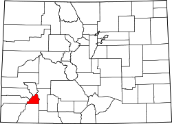
Charles Baker's group of prospectors found traces of placer gold in the San Juan Mountains in 1860 at Eureka. Forced out by the Ute Tribe in 1861, who had been awarded the area in a US treaty, the prospectors returned in 1871, when lode gold was found in the Little Giant vein at Arrastre Gulch near Silverton, Colorado. The miners were allowed to stay after the Brunot Treaty of 13 September 1873. In exchange for giving up 4 million acres, the Southern Ute Indian Reservation received $25,000 per year. [6] :49

The original mill was closed (reasons unknown) but to replace it, the Gold Prince Mill from Animas Forks was deconstructed and moved to the Eureka townsite to become the Sunnyside mill. In 1896, Eureka was connected to the Denver and Rio Grande Railroad via the Silverton Northern Railroad. Although the community grew steadily — not like a boomtown — it quickly declined after 1939, when the Sunnyside Mill closed for the last time. Today, the original townsite gravel roads remain, and debris litters the area. The only remaining structure is the Eureka jail, which has been restored. Foundations of the Sunnyside Mill and various remains of other structures still exist today.

Remains of the Sunnyside Mill in Eureka, July 2020 Remains of the Sunnyside Mill at the Ghost Town of Eureka, Colorado.jpg
Remains of the Sunnyside Mill in Eureka, July 2020

Geography

Eureka's elevation is 9,863 feet (3,006 m). [1]

See also

Related Research Articles

<span class="mw-page-title-main">San Juan County, Colorado</span> County in Colorado, United States

San Juan County is a county located in the U.S. state of Colorado. As of the 2020 census, the population was 705, making it the least populous county in Colorado. The county seat and the only incorporated municipality in the county is Silverton. The county name is the Spanish language name for "Saint John", the name Spanish explorers gave to a river and the mountain range in the area. With a mean elevation of 11,240 feet, San Juan County is the highest county in the United States and also has the two highest elevation houses in the United States; the ‘Bonnie Belle’ above Animas Forks at 11,900’ – 11,950’ elevation and an unnamed house above Picayune Gulch at 12,000’ elevation.

<span class="mw-page-title-main">Lake City, Colorado</span> Town in Colorado, United States

Lake City is a statutory town that is the county seat, the most populous community, and the only incorporated municipality in Hinsdale County, Colorado, United States. The population was 432 at the 2020 census. It is located in the San Juan Mountains in a valley formed by the convergence of Henson Creek and the headwaters of the Lake Fork of the Gunnison River about seven miles (11 km) east of Uncompahgre Peak, a Colorado fourteener. Lake City is named after nearby Lake San Cristobal. This area lies at the southern end of the Colorado Mineral Belt and when rich mineral deposits were discovered the native population was pushed from their tribal lands and the town of Lake City was incorporated in 1873.

<span class="mw-page-title-main">Silverton, Colorado</span> The only incorporated Town and county seat of San Juan County, Colorado, United States

Silverton is a statutory town that is the county seat, the most populous community, and the only incorporated municipality in San Juan County, Colorado, United States. The town is located in a remote part of the western San Juan Mountains, a range of the Rocky Mountains. The first mining claims were made in mountains above the Silverton in 1860, near the end of the Colorado Gold Rush and when the land was still controlled by the Utes. Silverton was established shortly after the Utes ceded the region in the 1873 Brunot Agreement, and the town boomed from silver mining until the Panic of 1893 led to a collapse of the silver market, and boomed again from gold mining until the recession caused by the Panic of 1907. The entire town is included as a federally designated National Historic Landmark District, the Silverton Historic District.

<span class="mw-page-title-main">Animas River</span> Tributary of the San Juan River in the US states of Colorado and New Mexico

Animas River is a 126-mile-long (203 km) river in the western United States, a tributary of the San Juan River, part of the Colorado River System.

<span class="mw-page-title-main">National Register of Historic Places listings in Colorado</span> List of National Register of Historic Places in the U.S. State of Colorado

There are more than 1,500 properties and historic districts in the U.S. State of Colorado listed on the National Register of Historic Places. They are distributed over 63 of Colorado's 64 counties; only the City and County of Broomfield currently has none.

<span class="mw-page-title-main">Animas Forks, Colorado</span> Unincorporated in Colorado, United States

Animas Forks is an extinct mining town located 12 miles (19 km) northeast of Silverton in San Juan County, Colorado, United States. The area is managed by the Bureau of Land Management. At an elevation of 11,185 feet (3,409 m), Animas Forks is one of the highest mining camps in the North America.

<span class="mw-page-title-main">Caribou, Colorado</span> Ghost town

Caribou is an extinct silver mining town located near Nederland in Boulder County, Colorado, United States. It was named after the Caribou silver mine nearby. The Caribou post office operated from January 31, 1871, until March 31, 1917. The Caribou Ranch recording studio was located several miles away, on the road from Nederland up to Caribou.

The Lake Fork of the Gunnison River begins in high mountains in the western region of Colorado, United States, draining the northeastern part of the San Juan Mountains.

<span class="mw-page-title-main">Silverton Northern Railroad</span>

The Silverton Northern Railroad, now defunct, was an American 3 ft Narrow Gauge Railroad constructed to reach the mining area north of Silverton, Colorado along the upper Animas River. This line was the third railroad project built by known Colorado toll road builder and Russian Immigrant Otto Mears, beginning in 1889 as a branch of the Silverton Railroad to Eureka. Incorporated in 1895 as the Silverton Northern Railroad, the line was projected to run past Eureka to Animas Forks and on to Mineral Point and then on to Lake City via Henson Creek, including a proposed three-quarter-mile tunnel through the mountains. However, Animas Forks was the end of the line, which was reached in 1896.

<span class="mw-page-title-main">Howardsville, Colorado</span> Unincorporated community in San Miguel County, Colorado, United States

Howardsville is an unincorporated community in San Juan County, Colorado, United States, along the Animas River at the mouth of Cunningham Creek. Its elevation is 9,748 feet (2,971 m). It is located about two miles from the town of Silverton and 8 miles from the famous ghost town of Animas Forks, and is on the same road as the ghost towns of Middleton and Eureka.

<span class="mw-page-title-main">Alpine Loop Back Country Byway</span>

The Alpine Loop Back Country Byway is a rugged 63-mile (101 km) Back Country Byway and Colorado Scenic and Historic Byway located in the high San Juan Mountains of Hindale, Ouray, and San Juan counties, Colorado, USA. The byway connects the mountain towns of Lake City, Ouray, and Silverton. The route ranges in elevation from 7,792 feet (2,375 m) in Ouray to 12,800 feet (3,901 m) at Engineer Pass. The byway features high mountain passes, alpine tundra, beautiful mountain meadows, ghost towns, and relics of the silver mining era. While the meadows and tundra are accessible to ordinary passenger vehicles, a high-clearance 4-wheel drive vehicle is required to travel the entire route.

<span class="mw-page-title-main">Ironton, Colorado</span> Ghost town in Ouray County, Colorado

Ironton is an extinct town located in Ouray County, Colorado, United States. It lay south of the present town of Ouray, adjacent to the sites Guston of Red Mountain Town, fellow ghost towns. During the 1880s and 1890s, Ironton formed part of the Red Mountain Pass mining district, the second largest silver mining district in Colorado. The Ironton post office operated from May 2, 1883, until August 2, 1920.

<span class="mw-page-title-main">Independence, Pitkin County, Colorado</span> Ghost town in Colorado, United States

Independence is an extinct town located in Pitkin County, Colorado, United States. It is located at an elevation of 10,913 feet (3,326 m) 2.2 miles (3.6 km) directly west of Independence Pass. It was the first settlement established in the Roaring Fork Valley, after gold was struck in the vicinity on Independence Day, July 4, 1879, hence its name. Independence was served by three differently named post offices: Farwell from July 14, 1881, until July 3, 1882; Sparkill from February 1, 1882, until October 18, 1887; and Chipeta from April 20, 1899, until October 17, 1899. It has also been known historically as Mammoth City, Mount Hope, and Hunter's Pass.

Abeyta is an extinct town in Las Animas County, in the U.S. state of Colorado. The townsite is located at 37.0797°N 104.1864°W at an elevation of 5,725 feet (1,745 m).

Beshoar is an extinct town located in Las Animas County, Colorado, United States. The townsite is located at 37.2181°N 104.4066°W at an elevation of 5,922 feet (1,805 m).

<span class="mw-page-title-main">Bloom, Colorado</span> Ghost town

Bloom is an extinct town located in Otero County, Colorado, United States. The townsite is located at 37.6875°N 103.9566°W at an elevation of 4,800 feet (1,463 m).

<span class="mw-page-title-main">Bowen, Las Animas County, Colorado</span> Ghost town

Bowen is an extinct town located in Las Animas County, Colorado, United States.

Buckingham is an extinct town located in Weld County, Colorado, United States. The townsite is located at 40.6214°N 103.9777°W at an elevation of 4,944 feet (1,507 m).

<span class="mw-page-title-main">Guston, Colorado</span> Ghost town in Ouray County, Colorado, United States

Guston is a silver mining ghost town in Ouray County, Colorado, United States, 11 miles (18 km) south of Ouray following the "Million Dollar Highway". Nestled in Champion Gulch, it is located near Red Mountain and the remnants of Red Mountain Town and Ironton. The Silverton Railroad ran from Guston in the Red Mountain Pass to Silverton in San Juan County. The silver mining camp was established in 1883. The Guston post office operated from January 26, 1892, until November 16, 1898.

References

  1. 1 2 "Eureka, Colorado". Geographic Names Information System . United States Geological Survey, United States Department of the Interior . Retrieved January 9, 2008.
  2. Eureka History
  3. The Silverton Railroads
  4. Dawson, John Frank. Place names in Colorado: why 700 communities were so named, 150 of Spanish or Indian origin. Denver, CO: The J. Frank Dawson Publishing Co. p. 20.
  5. Bauer, William H.; Ozment, James L.; Willard, John H. (1990). Colorado Post Offices 1859–1989. Golden, Colorado: Colorado Railroad Historical Foundation. ISBN   0-918654-42-4.
  6. Voynick, S.M., 1992, Colorado Gold, Missoula: Mountain Press Publishing Company, ISBN   0878424555