Howardsville, Colorado

Last updated

Howardsville
The Pride of the West Mill in Howardsville, Colorado.jpg
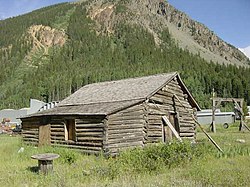
The Pride of the West Mill in Howardsville in 2018
USA Colorado location map.svg
Red pog.svg
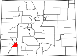
Howardsville
Location within the state of Colorado
Usa edcp location map.svg
Red pog.svg
Howardsville
Location within the United States
Coordinates: 37°50′08″N107°35′39″W / 37.83556°N 107.59417°W / 37.83556; -107.59417 (Howardsville)
Country United States
State Colorado
County San Juan
Elevation
[1]
9,748 ft (2,971 m)
Time zone UTC-7 (Mountain (MST))
  Summer (DST) UTC-6 (MDT)
GNIS feature ID187646 [1]

Howardsville is an unincorporated community in San Juan County, Colorado, United States, [1] along the Animas River at the mouth of Cunningham Creek. It is located about two miles from the town of Silverton and 8 miles from the famous ghost town of Animas Forks, and is on the same road as the ghost towns of Middleton and Eureka.

Contents

History

An abandoned cabin in Howardsville in September 2008 HowardsvilleCO.jpg
An abandoned cabin in Howardsville in September 2008

Established and laid out by the Bullion City Company as Bullion City in 1874, it was renamed either for Lieutenant Howard, a once-prominent local figure, or for George Howard, who once had a cabin in the area. Howardsville was the original La Plata County seat from its creation on February 10, 1874, until the creation of San Juan County on January 31, 1876. The Howardsville post office operated from June 24, 1874, until October 31, 1939. [2] The Silverton Northern Railroad laid tracks to reach Howardsville in 1896, with an extension getting built from Howardsville into Cunningham Gulch to reach the Old Hundred Mine, along with the Green Mountain Mine, in 1905. The town would be sustained for the remainder of its life by the Pride Of The West Mill and the Little Nation Tram House & Mill, among other mines & mills. The town effectively died in 1939 when its post office shut down, and the Silverton Northern Railroad tracks would get torn up in 1942. [3] [4]

See also

Related Research Articles

<span class="mw-page-title-main">San Juan County, Colorado</span> County in Colorado, United States

San Juan County is a county located in the U.S. state of Colorado. As of the 2020 census, the population was 705, making it the least populous county in Colorado. The county seat and the only incorporated municipality in the county is Silverton. The county name is the Spanish language name for "Saint John", the name Spanish explorers gave to a river and the mountain range in the area. With a mean elevation of 11,240 feet, San Juan County is the highest county in the United States and also has the two highest elevation houses in the United States; the ‘Bonnie Belle’ above Animas Forks at 11,900’ – 11,950’ elevation and an unnamed house above Picayune Gulch at 12,000’ elevation.

<span class="mw-page-title-main">Durango, Colorado</span> City in Colorado, United States

Durango is a home rule municipality that is the county seat and the most populous municipality of La Plata County, Colorado, United States. The city population was 19,071 at the 2020 United States Census. Durango is the home of Fort Lewis College.

<span class="mw-page-title-main">Silverton, Colorado</span> The only incorporated Town and county seat of San Juan County, Colorado, United States

Silverton is a statutory town that is the county seat, the most populous community, and the only incorporated municipality in San Juan County, Colorado, United States. The town is located in a remote part of the western San Juan Mountains, a range of the Rocky Mountains. The first mining claims were made in mountains above the Silverton in 1860, near the end of the Colorado Gold Rush and when the land was still controlled by the Utes. Silverton was established shortly after the Utes ceded the region in the 1873 Brunot Agreement, and the town boomed from silver mining until the Panic of 1893 led to a collapse of the silver market, and boomed again from gold mining until the recession caused by the Panic of 1907. The entire town is included as a federally designated National Historic Landmark District, the Silverton Historic District.

<span class="mw-page-title-main">Animas River</span> Tributary of the San Juan River in the US states of Colorado and New Mexico

Animas River is a 126-mile-long (203 km) river in the western United States, a tributary of the San Juan River, part of the Colorado River System.

<span class="mw-page-title-main">U.S. Route 550</span> Highway in the United States

U.S. Route 550 (US 550) is a spur of U.S. Highway 50 that runs from Bernalillo, New Mexico to Montrose, Colorado in the western United States. The section from Silverton to Ouray is frequently called the Million Dollar Highway. It is one of the roads on the Trails of the Ancients Byway, one of the designated New Mexico Scenic Byways.

<span class="mw-page-title-main">Old Hundred Gold Mine</span> Gold mine in Colorado, U.S.A.

The Old Hundred Gold Mine is a gold mine in San Juan County, Colorado, United States. The mine is about five miles east of Silverton, Colorado, near the ghost town of Howardsville. The property is no longer mined, but is open for tours in the summer.

<span class="mw-page-title-main">San Juan Skyway Scenic and Historic Byway</span> Colorado Scenic and Historic Byway

The San Juan Skyway Scenic and Historic Byway is a 236-mile (380 km) All-American Road, National Forest Scenic Byway, and Colorado Scenic and Historic Byway located in Dolores, La Plata, Montezuma, San Juan, and San Miguel counties, Colorado, United States. The byway forms a loop in southwestern Colorado traversing the heart of the San Juan Mountains. The San Juan Skyway reaches its zenith at Red Mountain Pass at elevation 11,018 feet (3,358 m). Mesa Verde National Park was one of the original UNESCO World Heritage Sites. The Silverton Historic District and the Telluride Historic District are National Historic Landmarks.

<span class="mw-page-title-main">Durango and Silverton Narrow Gauge Railroad</span> Heritage railroad in Colorado, US

The Durango and Silverton Narrow Gauge Railroad, often abbreviated as the D&SNG, is a 3 ft (914 mm) narrow-gauge heritage railroad that operates on 45.2 mi (72.7 km) of track between Durango and Silverton, in the U.S. state of Colorado. The railway is a federally-designated National Historic Landmark and was also designated by the American Society of Civil Engineers as a National Historic Civil Engineering Landmark in 1968.

<span class="mw-page-title-main">Silverton Railroad</span>

The Silverton Railroad, now defunct, was an American 3 ft narrow gauge railroad constructed between Silverton, Colorado and mining districts near Red Mountain Pass, Colorado.

<span class="mw-page-title-main">Animas Forks, Colorado</span> Unincorporated in Colorado, United States

Animas Forks is an extinct mining town located 12 miles (19 km) northeast of Silverton in San Juan County, Colorado, United States. The area is managed by the Bureau of Land Management. At an elevation of 11,185 feet (3,409 m), Animas Forks is one of the highest mining camps in North America.

Belleville, Nevada, in Mineral County, Nevada, United States, was a mining town that rose up around the milling of ore shipped in from nearby mines. Today it is a ghost town.

<span class="mw-page-title-main">Eureka, Colorado</span> Ghost town in San Juan County, Colorado, United States.

Eureka is an extinct mining town in San Juan County, Colorado, United States, along the Animas River, between Silverton and Animas Forks. The town derives its name from the Greek interjection Eureka! The Eureka post office operated from August 9, 1875, until April 30, 1942.

<span class="mw-page-title-main">Shenandoah-Dives Mill</span> United States historic place

The Shenandoah-Dives Mill or Mayflower Mill is an intact and functional but inactive historic ore mill 2 miles (3.2 km) east of Silverton, Colorado, United States. The mill was built in 1929 to recover gold, silver, lead, zinc, and copper from ore mined at the Mayflower mine and brought to the mill by an aerial tramway. Regularly active until 1945, it houses still-functional equipment for the separation by flotation of metals from crushed ores. It is the only intact and functional mill of its kind in Colorado. It was included in the expanded Silverton Historic District in 1997, and was declared a National Historic Landmark on its own in 2000. The mill is owned by the San Juan County Historic Society, which staffs an information and gift shop at the mill under the name Mayflower Mill. The mill is open for self-guided tours in the summer months.

<span class="mw-page-title-main">Silverton Northern Railroad</span>

The Silverton Northern Railroad, now defunct, was an American 3 ft Narrow Gauge Railroad constructed to reach the mining area north of Silverton, Colorado along the upper Animas River. This line was the third railroad project built by known Colorado toll road builder and Russian Immigrant Otto Mears, beginning in 1889 as a branch of the Silverton Railroad to Eureka. Incorporated in 1895 as the Silverton Northern Railroad, the line was projected to run past Eureka to Animas Forks and on to Mineral Point and then on to Lake City via Henson Creek, including a proposed three-quarter-mile tunnel through the mountains. However, Animas Forks was the end of the line, which was reached in 1896.

<span class="mw-page-title-main">Alpine Loop Back Country Byway</span>

The Alpine Loop Back Country Byway is a rugged 63-mile (101 km) Back Country Byway and Colorado Scenic and Historic Byway located in the high San Juan Mountains of Hindale, Ouray, and San Juan counties, Colorado, USA. The byway connects the mountain towns of Lake City, Ouray, and Silverton. The route ranges in elevation from 7,792 feet (2,375 m) in Ouray to 12,800 feet (3,901 m) at Engineer Pass. The byway features high mountain passes, alpine tundra, beautiful mountain meadows, ghost towns, and relics of the silver mining era. While the meadows and tundra are accessible to ordinary passenger vehicles, a high-clearance 4-wheel drive vehicle is required to travel the entire route.

<span class="mw-page-title-main">Alamosa–Durango line</span> Historic railroad line

The Alamosa–Durango line or San Juan extension was a railroad line built by the Denver and Rio Grande Western Railroad, following the border between the U.S. states of Colorado and New Mexico, in the Rocky Mountains. The line was originally built as a 3 ft narrow-gauge line between Alamosa, Colorado, and Durango, Colorado. Portions of the route survive: the now standard-gauged segment from Alamosa to Antonito, Colorado, and a narrow-gauge portion from Antonito to Chama, New Mexico.

<span class="mw-page-title-main">Guston, Colorado</span> Ghost town in Ouray County, Colorado, United States

Guston is a silver mining ghost town in Ouray County, Colorado, United States, 11 miles (18 km) south of Ouray following the "Million Dollar Highway". Nestled in Champion Gulch, it is located near Red Mountain and the remnants of Red Mountain Town and Ironton. The Silverton Railroad ran from Guston in the Red Mountain Pass to Silverton in San Juan County. The silver mining camp was established in 1883. The Guston post office operated from January 26, 1892, until November 16, 1898.

San Juan City was designated the county seat of Hinsdale County, Colorado when the county was established on February 10, 1874. On February 23, 1875, voters decided to move the county seat to Lake City. The town began as a mining camp, with the goal to become a hub for transportation of supplies to area mines. After a year as the county seat, it became a stage stop, offering food and lodging. It operated as a stage stop, post office, and roadhouse into the 1880s. In 1893, San Juan City became part of Mineral County, Colorado. A post office operated out of San Juan City, off and on, until 1923. The town's site, located along Clear Creek, is now Freemon's Guest Ranch. San Juan Ranch is also said to be the former site of San Juan City, but the former Galloway's transportion hub that became San Juan Ranch was located a few miles away from the town.

References

  1. 1 2 3 U.S. Geological Survey Geographic Names Information System: Howardsville, Colorado
  2. Bauer, William H.; Ozment, James L.; Willard, John H. (1990). Colorado Post Offices 1859–1989. Golden, Colorado: Colorado Railroad Historical Foundation. ISBN   0-918654-42-4.
  3. "DRGW.Net | Silverton Northern Railroad".
  4. "Howardsville Colorado".