Genoa, Colorado

Last updated

Genoa, Colorado
Town of Genoa [1]
Genoa Colorado Main street. January 2024.jpg
Genoa's main street as of January 2024
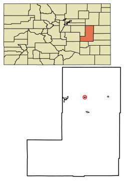
Lincoln County Colorado Incorporated and Unincorporated areas Genoa Highlighted 0829680.svg
Location of the Town of Genoa in Lincoln County, Colorado.
Usa edcp location map.svg
Red pog.svg
Genoa
Location of the Town of Genoa in the United States.
Coordinates: 39°16′35″N103°29′56″W / 39.27639°N 103.49889°W / 39.27639; -103.49889
Country Flag of the United States.svg  United States
State Flag of Colorado.svg  Colorado
County Lincoln County [1]
Incorporated (town) July 27, 1905 [2]
Government
  Type Statutory Town [1]
Area
[3]
  Total0.310 sq mi (0.804 km2)
  Land0.310 sq mi (0.804 km2)
  Water0.000 sq mi (0.000 km2)
Elevation
[4]
5,604 ft (1,708 m)
Population
 (2020) [3]
  Total153
  Density493/sq mi (190/km2)
Time zone UTC−07:00 (MST)
  Summer (DST) UTC−06:00 (MDT)
ZIP code [5]
80818
Area code 719
FIPS code 08-29680
GNIS feature ID0203757
Website townofgenoa.colorado.gov

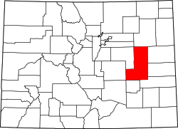
Genoa is a statutory town located in Lincoln County, Colorado, United States. [1] The town population was 153 at the 2020 United States Census. [3]

Contents

History

A post office called Genoa has been in operation since 1903. [6] The town most likely was named after Genoa, in Italy. [7]

Geography

Genoa is located at 39°16′35″N103°29′56″W / 39.27639°N 103.49889°W / 39.27639; -103.49889 (39.276479, -103.498850). [8]

At the 2020 United States Census, the town had a total area of 199 acres (0.804 km2), all of it land. [3]

Climate

According to the Köppen Climate Classification system, Genoa has a cold semi-arid climate, abbreviated "BSk" on climate maps.

Climate data for Genoa, Colorado, 19912020 normals, extremes 1970present
MonthJanFebMarAprMayJunJulAugSepOctNovDecYear
Record high °F (°C)70
(21)
76
(24)
79
(26)
85
(29)
96
(36)
102
(39)
101
(38)
100
(38)
98
(37)
90
(32)
79
(26)
70
(21)
102
(39)
Mean maximum °F (°C)62.7
(17.1)
63.9
(17.7)
73.5
(23.1)
78.9
(26.1)
86.3
(30.2)
94.6
(34.8)
95.8
(35.4)
93.9
(34.4)
91.0
(32.8)
82.6
(28.1)
72.4
(22.4)
63.4
(17.4)
97.2
(36.2)
Mean daily maximum °F (°C)42.0
(5.6)
42.2
(5.7)
52.2
(11.2)
58.9
(14.9)
68.7
(20.4)
80.0
(26.7)
86.3
(30.2)
83.4
(28.6)
75.8
(24.3)
63.3
(17.4)
50.2
(10.1)
41.3
(5.2)
62.0
(16.7)
Daily mean °F (°C)31.4
(−0.3)
31.2
(−0.4)
40.3
(4.6)
46.3
(7.9)
56.0
(13.3)
66.6
(19.2)
72.8
(22.7)
70.5
(21.4)
62.8
(17.1)
50.7
(10.4)
39.0
(3.9)
31.1
(−0.5)
49.9
(9.9)
Mean daily minimum °F (°C)20.7
(−6.3)
20.1
(−6.6)
28.3
(−2.1)
33.6
(0.9)
43.4
(6.3)
53.2
(11.8)
59.3
(15.2)
57.5
(14.2)
49.9
(9.9)
38.2
(3.4)
27.7
(−2.4)
20.9
(−6.2)
37.7
(3.2)
Mean minimum °F (°C)−0.3
(−17.9)
−1.5
(−18.6)
10.2
(−12.1)
17.9
(−7.8)
28.5
(−1.9)
43.0
(6.1)
51.7
(10.9)
49.0
(9.4)
37.3
(2.9)
20.6
(−6.3)
9.9
(−12.3)
−1.8
(−18.8)
−8.1
(−22.3)
Record low °F (°C)−20
(−29)
−23
(−31)
−6
(−21)
5
(−15)
17
(−8)
34
(1)
40
(4)
40
(4)
22
(−6)
2
(−17)
−8
(−22)
−12
(−24)
−23
(−31)
Average precipitation inches (mm)0.34
(8.6)
0.35
(8.9)
0.69
(18)
1.43
(36)
2.38
(60)
2.43
(62)
2.99
(76)
2.96
(75)
1.00
(25)
1.09
(28)
0.34
(8.6)
0.18
(4.6)
16.18
(410.7)
Average snowfall inches (cm)5.3
(13)
5.0
(13)
5.6
(14)
7.1
(18)
1.1
(2.8)
0.0
(0.0)
0.0
(0.0)
0.0
(0.0)
0.4
(1.0)
2.5
(6.4)
4.5
(11)
3.8
(9.7)
35.3
(88.9)
Average precipitation days (≥ 0.01 in)2.52.93.96.28.88.28.98.74.64.03.02.864.5
Average snowy days (≥ 0.1 in)2.93.02.92.50.50.10.00.00.21.12.42.518.1
Source 1: NOAA [9]
Source 2: National Weather Service (mean maxima and minima 2006–2020) [10]

Demographics

Historical population
CensusPop.Note
1930 218
1940 214−1.8%
1950 25720.1%
1960 185−28.0%
1970 161−13.0%
1980 1652.5%
1990 1671.2%
2000 21126.3%
2010 139−34.1%
2020 15310.1%
U.S. Decennial Census

As of the census [11] of 2000, there were 211 people, 75 households, and 54 families residing in the town. The population density was 592.4 inhabitants per square mile (228.7/km2). There were 84 housing units at an average density of 235.8 units per square mile (91.0 units/km2). The racial makeup of the town was 84.83% White, 7.58% African American, 0.47% Native American, 3.32% from other races, and 3.79% from two or more races. Hispanic or Latino of any race were 4.27% of the population.

There were 75 households, out of which 36.0% had children under the age of 18 living with them, 58.7% were married couples living together, 9.3% had a female householder with no husband present, and 28.0% were non-families. 22.7% of all households were made up of individuals, and 14.7% had someone living alone who was 65 years of age or older. The average household size was 2.81 and the average family size was 3.35.

In the town, the population was spread out, with 35.1% under the age of 18, 7.6% from 18 to 24, 21.8% from 25 to 44, 21.3% from 45 to 64, and 14.2% who were 65 years of age or older. The median age was 33 years. For every 100 females, there were 95.4 males. For every 100 females age 18 and over, there were 90.3 males.

The median income for a household in the town was $27,375, and the median income for a family was $28,750. Males had a median income of $28,750 versus $22,500 for females. The per capita income for the town was $12,443. About 10.4% of families and 20.2% of the population were below the poverty line, including 32.1% of those under the age of eighteen and 25.0% of those 65 or over.

Attractions

World's Wonder View Tower, a tourist trap and roadside attraction. [12]

See also

Related Research Articles

<span class="mw-page-title-main">Crestline, California</span> Census-designated place in California, United States

Crestline is a census-designated place in the San Bernardino Mountains of San Bernardino County, California, USA. The population was 10,770 at the 2010 census, up from 10,218 at the 2000 census.

<span class="mw-page-title-main">Kim, Colorado</span> Town in Colorado, United States

Kim is a Statutory Town in Las Animas County, Colorado, United States. The population was 63 at the time of the 2020 United States Census.

<span class="mw-page-title-main">Palisade, Colorado</span> Town in Mesa County, Colorado, United States

Palisade is a statutory town in Mesa County, Colorado, United States. It is part of the Grand Junction Metropolitan Statistical Area. The population was 2,565 at the 2020 census, down from 2,692 in 2010.

<span class="mw-page-title-main">Hillrose, Colorado</span> Town in Colorado, United States

The Town of Hillrose is a statutory town located in Morgan County, Colorado, United States. The town population was 312 at the 2020 United States Census, an 18.18% increase since the 2010 United States Census.

<span class="mw-page-title-main">Alma, Colorado</span> Town in Park County, Colorado, United States

Alma is a statutory town in Park County, Colorado, United States. The town population was 296 at the 2020 United States Census. Alma is located West and South of the Denver-Aurora-Lakewood, CO Metropolitan Statistical Area and the Front Range Urban Corridor.

<span class="mw-page-title-main">Holly, Colorado</span> Town in Colorado, United States

Holly is a statutory town in Prowers County in southeastern Colorado, United States. The town is located 4.3 miles (6.9 km) west of the Kansas border at an elevation of 3,393 feet (1,034 m). Despite having the lowest elevation of any Colorado municipality, Holly is higher than the high points of 19 states and the District of Columbia. The town population was 837 at the 2020 United States Census.

<span class="mw-page-title-main">Akron, Colorado</span> Town in Colorado, United States

Akron is the Statutory Town that is the county seat and the most populous municipality of Washington County, Colorado, United States. The town population was 1,757 at the 2020 United States Census.

<span class="mw-page-title-main">Selden, Kansas</span> City in Sheridan County, Kansas

Selden is a city in Sheridan County, Kansas, United States. As of the 2020 census, the population of the city was 184.

<span class="mw-page-title-main">Hersey, Maine</span> Town in the state of Maine, United States

Hersey is a town in Aroostook County, Maine, United States. The population was 73 at the 2020 census.

<span class="mw-page-title-main">Masardis, Maine</span> Town in Maine, United States

Masardis is a town in Aroostook County, Maine, United States. The population was 204 at the 2020 census.

<span class="mw-page-title-main">Elizabeth, Minnesota</span> City in Minnesota, United States

Elizabeth is a city in Otter Tail County, Minnesota, United States. The population was 168 at the 2020 census.

<span class="mw-page-title-main">Reeds, Missouri</span> Village in Missouri, United States

Reeds is a village in Jasper County, Missouri, United States. The population was 91 at the 2020 census. It is part of the Joplin, Missouri Metropolitan Statistical Area. For a short time, it was the county seat of Jasper County.

<span class="mw-page-title-main">Sutcliffe, Nevada</span> CDP in Nevada, United States

Sutcliffe is a census-designated place (CDP) in Washoe County, Nevada, United States. The population was 253 at the 2010 census. It is part of the Reno–Sparks Metropolitan Statistical Area.

<span class="mw-page-title-main">Lewiston, Utah</span> City in Utah, United States

Lewiston is a city in Cache County, Utah, United States. It is situated at the northern Utah border and borders the state of Idaho. The population was 1,766 at the 2010 census. It is included in the Logan, Utah-Idaho (partial) Metropolitan Statistical Area.

<span class="mw-page-title-main">Glen Lyn, Virginia</span> Town in Virginia, United States

Glen Lyn is a town in Giles County, Virginia, United States, at the confluence of the East and New rivers. The population was 115 at the 2010 census, down from 151 at the 2000 census. It is part of the Blacksburg–Christiansburg Metropolitan Statistical Area.

<span class="mw-page-title-main">Scottsburg, Virginia</span> Town in Virginia, United States

Scottsburg is a town in Halifax County, Virginia, United States. The population was 119 at the 2010 census, down from 145 at the 2000 census.

<span class="mw-page-title-main">Worthington, West Virginia</span> Town in West Virginia, United States

Worthington is a town in Marion County, West Virginia, United States. The population was 158 at the 2010 census. Worthington was incorporated in 1893 and named for Colonel George Worthington, an early settler. U.S. Route 19 passes through the town.

<span class="mw-page-title-main">Smithfield, West Virginia</span> Town in West Virginia, United States

Smithfield is a town in Wetzel County, West Virginia, United States. The population was 103 at the 2020 census.

<span class="mw-page-title-main">North Bend, Wisconsin</span> Town in Wisconsin, United States

North Bend is a town in Jackson County, Wisconsin, United States. The population was 397 at the 2000 census. The unincorporated communities of Buckholz Corners and North Bend are located in the town.

<span class="mw-page-title-main">Dover (CDP), Massachusetts</span> CDP in Massachusetts, United States

Dover is a census-designated place (CDP) in the town of Dover in Norfolk County, Massachusetts, United States. The population was 2,265 at the 2010 census.

References

  1. 1 2 3 4 5 "Active Colorado Municipalities". Colorado Department of Local Affairs . Retrieved October 18, 2021.
  2. "Colorado Municipal Incorporations". State of Colorado, Department of Personnel & Administration, Colorado State Archives. December 1, 2004. Retrieved September 2, 2007.
  3. 1 2 3 4 "Decennial Census P.L. 94-171 Redistricting Data". Census.gov . United States Census Bureau, United States Department of Commerce. August 12, 2021. Retrieved September 28, 2021.
  4. "US Board on Geographic Names". United States Geological Survey. October 25, 2007. Retrieved January 31, 2008.
  5. "ZIP Code Lookup". USPS.com. United States Postal Service. Archived from the original (JavaScript/HTML) on November 4, 2010. Retrieved September 22, 2007.
  6. "Post offices". Jim Forte Postal History. Archived from the original on March 6, 2016. Retrieved June 25, 2016.
  7. Dawson, John Frank. Place names in Colorado: why 700 communities were so named, 150 of Spanish or Indian origin. Denver, CO: The J. Frank Dawson Publishing Co. p. 24.
  8. "US Gazetteer files: 2010, 2000, and 1990". United States Census Bureau. February 12, 2011. Retrieved April 23, 2011.
  9. "U.S. Climate Normals Quick Access". National Oceanic and Atmospheric Administration. Retrieved August 8, 2022.
  10. "NOAA Online Weather Data". National Weather Service. Retrieved August 8, 2022.
  11. "U.S. Census website". United States Census Bureau . Retrieved January 31, 2008.
  12. Pohlen, Jerome. Oddball Colorado. 2002, Chicago Review Press, ISBN   1-55652-460-9, pp. 54-55