Punkin Center, Colorado

Last updated

Punkin Center, Colorado
Punkin Center, Colorado.JPG
Looking north along State Highway 71 from a point south of its intersection with State Highway 94 (2021)
USA Colorado location map.svg
Red pog.svg
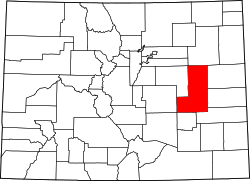
Punkin Center
Location within Lincoln County and Colorado
Usa edcp location map.svg
Red pog.svg
Punkin Center
Punkin Center (the United States)
Coordinates: 38°51′07″N103°42′02″W / 38.85194°N 103.70056°W / 38.85194; -103.70056 [1]
Country United States
State Colorado
County Lincoln
Elevation
[1]
5,364 ft (1,635 m)
Time zone UTC−7 (MST)
  Summer (DST) UTC−6 (MDT)
ZIP Codes
81063 (Ordway),
80821 (Hugo) [2]
Area code 719
GNIS ID 195180 [1]

Punkin Center is an unincorporated community in Lincoln County, Colorado, United States, [1] located at the junction of State Highway 94 and State Highway 71.

Contents

History

John Stevens built the first store at the farmers crossroads in 1920. He painted each new building a pumpkin color, inspiring the name. Everything burned in the 1950s.

The Post Offices at Hugo (ZIP Code 80821) and Ordway (ZIP 81063) serve Punkin Center postal addresses. [2]

There is a communication tower near the intersection of the highways, and a larger communication tower about 3 miles (4.8 km) southwest of the intersection.

See also

Flag of Colorado.svg Coloradoportal

References

  1. 1 2 3 4 "Punkin Center, Colorado", Geographic Names Information System , United States Geological Survey, United States Department of the Interior
  2. 1 2 "Punkin Center, CO". ZIP Code Lookup. United States Postal Service . Retrieved November 15, 2010.

Commons-logo.svg Media related to Punkin Center, Colorado at Wikimedia Commons