Karval, Colorado | |
|---|---|
 Karval K–12 public school | |
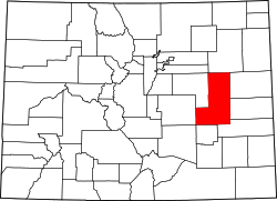
 Karval Location within Lincoln County and Colorado  Karval Karval (the United States) | |
| Coordinates: 38°44′00″N103°32′13″W / 38.73333°N 103.53694°W [1] | |
| Country | United States |
| State | Colorado |
| County | Lincoln [2] |
| Elevation | 5,115 ft (1,559 m) |
| Time zone | UTC−7 (MST) |
| • Summer (DST) | UTC−6 (MDT) |
| ZIP Code | 80823 [3] |
| Area code | 719 |
| FIPS code | 08-40130 [1] |
| GNIS ID | 196395 [1] |
Karval is an unincorporated community in Lincoln County, Colorado, United States. [1]