Bayfield, Colorado

Last updated

Bayfield, Colorado
Bayfield, Colorado town hall.JPG
Bayfield Town Hall
La Plata County Colorado Incorporated and Unincorporated areas Bayfield Highlighted 0805265.svg
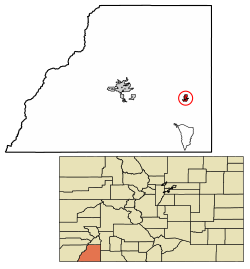
Location of the Town of Bayfield in La Plata County, Colorado.
Usa edcp location map.svg
Red pog.svg
Bayfield
Location of the Town of Bayfield in the United States.
Coordinates: 37°14′03″N107°35′43″W / 37.23417°N 107.59528°W / 37.23417; -107.59528 [2]
Country Flag of the United States.svg  United States
State Flag of Colorado.svg  Colorado
County La Plata [1]
Incorporated (town) August 18, 1906 [3]
Government
  Type Statutory Town [1]
  MayorAshleigh Tarkington [4]
  Town ManagerKatie Sickles [5]
Area
[6]
  Total1.646 sq mi (4.264 km2)
  Land1.646 sq mi (4.264 km2)
  Water0.000 sq mi (0.000 km2)
Elevation
[2]
6,975 ft (2,126 m)
Population
 (2020) [6]
  Total2,838
  Density1,724/sq mi (666/km2)
   Metro
55,638
Time zone UTC−07:00 (MST)
  Summer (DST) UTC−06:00 (MDT)
ZIP code
81122 [7]
Area code 9708849544
FIPS code 08-05265
GNIS feature ID2411667 [2]
Website www.colorado.gov/townofbayfield

Bayfield is a Statutory Town located in La Plata County, Colorado, United States. [1] The town population was 2,838 at the 2020 United States Census, a +21.65% increase since the 2010 United States Census. [6] Bayfield is part of the Durango, CO Micropolitan Statistical Area.

Contents

History

The town derives its name from W.A. Bay, founder. [8]

On January 19, 1988, Trans-Colorado Airlines Flight 2286 crashed in Bayfield, killing nine of the 17 people aboard. [9]

Geography

Bayfield is located at 37°13′50″N107°35′58″W / 37.23056°N 107.59944°W / 37.23056; -107.59944 (37.230532, -107.599539), [10] along U.S. Highway 160.

At the 2020 United States Census, the town had a total area of 1,054 acres (4.264 km2), all of it land. [6]

Cattle grazing in Bayfield, Colorado.jpg

Demographics

Historical population
CensusPop.Note
1910 227
1920 26717.6%
1930 2773.7%
1940 37234.3%
1950 335−9.9%
1960 322−3.9%
1970 320−0.6%
1980 724126.3%
1990 1,09050.6%
2000 1,54942.1%
2010 2,33350.6%
2020 2,83821.6%
U.S. Decennial Census

As of the census [11] of 2000, there were 1,549 people, 567 households, and 409 families residing in the town. The population density was 1,433.3 inhabitants per square mile (553.4/km2). There were 597 housing units at an average density of 552.4 per square mile (213.3/km2). The racial makeup of the town was 91.67% White, 0.19% African American, 2.13% Native American, 0.13% Asian, 3.36% from other races, and 2.52% from two or more races. Hispanic or Latino of any race were 10.46% of the population.

There were 567 households, out of which 43.2% had children under the age of 18 living with them, 59.3% were married couples living together, 8.6% had a female householder with no husband present, and 27.7% were non-families. 22.8% of all households were made up of individuals, and 6.0% had someone living alone who was 65 years of age or older. The average household size was 2.71 and the average family size was 3.19.

In the town, the population was spread out, with 31.2% under the age of 18, 7.4% from 18 to 24, 30.0% from 25 to 44, 23.8% from 45 to 64, and 7.5% who were 65 years of age or older. The median age was 35 years. For every 100 females, there were 98.3 males. For every 100 females age 18 and over, there were 92.9 males.

The median income for a household in the town was $39,336, and the median income for a family was $46,583. Males had a median income of $34,464 versus $22,027 for females. The per capita income for the town was $17,324. About 2.9% of families and 5.6% of the population were below the poverty line, including 3.8% of those under age 18 and 7.9% of those age 65 or over.

See also

Related Research Articles

<span class="mw-page-title-main">La Plata County, Colorado</span> County in Colorado, United States

La Plata County is a county located in the U.S. state of Colorado. As of the 2020 census, the population was 55,638. The county seat is Durango. The county was named for the La Plata River and the La Plata Mountains. "La plata" means "the silver" in Spanish.

<span class="mw-page-title-main">Columbine Valley, Colorado</span> Town in Colorado, United States

The Town of Columbine Valley is a Statutory Town located in western Arapahoe County, Colorado, United States. The town population was 1,502 at the 2020 United States Census, a +19.59% increase since the 2010 United States Census. Columbine Valley is a part of the Denver-Aurora-Lakewood, CO Metropolitan Statistical Area and the Front Range Urban Corridor.

<span class="mw-page-title-main">Brookside, Colorado</span> Town in Fremont County, Colorado, United States

Brookside is a Statutory Town located in Fremont County, Colorado, United States. The town population was 236 at the 2020 United States Census.

<span class="mw-page-title-main">Carbondale, Colorado</span> Town in Colorado, United States

The Town of Carbondale is a home rule municipality located in Garfield County, Colorado, United States. The town population was 6,434 at the 2020 United States Census. Carbondale is a part of the Glenwood Springs, CO Micropolitan Statistical Area.

<span class="mw-page-title-main">Cokedale, Colorado</span> Town in Colorado, United States

Cokedale is a Statutory Town located in Las Animas County, Colorado, United States. The town population was 127 at the 2020 United States Census.

<span class="mw-page-title-main">Kim, Colorado</span> Town in Colorado, United States

Kim is a Statutory Town in Las Animas County, Colorado, United States. The population was 63 at the time of the 2020 United States Census.

<span class="mw-page-title-main">Fleming, Colorado</span> Town in Colorado, United States

The Town of Fleming is a Statutory Town in Logan County, Colorado, United States. The town population was 428 at the 2020 United States Census. Fleming is a part of the Sterling, CO Micropolitan Statistical Area.

<span class="mw-page-title-main">Collbran, Colorado</span> Town in Mesa County, Colorado, United States

The Town of Collbran is a Statutory Town located in Mesa County, Colorado, United States. The town population was 369 at the 2020 United States Census. Collbran is a part of the Grand Junction, CO Metropolitan Statistical Area.

<span class="mw-page-title-main">Dolores, Colorado</span> Town in Montezuma County, Colorado, United States

Dolores is a Statutory Town located in Montezuma County, Colorado, United States. The town population was 885 at the 2020 United States Census.

<span class="mw-page-title-main">Naturita, Colorado</span> Town in Colorado, United States

Naturita is a statutory town in Montrose County, Colorado, United States. The population was 485 at the 2020 census, down from 546 in 2010.

<span class="mw-page-title-main">Hayden, Colorado</span> Town in Colorado, United States

The Town of Hayden is a home rule municipality located in Routt County, Colorado, United States. The town population was 1,941 at the 2020 United States Census. Hayden is a part of the Steamboat Springs, CO Micropolitan Statistical Area. The town sits along U.S. Highway 40 in the Yampa River Valley between Craig and Steamboat Springs. Hayden is located near the Yampa Valley Regional Airport, by which Hayden is one of the smallest communities in the U.S. to have mainline passenger jet service provided by American Airlines, Delta Air Lines, Southwest Airlines and United Airlines on a scheduled basis.

<span class="mw-page-title-main">Bayview, Wisconsin</span> Town in Wisconsin, United States

Bayview is a town in Bayfield County, Wisconsin, United States. The population was 487 at the 2010 census. The unincorporated community of Sioux is located in the town.

<span class="mw-page-title-main">Delta, Wisconsin</span> Town in Wisconsin, United States

Delta is a town in Bayfield County, Wisconsin, United States. The population was 273 at the 2010 census. The unincorporated communities of Delta and Pike River are located in the town. The unincorporated community of Sutherland is located partially in the town.

<span class="mw-page-title-main">Hughes, Wisconsin</span> Town in Wisconsin, United States

Hughes is a town in Bayfield County, Wisconsin, United States. The population was 383 at the 2010 census. The unincorporated communities of Muskeg and Wills are located in the town.

<span class="mw-page-title-main">Kelly, Wisconsin</span> Town in Wisconsin, United States

Kelly is a town in Bayfield County, Wisconsin, United States. The population was 463 at the 2010 census.

<span class="mw-page-title-main">Orienta, Wisconsin</span> Town in Wisconsin, United States

Orienta is a town in Bayfield County, Wisconsin, United States. The population was 122 at the 2010 census.

<span class="mw-page-title-main">Port Wing (town), Wisconsin</span> Town in Wisconsin, United States

Port Wing is a town in Bayfield County, Wisconsin, United States. The population was 368 at the 2010 census. The unincorporated community of Port Wing is located in the town.

<span class="mw-page-title-main">Bayfield (town), Wisconsin</span> Town in Wisconsin, United States

Bayfield is a town in Bayfield County, Wisconsin, United States. The population was 680 at the 2010 census. The unincorporated communities of Pureair and Salmo are located in the town, as are Eagle Island and Sand Island of the Apostle Islands.

Washburn is a town in Bayfield County, Wisconsin, United States. The population was 530 at the 2010 census. The City of Washburn is located just east of and adjacent to the town.

<span class="mw-page-title-main">Coal Creek, Colorado</span> Town in Colorado, United States

The Town of Coal Creek is a Statutory Town located in Fremont County, Colorado, United States. The town population was 364 at the 2020 United States Census. Coal Creek is a part of the Cañon City, CO Micropolitan Statistical Area and the Front Range Urban Corridor.

References

  1. 1 2 3 4 "Active Colorado Municipalities". Colorado Department of Local Affairs . Retrieved October 15, 2021.
  2. 1 2 3 U.S. Geological Survey Geographic Names Information System: Bayfield, Colorado
  3. "Colorado Municipal Incorporations". State of Colorado, Department of Personnel & Administration, Colorado State Archives. December 1, 2004. Archived from the original on September 27, 2007. Retrieved August 18, 2007.
  4. "Town Mayor and Trustees". Town of Bayfield. Archived from the original on November 1, 2006. Retrieved August 20, 2007.
  5. "Administration". Town of Bayfield. Archived from the original on August 24, 2007. Retrieved August 20, 2007.
  6. 1 2 3 4 "Decennial Census P.L. 94-171 Redistricting Data". United States Census Bureau, United States Department of Commerce. August 12, 2021. Retrieved September 7, 2021.
  7. "ZIP Code Lookup". United States Postal Service. August 20, 2007. Archived from the original (JavaScript/HTML) on August 21, 2007. Retrieved August 20, 2007.
  8. Dawson, John Frank (1954). Place names in Colorado: why 700 communities were so named, 150 of Spanish or Indian origin. Denver, CO: The J. Frank Dawson Publishing Co. p. 9.[ permanent dead link ]
  9. TRANS-COLORADO AIRLINES, INC., FLIGHT 2286, FAIRCHILD METRO III, SA227 AC, N68TC, BAYFIELD, COLORADO, JANUARY 19, 1988 (PDF). National Transportation Safety Board. February 4, 1989. NTSB/AAR-89/01. Retrieved September 6, 2016.
  10. "US Gazetteer files: 2010, 2000, and 1990". United States Census Bureau. February 12, 2011. Retrieved April 23, 2011.
  11. "U.S. Census website". United States Census Bureau . Retrieved January 31, 2008.