
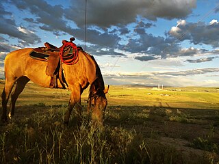
Routt County is a county located in the U.S. state of Colorado. As of the 2010 census, the population was 23,509. The county seat is Steamboat Springs. Routt County comprises the Steamboat Springs, CO Micropolitan Statistical Area.
Moffat County is a county located in the U.S. state of Colorado. As of the 2010 census, the population was 13,795. The county seat is Craig. With an area of 4,751 square miles, it is the 2nd largest county by area in Colorado, behind Las Animas County.

Craig is the Home Rule Municipality and the county seat and the most populous municipality of Moffat County, Colorado, United States. The city population was 9,464 at the 2010 United States Census.

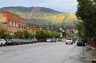
The City of Steamboat Springs is a Home Rule Municipality that is the county seat and the most populous municipality of Routt County, Colorado, United States. Steamboat Springs is the principal city of the Steamboat Springs, CO Micropolitan Statistical Area. According to 2019 census data, the city had an estimated population of 13,214.
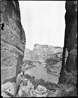
The Yampa River flows 250 miles (400 km) through northwestern Colorado in the United States. Rising in the Rocky Mountains, it is a tributary of the Green River and a major part of the Colorado River system. The Yampa is one of the few free-flowing rivers in the western United States, with only a few small dams and diversions.

The Little Snake River is a tributary of the Yampa River, approximately 155 miles (249 km) long, in southwestern Wyoming and northwestern Colorado in the United States.
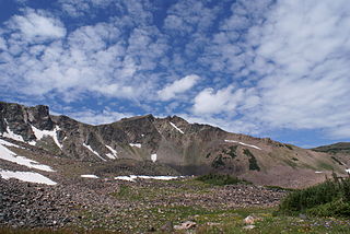
The Park Range, elevation approximately 12,000 feet (3,700 m), is a mountain range in the Rocky Mountains of northwestern Colorado in the United States. The range forms a relatively isolated part of the Continental Divide, extending north-to-south for approximately 40 miles (64 km) along the boundary between Jackson (east) and Routt counties. It separates North Park in the upper basin of the North Platte River on the east from the Elk River basin in the watershed of the Yampa River the west. It rises steeply out of the Yampa River basin, forming a climatic barrier that receives much snowfall in winter. The northern end of the range lies in Wyoming and is known as the Sierra Madre Range.

Yampa Valley Regional Airport is in Routt County, Colorado, United States, two miles southeast of Hayden and about 25 miles (40 km) west of Steamboat Springs. It has the only scheduled passenger flights to northwest Colorado. It is also used by larger business jets that cannot use the smaller Steamboat Springs Airport.
Mount Werner is a mountain summit in the Park Range of the Rocky Mountains of North America. The 10,570-foot (3,222 m) peak is located in Routt National Forest, 4.6 miles (7.4 km) east-southeast of the City of Steamboat Springs in Routt County, Colorado, United States. The mountain was renamed in 1964 in honor of skier Buddy Werner.

Medicine Bow–Routt National Forest is the official title to a U.S. Forest Service managed area extending over 2,222,313 acres (8,993.38 km2) in the states of Wyoming and Colorado, United States. What were once three separate areas, Medicine Bow National Forest, Routt National Forest, and Thunder Basin National Grassland were administratively combined in 1995 due to similarity of the resources, proximity to each other and for administrative purposes.

Toponas is an unincorporated rural village in Routt County, Colorado, United States. The community took its name from nearby Toponas Rock. The population in 2010 was 48; in 2017 it is estimated at 26, all in ages ranging from 55 years upwards.

Yampa River State Park is a Colorado state park located along the Yampa River in Routt and Moffat Counties in northwestern Colorado in the United States.

Steamboat Lake State Park is a Colorado state park located in Routt County 27 miles (43 km) north of Steamboat Springs, Colorado, and near the community of Hahns Peak Village. The 2,820-acre (1,140 ha) park, established west of Hahns Peak in 1967, includes a 1,101 acres (446 ha) reservoir. Park facilities include a visitors center, marina, boat ramps, campsites, cabins, picnic sites and 5.5 miles (8.9 km) of hiking trails. Plant communities include sagebrush shrubland, quaking aspen and lodgepole pine forests, willow carr and marsh. Commonly seen mammalian wildlife species include mule deer and red fox. The reservoir attracts many species of shorebirds and waterfowl, including sandhill cranes that nest in the wetland areas.

Stagecoach State Park is a Colorado State Park located in Routt County 17 miles (27 km) south of Steamboat Springs, Colorado. The 1,641-acre (6.64 km2) park established in 1989 includes a 771-acre (3.12 km2) reservoir on the Yampa River formed by Stagecoach Dam. Facilities include a marina, boat ramps, campsites, picnic sites and 8 miles (13 km) of trails. Park uplands are montane shrub communities, with riparian areas and wetlands around the reservoir and along the river. Commonly sighted wildlife includes elk, mule deer, coyote, red fox and badger.
The Elkhead Mountains are a mountain range in Colorado. The mountain range is considered to be low altitude within Colorado as the mountains are under 11,000 feet (3,400 m). Located within Routt and Moffat counties, the mountain range is far from metropolitan areas and has few lakes and streams, so it attracts few visitors. The mountain range is a volcanic range and all of the peaks were formed by volcanic action. The mountain range extends approximately 16 miles (26 km) east to west and 10 miles (16 km) north to south, and its center is located at 40.77404°N 107.32132°W, approximately 20 miles (32 km) northeast of Craig and north of Hayden, Colorado 13 miles (21 km) south of the Wyoming border. Almost all of the peaks within the Elkhead Mountains are a part of Routt National Forest. Significant peaks are: Bears Ears, Sugar Loaf, Saddle Mountain, Black Mountain, Pilot Knob, and Meaden Peak.

Stagecoach Dam is a gravity dam on the Yampa River in Routt County, Colorado, located about 20 miles (32 km) south of Steamboat Springs. Built of roller-compacted concrete, the dam is 145 feet (44 m) high and 360 feet (110 m) long. The impounded water forms Stagecoach Reservoir, with a storage capacity of 33,700 acre⋅ft (41,600,000 m3) and a surface area of 780 acres (320 ha) at maximum pool. The dam serves for irrigation, municipal water supply, and flood control, and it also supports a hydroelectric power station with a capacity of 800 kilowatts.

Black Mountain is a prominent mountain summit in the Elkhead Mountains range of the Rocky Mountains of North America. The 10,865-foot (3,312 m) peak is located in Routt National Forest, 20.9 miles (33.6 km) north-northeast of the City of Craig in Moffat County, Colorado, United States. Black Mountain is the highest point in Moffat County.
Elkhead Reservoir is located in northwest Colorado near the town of Craig. It was originally constructed by the Division of Wildlife on the Elkhead Creek, which is a major tributary of the Yampa River. A 205 square miles (530 km2) river basin drains into the reservoir. It has a capacity of 25,550 acre-feet (0.03152 km3). The dam was enlarged for two years ending in 2006. This enlargement cost $31 million and raised the height of the dam by 25 feet (7.6 m) and of the pool by 20 feet (6.1 m). The reservoir is found at an elevation of 6,355 feet (1,937 m).

Elk Mountain is a summit in Routt County, Colorado. The mountain lies to the northwest of Steamboat Springs and is easily seen from the city, especially from along Lincoln Avenue, Steamboat's main street. The mountain is also easily seen from Mount Werner, the home of the Steamboat Ski Resort.

