Johnson Village, Colorado

Last updated
Johnson Village, Colorado
Johnson Village, Colorado.JPG
View of Johnson Village with Mount Princeton in the background.
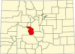
Chaffee County Colorado Incorporated and Unincorporated areas Johnson Village Highlighted 0839800.svg
Location of the Johnson Village CDP in Chaffee County, Colorado.
Usa edcp location map.svg
Red pog.svg
Johnson Village
Location of the Johnson Village CDP in the United States.
Coordinates: 38°48′43″N106°06′26″W / 38.8118940°N 106.1071117°W / 38.8118940; -106.1071117 (Johnson Village CDP, Colorado) Coordinates: 38°48′43″N106°06′26″W / 38.8118940°N 106.1071117°W / 38.8118940; -106.1071117 (Johnson Village CDP, Colorado) [1]
Country Flag of the United States.svg  United States
State Flag of Colorado.svg  Colorado
County Chaffee County
Government
[2]
  Type unincorporated community
Area
[1]
  Total0.299 sq mi (0.774 km2)
  Land0.299 sq mi (0.774 km2)
  Water0.000 sq mi (0.000 km2)
Elevation
[2]
7,854 ft (2,394 m)
Population
 (2020) [3]
  Total299
  Density1,000/sq mi (390/km2)
Time zone UTC-7 (MST)
  Summer (DST) UTC-6 (MDT)
ZIP Code [4]
Area code 719
GNIS feature [2] Johnson Village CDP

Johnson Village is an unincorporated community and a census-designated place (CDP) located in and governed by Chaffee County, Colorado, United States. The population of the Johnson Village CDP was 299 at the United States Census 2020. [3] The Buena Vista post office (Zip Code 81211) serves the area. [4]

Contents

Geography

Johnson Village is located along the west side of the Arkansas River, where the river is bridged by U.S. Highway 24. It is approximately three miles south of the town of Buena Vista. The community consists largely of a strip of retail establishments along either side of U.S. Highway 24, on the west side of Trout Creek Pass. The economy of the town is based largely on pass-through traffic, including tourism, in particular whitewater rafting on the Arkansas River.

The Johnson Village CDP has an area of 191 acres (0.774 km2), all land. [1]

Demographics

The United States Census Bureau initially defined the Johnson Village CDP for the United States Census 2010.

Johnson Village CDP, Colorado
YearPop.±%
2010 246    
2020 299+21.5%
Source: United States Census Bureau

See also

Related Research Articles

<span class="mw-page-title-main">Chaffee County, Colorado</span> County in Colorado, United States

Chaffee County is a county located in the U.S. state of Colorado. As of the 2020 census, the population was 19,476. The county seat is Salida.

<span class="mw-page-title-main">Todd Creek, Colorado</span> Census Designated Place in Colorado, United States

Todd Creek is an unincorporated community and a census-designated place (CDP) located in and governed by Adams County, Colorado, United States. The CDP is a part of the Denver–Aurora–Lakewood, CO Metropolitan Statistical Area. The population of the Todd Creek CDP was 3,768 at the United States Census 2010. The Todd Creek Village Metropolitan District and the Todd Creek Village Park and Recreation District provide services to the community, which lies in ZIP Code 80602.

<span class="mw-page-title-main">Buena Vista, Colorado</span> Town in Colorado, United States

The Town of Buena Vista is a Statutory Town located in Chaffee County, Colorado, United States. The town population was 2,855 at the 2020 United States Census.

<span class="mw-page-title-main">Aspen Park, Colorado</span> Census Designated Place in Colorado, United States

Aspen Park is an unincorporated community and a census-designated place (CDP) located in Jefferson County, Colorado, United States. The CDP is a part of the Denver–Aurora–Lakewood, CO Metropolitan Statistical Area. The population of the Aspen Park CDP was 810 at the United States Census 2020. The Aspen Park Metropolitan District provides services. The Conifer post office serves the area.

<span class="mw-page-title-main">Leadville North, Colorado</span> Census-designated place in Lake County, Colorado, United States

Leadville North is a census-designated place (CDP) in and governed by Lake County, Colorado, United States. The population of the Leadville North CDP was 1,892 at the United States Census 2020. The Leadville post office serves the area.

<span class="mw-page-title-main">Woody Creek, Colorado</span> Census Designated Place in Colorado, United States

Woody Creek is an unincorporated town, a post office, and a census-designated place (CDP) located in and governed by Pitkin County, Colorado, United States. The Woody Creek post office has the ZIP Code 81656. At the United States Census 2020, the population of the Woody Creek CDP was 290. The Woody Creek Metropolitan District provides services. The CDP is a part of the Glenwood Springs, CO Micropolitan Statistical Area.

<span class="mw-page-title-main">Trout Creek Pass</span>

Trout Creek Pass, elevation 9,346 ft (2,849 m), is a mountain pass located in the Rocky Mountains of south-central Colorado in the United States. The pass sits atop the southern end of the Mosquito Range on the Park-Chaffee county line, between South Park and the headwaters of the Arkansas River to the west. It is traversed jointly by U.S. Highway 24 (US 24) and US 285. Most motorised vehicles can travel on it, and it is only ever closed during really bad winter storms. While the south side has a moderate 5% gradient, the approach from the north is gentle.

<span class="mw-page-title-main">Divide, Colorado</span> Census Designated Place in Colorado, United States

Divide is an unincorporated town, a post office, and a census-designated place (CDP) located in and governed by Teller County, Colorado, United States. The CDP is a part of the Colorado Springs, CO Metropolitan Statistical Area. The Divide post office has the ZIP Code 80814. At the United States Census 2020, the population of the Divide CDP was 143.

<span class="mw-page-title-main">Twin Lakes, Lake County, Colorado</span> Census-designated place in Lake County, Colorado, United States

Twin Lakes is a pair of glacier-carved alpine lakes about 15 miles (24 km) south of historic Leadville, Colorado. They are downstream along the Arkansas River, whose headwaters are by Leadville. The lakes, however, are on a tributary, Lake Creek, which joins the Arkansas just below the lakes. After dredging, the lakes now have a surface area of 2,700 acres (11 km2), and they serve as a reservoir to store water for use in the Front Range. Both east and west lakes are recreation areas for boating and fishing.

<span class="mw-page-title-main">Coaldale, Colorado</span> Census-designated place in Fremont County, Colorado, United States

Coaldale is a census-designated place (CDP) and post office located in and governed by Fremont County, Colorado, United States. The CDP is a part of the Cañon City, CO Micropolitan Statistical Area. The Coaldale post office has the ZIP Code 81222. At the United States Census 2020, the population of the Coaldale CDP was 343.

<span class="mw-page-title-main">Granite, Colorado</span> Unincorporated community in Colorado, United States

Granite is an unincorporated community with a U.S. Post Office in Chaffee County, Colorado, United States. The zip code of Granite is 81228. According to the 2010 census, the population is 116.

<span class="mw-page-title-main">Howard, Colorado</span> Census-designated place in Fremont County, Colorado, United States

Howard is a census-designated place (CDP) and post office in and governed by Fremont County, Colorado, United States. The CDP is a part of the Cañon City, CO Micropolitan Statistical Area. The Howard post office has the ZIP Code 81233. At the United States Census 2020, the population of the Howard CDP was 852.

<span class="mw-page-title-main">Idledale, Colorado</span> Census Designated Place in Colorado, United States

Idledale is an unincorporated town, a post office, and a census-designated place (CDP) located in and governed by Jefferson County, Colorado, United States. The CDP is a part of the Denver–Aurora–Lakewood, CO Metropolitan Statistical Area. The Idledale post office has the ZIP code 80453. At the United States Census 2020, the population of the Idledale CDP was 244.

<span class="mw-page-title-main">McCoy, Colorado</span> Census Designated Place in Colorado, United States

McCoy is an unincorporated town, a census-designated place (CDP), and a post office located in and governed by Eagle County, Colorado, United States. The CDP is a part of the Edwards, CO Micropolitan Statistical Area. The McCoy post office has the ZIP Code 80463. At the United States Census 2020, the population of the McCoy CDP was 30.

<span class="mw-page-title-main">Nathrop, Colorado</span> Census Designated Place in Colorado, United States

Nathrop is an unincorporated town, a post office, and a census-designated place (CDP) located in and governed by Chaffee County, Colorado, United States. The population was 288 at the 2020 census. The Nathrop post office has the ZIP code 81236.

<span class="mw-page-title-main">Upper Bear Creek, Colorado</span> Census Designated Place in Colorado, United States

Upper Bear Creek is an unincorporated community and a census-designated place (CDP) located in and governed by Clear Creek County, Colorado, United States. The CDP is a part of the Denver–Aurora–Lakewood, CO Metropolitan Statistical Area. The population of the Upper Bear Creek CDP was 984 at the United States Census 2020. The Evergreen post office serves the area.

<span class="mw-page-title-main">Rock Creek Park, Colorado</span> Census Designated Place in Colorado, United States

Rock Creek Park is an unincorporated community and a census-designated place (CDP) located in and governed by El Paso County, Colorado, United States. The CDP is a part of the Colorado Springs, CO Metropolitan Statistical Area. The population of the Rock Creek Park CDP was 68 at the United States Census 2020. The Colorado Springs post office serves the area.

<span class="mw-page-title-main">Garfield, Colorado</span> Census Designated Place in Colorado, United States

Garfield is an unincorporated community and a census-designated place (CDP) located in and governed by Chaffee County, Colorado, United States. The population of the Garfield CDP was 27 at the United States Census 2020. The Salida post office serves the area.

<span class="mw-page-title-main">Maysville, Colorado</span> Census Designated Place in Colorado, United States

Maysville is an unincorporated community and a census-designated place (CDP) located in and governed by Chaffee County, Colorado, United States. The population of the Maysville CDP was 173 at the United States Census 2020. The Salida post office serves the area.

<span class="mw-page-title-main">Smeltertown, Colorado</span> Census Designated Place in Colorado, United States

Smeltertown is an unincorporated community and a census-designated place (CDP) located in and governed by Chaffee County, Colorado, United States. The population of the Smeltertown CDP was 88 at the United States Census 2020. The Salida post office serves the area.

References

  1. 1 2 3 "State of Colorado Census Designated Places - BAS20 - Data as of January 1, 2020". United States Census Bureau . Retrieved December 21, 2020.
  2. 1 2 3 "U.S. Board on Geographic Names: Domestic Names". United States Geological Survey . Retrieved December 21, 2020.
  3. 1 2 United States Census Bureau. "Johnson Village CDP, Colorado" . Retrieved April 17, 2023.
  4. 1 2 "Zip Code 81211 Map and Profile". zipdatamaps.com. 2020. Retrieved December 21, 2020.